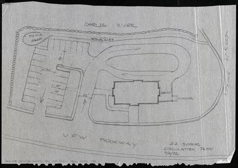
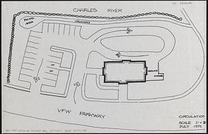
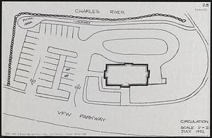
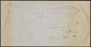
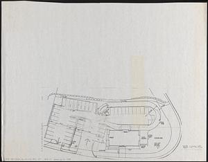
Circulation plan of parking lot at the corner of VFW Parkway and Spring Street, West Roxbury
Title (alt.):
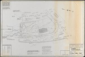
Topographic plan of land in West Roxbury, Mass. Acro Construction Co.
Description:
6 maps consisting of 1) photocopy of "Topographic plan of land in West Roxbury, Mass. Acro Construction Co." (Boston : Liston Associates, Inc., 1992); 2) manuscript map in pencil on tracing paper of the parking area with 22 parking spaces, traced from the Topographic plan; 3) photocopy of a plan with 22 parking spaces, based on the traced map; 4) photocopy of a plan with 28 parking spaces, based on the traced map; 5) thermal print copy of a manuscript map of the parking area for 38 parking spaces; 6) photocopy of a manuscript map of the parking area for 38 parking spaces with manuscript annotations in pencil. Maps show parking spaces, dimensions, planting areas and traffic circulation.
Oriented with north to the lower right.
In left margin of photocopies of manuscript map: Jul 09 '92 15:08 Grazado Velleco Architecture.
Title from manuscript map on tracing paper.
Topographic plan shows flood plain elevation, buildings, utility poles, manholes, overhead wires, catch basins, rocks, cyclone fence, pole lights, and utility lines.