Skip to search
Skip to main content
Skip to first result
Digital Commonwealth
Folders
Sign Up / Log In
Search for
Search
Search
Search
Basic
Advanced
Explore
Map
Collections
Institutions
Formats
For Educators
Primary Source Sets
Lesson Plans
Using Primary Sources
Searching Digital Commonwealth
For Institutions
Join Digital Commonwealth
Conferences, Trainings, & Events
How to Contribute Collections
Digitization Services
Board & Committees
Frequently Asked Questions
About
About Digital Commonwealth
News & Announcements
Copyright & Terms of Use
Harmful Content Statement
Partners
API
Contact Us
Search
Search Constraints
Start Over
Save Search
Your search:
More Like
commonwealth:x059cc62v
✖
Remove constraint More Like: commonwealth:x059cc62v
« Prev. |
1
-
100
of
11,233
|
Next »
Sort
by date (desc)
relevance
title
date (asc)
date (desc)
Number of results to display per page
100
per page
per page
10
per page
20
per page
50
per page
100
per page
View results as:
List
list view
Maps
map view
Gallery
grid view
Search Results
1.
Barton Street, West End
2.
Boston's top 5 immigrant populations
3.
East Boston flood risk
4.
Fairbanks Street, Brighton
5.
How we get around today
6.
Oxford Street, Chinatown
7.
A city of unequal risks
8.
A people's map of Lawrence, Massachusetts
9.
A shared problem, an unequal burden : causes & consequences of climate change
10.
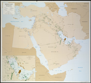
Tax parcels that would have been underwater in 1630
11.
Boston kids count
12.
Change in median housing value, 2010 to 2018
13.
Change in white population (non-Hispanic), 2010 to 2018
14.
Disconnected : Boston's free wi-fi leaves many in the dark
15.
The great transit desert
16.
Health crisis : Massachusetts' low income families more likely to live near hazardous sites
17.
Health success : Massachusetts well-prepared to deal with health issues from hazardous sites
18.
A hexagonal chart of yearly snowfall in New England up through and including November 1, 2020
19.
Hotbeds of contamination : the toxicity of our cities
20.
Jamaica Plain view of the world
21.
Map of public transportation routes in Greater Boston served by the Massachusetts Bay Transportation Authority comprising 64...
22.
Mean travel time to work
23.
Most popular mode of commuting : 2014-2018 American Community Survey
24.
Percent foreign-born
25.
Plenty of free wi-fi is keeping Boston connected!
26.
Proportion of units where rent costs over 30% of resident's income
27.
Rethinking hazardous beliefs : challenging perceptions of the "dirty city"
28.
Suburban Boston teachers are the highest earners
29.
Suburban Boston teachers are the lowest earners
30.
Total foreign-born
31.
A type-ology of population in Massachusetts
32.
United States bee colonies
33.
Western Massachusetts closed to the public
34.
Western Massachusetts open space abounds
35.
Boston Public Library
36.
Boston's neighborhoods by percentage of foreign-born (by census tract)
37.
Back Bay view of the world
38.
Open space 2017
39.
Boston distance to the nearest supermarket
40.
Boston open space and supermarkets
41.
View of SoWa food trucks
42.
Boston over Time
43.
Boston's diversity index, 2010 : measures of diversity : age
44.
Boston's diversity index, 2010 : measures of diversity : region of birth
45.
Boston's diversity index, 2010 : measures of diversity : education
46.
Boston's diversity index, 2010 : measures of diversity : language other than English spoken at home
47.
Boston's diversity index, 2010 : measures of diversity : household income
48.
Boston's diversity index, 2010 : measures of diversity : race
49.
Boston's top 6 foreign languages spoken at home, 2010
50.
Boston's top foreign-born populations : Cape Verdeans
51.
Boston's top foreign-born populations : Haitians
52.
Boston's top foreign-born populations : Dominicans
53.
Boston's top foreign-born populations : Salvadorans
54.
Boston's top foreign-born populations : Chinese
55.
Boston's top foreign-born populations : Vietnamese
56.
Map of the countries near to the land of Oz
57.
A South Ender's view of the world
58.
Massachusetts official transportation map
59.
Neighborhoods of Boston
60.
1630 shoreline
61.
Nantucket
62.
Boston Over Time : filling in the land 1630 - present
63.
The people's republic of Cambridge
64.
State of Louisiana, highlighting low-lying areas derived from USGS digital elevation data
65.
Peters World map
66.
2005 significant U.S. hurricane strikes
67.
Africa
68.
Massachusetts Turnpike map : the main street of Massachusetts
69.
The population map
70.
South America
71.
The world turned upside down
72.
Asia
73.
Iraq
74.
Massachusetts official transportation map
75.
What's up? South! : world map
76.
China
77.
China
78.
Physical map of the world, April 2001
79.
Political map of the world, April 2001
80.
Area plan as of May 1962
81.
The Boston Public Libraries
82.
The public libraries of Massachusetts
83.
Sudan
84.
Boston shoreline 1630
85.
Boston shoreline 1795
86.
Boston shoreline 1852
87.
Boston shoreline 1880
88.
Boston shoreline 1916
89.
Boston shoreline 1934
90.
Boston shoreline 1950
91.
Boston shoreline 1995
92.
Boston shoreline composite
93.
Tactical pilotage chart, TPC
94.
Mediterranean Sea, plans on the coasts of Italy and Sicilia
95.
Haiti
96.
Major thoroughfare system, city of Boston, July, 1994
97.
North Atlantic Ocean, southeast coast of North America, including the Bahamas and Greater Antilles
98.
East Asia
99.
Middle East, oil and gas : Middle East
100.
North Atlantic Ocean, West Indies
« Previous
Next »
1
2
3
4
5
…
112
113
Limit your search
Subject
Real property--Massachusetts--Boston--Maps
2,298
Boston (Mass.)--Maps
2,181
Landowners--Massachusetts--Boston--Maps
2,126
Roxbury (Boston, Mass.)--Maps
353
Dorchester (Boston, Mass.)--Maps
317
Cambridge (Mass.)--Maps
268
Brookline (Mass.)--Maps
237
Real property--Massachusetts--Cambridge--Maps
216
more
Subject
»
Place
North and Central America
8,047
United States
6,806
Suffolk (county)
3,566
Boston
3,426
Massachusetts
3,262
Europe
963
Middlesex (county)
619
Canada
427
more
Place
»
Format
Maps/Atlases
11,174
Manuscripts
215
Prints
51
Books
35
Objects/Artifacts
10
Drawings/Illustrations
8
Posters
4
Available to use
No known restrictions
11,059
Creative Commons license
67
Date
View distribution
Current results range from
1482
to
2023
Date range begin
Date range end
View larger »
Unknown
3
Collection
Norman B. Leventhal Map Center Collection
11,033
Boston and New England Maps (Collection of Distinction)
5,244
Urban Maps (Collection of Distinction)
4,977
Maritime Charts and Atlases (Collection of Distinction)
750
American Revolutionary War-Era Maps (Collection of Distinction)
625
Boston Redevelopment Authority Collection
201
Historic Maps
49
Mapping Boston Collection
20
more
Collection
»
Institution
Boston Public Library
11,127
Salem State University Archives and Special Collections
49
State Library of Massachusetts
27
Private Collection
20
American Antiquarian Society
9
Boston Athenaeum
1