Skip to search
Skip to main content
Digital Commonwealth
Sign Up / Log In
Search for
Search
Search
Search
Basic
Advanced
Explore
Map
Collections
Institutions
Formats
For Educators
Primary Source Sets
Lesson Plans
Using Primary Sources
Searching Digital Commonwealth
For Institutions
Join Digital Commonwealth
Conferences, Trainings, & Events
How to Contribute Collections
Digitization Services
Board & Committees
Frequently Asked Questions
About
About Digital Commonwealth
News & Announcements
Copyright & Terms of Use
Harmful Content Statement
Partners
API
Contact Us
Boston Public Library
Norman B. Leventhal Map & Education Center Collection
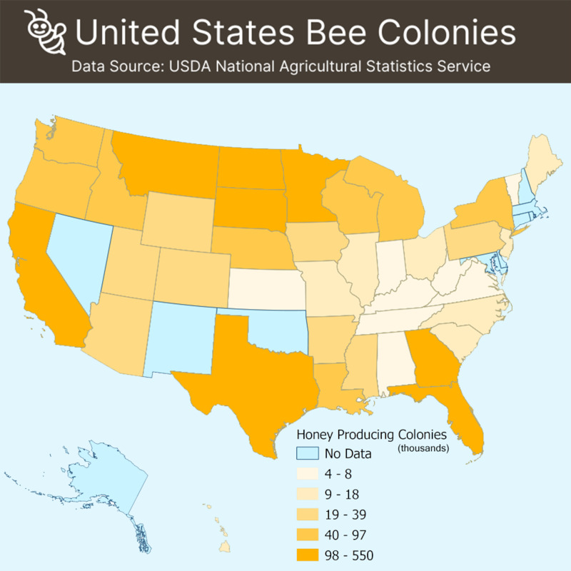
United States bee colonies
United States bee colonies
×
Item Information
Title:
United States bee colonies
Cartographer:
Boston Public Library. Norman B. Leventhal Map and Education Center
Date:
[2020]
Format:
Maps/Atlases
Location:
Boston Public Library
Norman B. Leventhal Map & Education Center
Collection (local):
Norman B. Leventhal Map & Education Center Collection
Subjects:
Honeybee--United States--Maps
United States--Maps
Places:
United States
Extent:
1 map : color
Permalink:
https://ark.digitalcommonwealth.org/ark:/50959/3x817769h
Terms of Use:
No known copyright restrictions.
No known restrictions on use.
Language:
English
Notes:
"Data source: USDA National Agricultural Statistics Service."
Notes (date):
This date is inferred.
Identifier:
honeybees
show more...
View MODS XML
More Like This
19th annual convention of the National Association of Real Estate ...
2005 significant U.S. hurricane strikes
38,000,000 escaped -- 10,000,000 died
Aboriginal map of North America, denoting the boundaries and the ...
Find More Like This >>
Tools
Share
Facebook
Pinterest
X
Reddit
Tumblr
Email
Copy link
Add to Folder
Questions/Comments
Cite This Item
IIIF Manifest
Downloads
Primary (full resolution, uncompressed)
(TIF, 4.21 MB)
Large (full resolution)
(JPEG, 362 KB)
Medium
(JPEG, 106 KB)