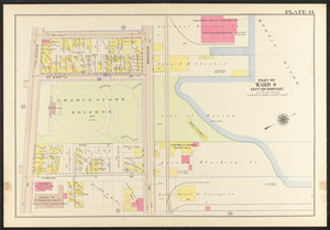
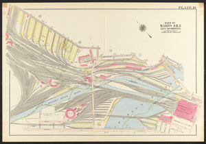
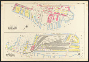
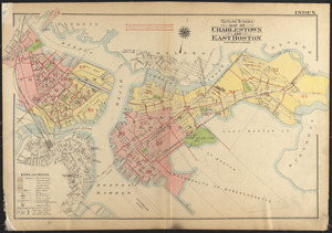
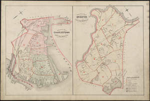
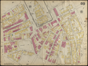
Skip to search
Skip to main content
Skip to first result
Digital Commonwealth
Folders
Sign Up / Log In
Search for
Search
Search
Search
Basic
Advanced
Explore
Map
Collections
Institutions
Formats
For Educators
Primary Source Sets
Lesson Plans
Using Primary Sources
Searching Digital Commonwealth
For Institutions
Join Digital Commonwealth
Conferences, Trainings, & Events
How to Contribute Collections
Digitization Services
Board & Committees
Frequently Asked Questions
About
About Digital Commonwealth
News & Announcements
Copyright & Terms of Use
Harmful Content Statement
Partners
API
Contact Us
Search
Search Constraints
Start Over
Save Search
Your search:
More Like
commonwealth:8p58s3456
✖
Remove constraint More Like: commonwealth:8p58s3456
« Prev.
|
101
-
200
of
11,255
|
Next »
Sort
by relevance
relevance
title
date (asc)
date (desc)
Number of results to display per page
100
per page
per page
10
per page
20
per page
50
per page
100
per page
View results as:
List
list view
Maps
map view
Gallery
grid view
Search Results
101.
Atlas of the city of Boston, Charlestown and East Boston : plate 13
102.
Atlas of the city of Boston, Charlestown and East Boston : plate 14
103.
Atlas of the city of Boston, Charlestown and East Boston : plate 15
104.
Atlas of the city of Boston, Charlestown and East Boston : plate 16
105.
Atlas of the city of Boston, Charlestown and East Boston : plate 17
106.
Atlas of the city of Boston, Charlestown and East Boston : plate 18
107.
Atlas of the city of Boston, Charlestown and East Boston : plate 19
108.
Boston with Charlestown and Roxbury
109.
A new & complete map of the city of Boston, with part of Charlestown, Cambridge & Roxbury
110.
A new & complete map of the city of Boston, with part of Charlestown, Cambridge & Roxbury
111.
A new & complete map of the city of Boston, with part of Charlestown, Cambridge & Roxbury
112.
Outline & index map of Charlestown and East Boston
113.
Outline & index map of Charlestown, city of Boston ; Outline & index map of Brighton, city of Boston
114.
Outline & index map of Charlestown, wards 3, 4 & 5, city of Boston
115.
Outline and index map of Charlestown and East Boston
116.
Boston with Charlestown and Roxbury
117.
Map of Boston inner harbor to accompany report under chapter 93, resolves of 1907, December 1, 1907
118.
Metropolitan district - inner section : population of cities & towns by five year periods from 1910 to 1925
119.
Atlas of the city of Boston : Charlestown : from actual surveys and official plans
120.
Atlas of the city of Boston : Charlestown and Brighton, volume six : from actual surveys and official records
121.
Atlas of the city of Boston : Charlestown and East Boston : from actual surveys and official plans
122.
Atlas of the city of Boston : Charlestown and East Boston : from actual surveys and official plans
123.
Atlas of the city of Boston : Charlestown, Mass. : volume ten : from actual surveys and official plans
124.
Atlas of the county of Suffolk, Massachusetts : vol. 6th including the late city of Charlestown, now wards 20,21 and 22, city...
125.
Atlas of the county of Suffolk, Massachusetts : vol. 6th including the late city of Charlestown, now wards 20,21 and 22, city...
126.
Atlas of the county of Suffolk, Massachusetts : vol. 6th including the late city of Charlestown, now wards 20,21 and 22, city...
127.
Atlas of the county of Suffolk, Massachusetts : vol. 6th including the late city of Charlestown, now wards 20,21 and 22, city...
128.
Atlas of the county of Suffolk, Massachusetts : vol. 6th including the late city of Charlestown, now wards 20,21 and 22, city...
129.
Atlas of the county of Suffolk, Massachusetts : vol. 6th including the late city of Charlestown, now wards 20,21 and 22, city...
130.
Atlas of the county of Suffolk, Massachusetts : vol. 6th including the late city of Charlestown, now wards 20,21 and 22, city...
131.
Atlas of the county of Suffolk, Massachusetts : vol. 6th including the late city of Charlestown, now wards 20,21 and 22, city...
132.
Atlas of the county of Suffolk, Massachusetts : vol. 6th including the late city of Charlestown, now wards 20,21 and 22, city...
133.
Atlas of the county of Suffolk, Massachusetts : vol. 6th including the late city of Charlestown, now wards 20,21 and 22, city...
134.
Atlas of the county of Suffolk, Massachusetts : vol. 6th including the late city of Charlestown, now wards 20,21 and 22, city...
135.
Atlas of the county of Suffolk, Massachusetts : vol. 6th including the late city of Charlestown, now wards 20,21 and 22, city...
136.
Atlas of the county of Suffolk, Massachusetts : vol. 6th including the late city of Charlestown, now wards 20,21 and 22, city...
137.
Atlas of the county of Suffolk, Massachusetts : vol. 6th including the late city of Charlestown, now wards 20,21 and 22, city...
138.
Atlas of the county of Suffolk, Massachusetts : vol. 6th including the late city of Charlestown, now wards 20,21 and 22, city...
139.
Atlas of the county of Suffolk, Massachusetts : vol. 6th including the late city of Charlestown, now wards 20,21 and 22, city...
140.
Charlestown Navy Yard area
141.
Charlestown Navy Yard master plan
142.
Charlestown urban renewal area project no. Mass. R-55 Boston - Suffolk County - Massachusetts delivery parcel plan : parcel...
143.
Charlestown urban renewal project Boston (Suffolk County) Massachusetts Mass. R-55 : topographic map
144.
Charlestown Veterans Memorial, Charlestown, Massachusetts
145.
City atlas of Boston, Massachusetts : complete in one volume : from official records, private plans and actual surveys : plate 5
146.
City atlas of Boston, Massachusetts : complete in one volume : from official records, private plans and actual surveys : plate 6
147.
Flirtation walk existing conditions plan Charlestown Navy Yard
148.
Flirtation walk schematic planting plan Charlestown Navy Yard
149.
Gate 5 - Chelsea Street modified landscape scheme, Charlestown, MA
150.
Infrastructure around Tobin Bridge/US route 1 in Charlestown
151.
Insurance map of Charlestown : portions of Roxbury (now annexed to Boston) and Cambridge : plate 4
152.
Insurance map of Charlestown : portions of Roxbury (now annexed to Boston) and Cambridge : plate 5
153.
Insurance map of Charlestown : portions of Roxbury (now annexed to Boston) and Cambridge : plate 6
154.
Insurance map of Charlestown : portions of Roxbury (now annexed to Boston) and Cambridge : plate 7
155.
Insurance map of Charlestown : portions of Roxbury (now annexed to Boston) and Cambridge : plate 8
156.
Insurance map of Charlestown : portions of Roxbury (now annexed to Boston) and Cambridge : plate 9
157.
Insurance map of Charlestown : portions of Roxbury (now annexed to Boston) and Cambridge : plate 10
158.
Insurance map of Charlestown : portions of Roxbury (now annexed to Boston) and Cambridge : plate 1
159.
Insurance map of Charlestown : portions of Roxbury (now annexed to Boston) and Cambridge : plate 2
160.
Insurance map of Charlestown : portions of Roxbury (now annexed to Boston) and Cambridge : plate 3
161.
Insurance map of Charlestown : portions of Roxbury (now annexed to Boston) and Cambridge
162.
Insurance map of Charlestown : portions of Roxbury (now annexed to Boston) and Cambridge : 1868 : corrected Nov. 1871
163.
Insurance map of Charlestown : portions of Roxbury (now annexed to Boston) and Cambridge : 1868 : corrected Nov. 1871 : plate 1
164.
Insurance map of Charlestown : portions of Roxbury (now annexed to Boston) and Cambridge : 1868 : corrected Nov. 1871 : plate 2
165.
Insurance map of Charlestown : portions of Roxbury (now annexed to Boston) and Cambridge : 1868 : corrected Nov. 1871 : plate 3
166.
Insurance map of Charlestown : portions of Roxbury (now annexed to Boston) and Cambridge : 1868 : corrected Nov. 1871 : plate 4
167.
Insurance map of Charlestown : portions of Roxbury (now annexed to Boston) and Cambridge : 1868 : corrected Nov. 1871 : plate 5
168.
Insurance map of Charlestown : portions of Roxbury (now annexed to Boston) and Cambridge : 1868 : corrected Nov. 1871 : plate 6
169.
Insurance map of Charlestown : portions of Roxbury (now annexed to Boston) and Cambridge : 1868 : corrected Nov. 1871 : plate 7
170.
Insurance map of Charlestown : portions of Roxbury (now annexed to Boston) and Cambridge : 1868 : corrected Nov. 1871 : plate 8
171.
Insurance map of Charlestown : portions of Roxbury (now annexed to Boston) and Cambridge : 1868 : corrected Nov. 1871 : plate 9
172.
Insurance map of Charlestown : portions of Roxbury (now annexed to Boston) and Cambridge : 1868 : corrected Nov. 1871 : plate 10
173.
Insurance maps of Boston volume 4 : comprising portions of Charlestown, East Cambridge, Cambridge Port, Old Cambridge & Somerville
174.
Insurance maps of Boston volume 4 : comprising portions of Charlestown, East Cambridge, Cambridge Port, Old Cambridge &...
175.
Insurance maps of Boston volume 4 : comprising portions of Charlestown, East Cambridge, Cambridge Port, Old Cambridge &...
176.
Insurance maps of Boston volume 4 : comprising portions of Charlestown, East Cambridge, Cambridge Port, Old Cambridge &...
177.
Insurance maps of Boston volume 4 : comprising portions of Charlestown, East Cambridge, Cambridge Port, Old Cambridge &...
178.
Insurance maps of Boston volume 4 : comprising portions of Charlestown, East Cambridge, Cambridge Port, Old Cambridge &...
179.
Insurance maps of Boston volume 4 : comprising portions of Charlestown, East Cambridge, Cambridge Port, Old Cambridge &...
180.
Insurance maps of Boston volume 4 : comprising portions of Charlestown, East Cambridge, Cambridge Port, Old Cambridge &...
181.
Insurance maps of Boston volume 4 : comprising portions of Charlestown, East Cambridge, Cambridge Port, Old Cambridge &...
182.
Insurance maps of Boston volume 4 : comprising portions of Charlestown, East Cambridge, Cambridge Port, Old Cambridge &...
183.
Insurance maps of Boston volume 4 : comprising portions of Charlestown, East Cambridge, Cambridge Port, Old Cambridge &...
184.
Insurance maps of Boston volume 4 : comprising portions of Charlestown, East Cambridge, Cambridge Port, Old Cambridge &...
185.
Little Mystic Channel landscape scheme, Charlestown, MA
186.
Plan of Charlestown
187.
Plan of Charlestown
188.
Plan of Charlestown peninsula in the state of Massachusetts
189.
Plan of Hoosac Tunnel Dock and Elevator Company's docks and land in Charlestown, Mass.
190.
Plan of land in Charlestown held by the receivers of the Phoenix Bank : to be sold by public auction [Tuesday] June 19 1851 at...
191.
Plan of real estate in Charlestown belonging to Seth Barker & others : to be sold on the premises at public auction, June 26th,...
192.
[Plan of real estate in Charlestown, showing park laid out]
193.
Plan of the city of Charlestown
194.
Plan showing proposed method of introducing the water of Mystic Pond into Charlestown
195.
Ropewalk bldg. Charlestown Navy Yard
196.
Shipyard Park phase 3 : Boston Naval Shipyard at Charlestown : schematic design
197.
Back Bay urban renewal area r-47 : existing circulation
198.
East Boston urban renewal area r-44 : proposed circulation
199.
East Boston urban renewal area r-44 : existing circulation
200.
Fenway urban renewal area : major thoroughfares
« Previous
Next »
1
2
3
4
5
6
…
112
113
Limit your search
Subject
Real property--Massachusetts--Boston--Maps
2,300
Boston (Mass.)--Maps
2,181
Landowners--Massachusetts--Boston--Maps
2,127
Roxbury (Boston, Mass.)--Maps
353
Dorchester (Boston, Mass.)--Maps
317
Cambridge (Mass.)--Maps
270
Brookline (Mass.)--Maps
237
Real property--Massachusetts--Cambridge--Maps
216
more
Subject
»
Place
North and Central America
8,069
United States
6,828
Suffolk (county)
3,588
Boston
3,448
Massachusetts
3,259
Europe
963
Middlesex (county)
621
Canada
427
more
Place
»
Format
Maps/Atlases
11,196
Manuscripts
215
Prints
51
Books
35
Objects/Artifacts
10
Drawings/Illustrations
8
Posters
4
Available to use
No known restrictions
11,078
Creative Commons license
68
Date
View distribution
Current results range from
1482
to
2023
Date range begin
Date range end
View larger »
Unknown
3
Collection
Norman B. Leventhal Map Center Collection
11,029
Boston and New England Maps (Collection of Distinction)
5,264
Urban Maps (Collection of Distinction)
4,999
Maritime Charts and Atlases (Collection of Distinction)
750
American Revolutionary War-Era Maps (Collection of Distinction)
626
Boston Redevelopment Authority Collection
225
Historic Maps
49
Mapping Boston Collection
21
more
Collection
»
Institution
Boston Public Library
11,146
Salem State University Archives and Special Collections
49
State Library of Massachusetts
29
Private Collection
21
American Antiquarian Society
9
Boston Athenaeum
1