Skip to search
Skip to main content
Skip to first result
Digital Commonwealth
Folders
Sign Up / Log In
Search for
Search
Search
Search
Basic
Advanced
Explore
Map
Collections
Institutions
Formats
For Educators
Primary Source Sets
Lesson Plans
Using Primary Sources
Searching Digital Commonwealth
For Institutions
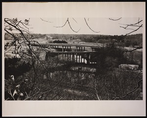
Join Digital Commonwealth
Conferences, Trainings, & Events
How to Contribute Collections
Digitization Services
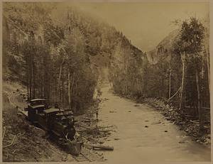
Board & Committees
Frequently Asked Questions
About
About Digital Commonwealth
News & Announcements
Copyright & Terms of Use
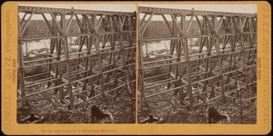
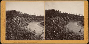
Harmful Content Statement
Partners
API
Contact Us
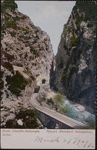
Search
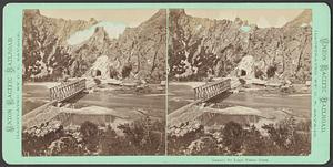
Search Constraints
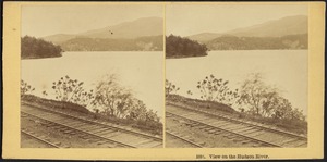
Start Over
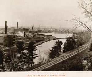
Save Search
Your search:
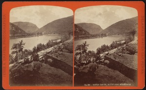
More Like
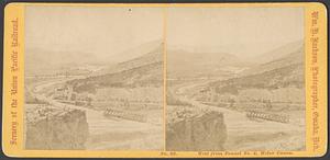
commonwealth:70796d559
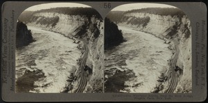
✖
Remove constraint More Like: commonwealth:70796d559
« Prev. |
1
-
100
of
6,219
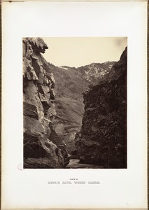
|
Next »
Sort
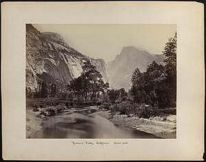
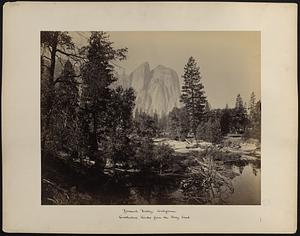
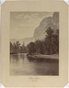
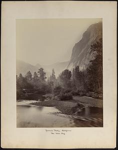
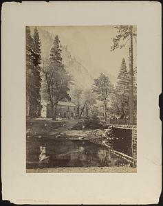
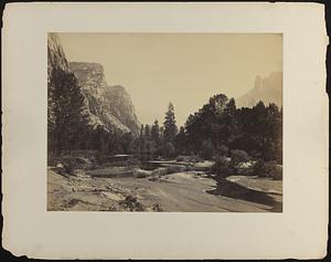
by relevance
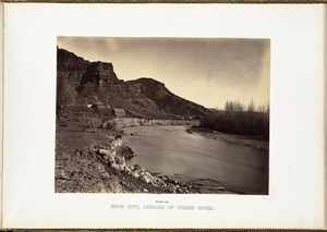
relevance
title
date (asc)
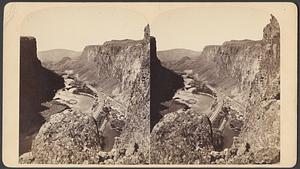
date (desc)
Number of results to display per page
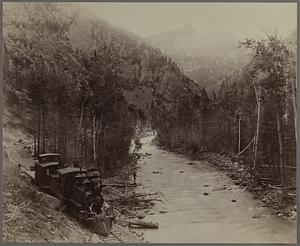
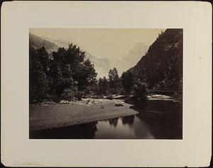
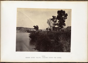
100
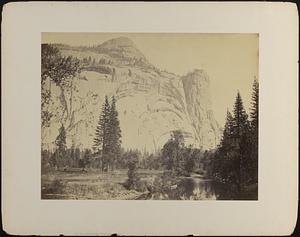
per page
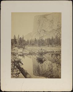
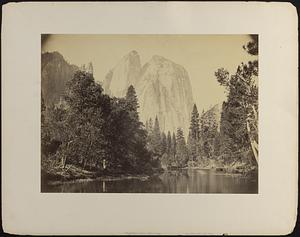
per page
10
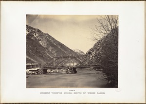
per page
20
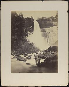
per page
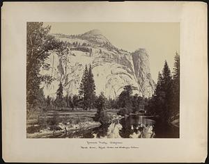
50
per page
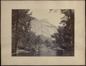
100
per page
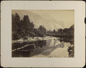
View results as:
List
list view
Maps
map view
Gallery
grid view
Search Results
1.
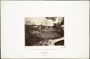
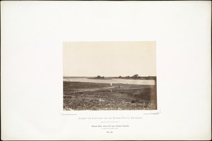
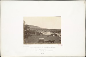
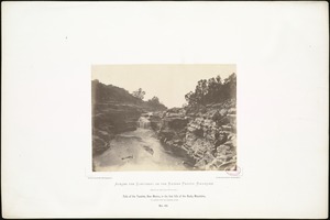
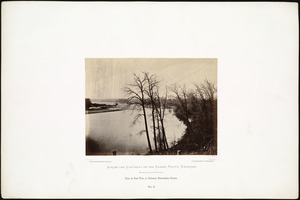
Muddy Creek, Kansas, 162 miles west of Missouri River.
2.
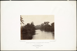
Crossing of the Grasshopper, in Kansas, 50 miles west of Missouri River.
3.
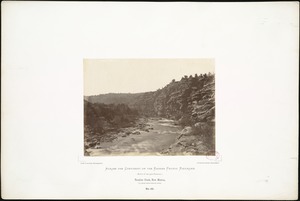
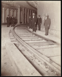
Crossing of the Republican, in Kansas, 136 miles west of Missouri River.
4.
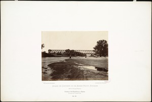
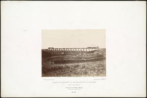
Railroad Bridge across the Kaw at state line, Kansas.
5.
Valley of the Gunnison near Sapinero
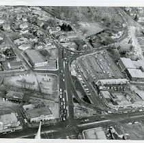
6.
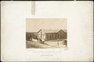
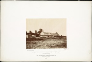
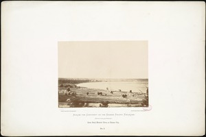
Depot of Pacific Railroad, St. Louis, Mo.
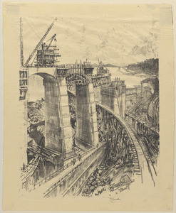
7.
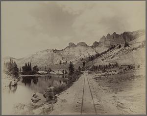
On the Great Plains, Kansas, September, 1867, 296 miles west of Missouri River.
8.
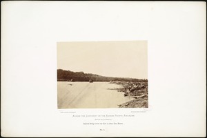
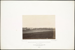
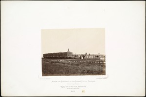
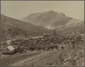
Shipping Point for Texan Cattle, Abilene, Kansas, 162 miles west of Missouri River.
9.
State line between Kansas and Missouri, near Kansas City, 275 miles west of St. Louis, Mo.
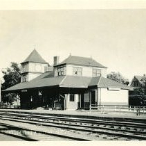
10.
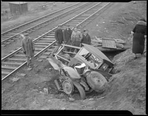
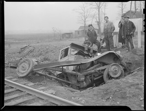
View near Fort Harker, Kansas, 216 miles west of Missouri River.
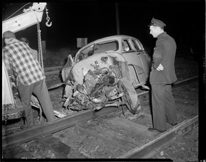
11.
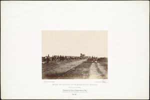
"Westward the Course of Empire takes it Way." Laying track, 300 miles west of Missouri River, 19th October, 1867.
12.
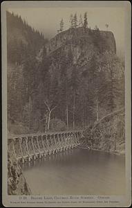
Beaver Lake, Columbia River scenery. Oregon
13.
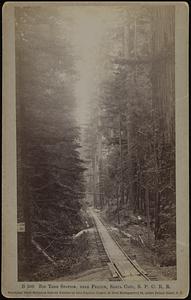
Big Tree Station, near Felton, Santa Cruz, S. P. C. R. R.
14.
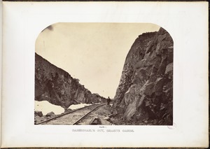
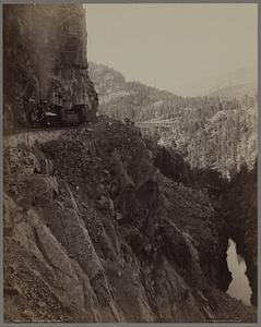
Carmichael's Cut, Granite Canon.
15.
Castle Gate
16.
Castle Gate
17.
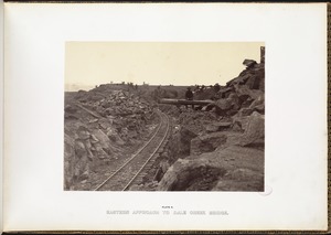
Eastern approach to Dale Creek Bridge.
18.
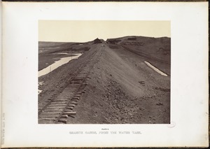
Granite Canon, from the water tank.
19.
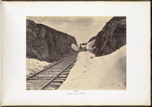
Hall's Cut.
20.
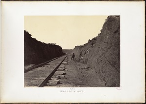
Malloy's Cut.
21.
Marshall Pass and Mt. Ouray
22.
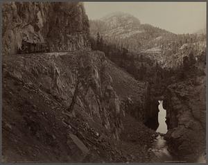
The Royal Gorge, Grand Cañon of the Arkansas
23.
Arch bridge under RR tracks in Salisbury
24.
Cheesecake Brook looking North
25.
Chester, Massachusetts
26.
Delaware Water Gap
27.
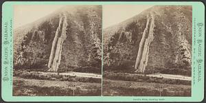
Devil's Slide, showing trade
28.
Falls Station, Niagara
29.
Grain elevators, Chicago
30.
Kittatinny Mountains
31.
Man standing on retaining wall on edge of railroad tracks near Revetazón River; heads of 3 men on left in foreground
32.
Miamus River
33.
On the Lake Superior & Mississippi Railroad
34.
On the Lake Superior and Mississippi Railroad
35.
Palisades and palaces
36.
Palisades Humboldt River C.P.R.R.
37.
Route Diacofto - Kalavryta = Γραμμή Διακοφτοῦ Καλαβρύτων
38.
Tunnel No 3 and Weber River
39.
View on the Hudson River
40.
View on the Spicket River, Lawrence
41.
Villages of Newton, MA. Auburndale. Central St. toward Charles River, railroad tracks, Auburndale
42.
Water Gap PA Kittatinny Mountains
43.
West from Tunnel No. 4, Weber Canon
44.
The whirlpool rapids from the steel bridge, Niagara Falls
45.
Arkansas River, below Fort Lyon, Southern Colorado, 500 miles from Missouri River.
46.
Cañon of the Rio Las Animas
47.
Cañon of the Rio Las Animas
48.
Cañon of the Rio Las Animas, the Needle Mountains
49.
Cañon of the Rio Las Animas, the Needle Mountains
50.
A cattle ranch on the cimarron
51.
Crossing of the Line at Tecalote Creek, New Mexico, north of Anton Chico, 775 miles west of Missouri River.
52.
Devil's Gate, Weber Canon.
53.
The Domes, close view, Yosemite
54.
The Domes from Yosemite Valley
55.
Down Yosemite Valley, showing river and Cathedral Rock
56.
Echo City, looking up Weber River.
57.
Falls of the Tecalote, New Mexico, in the foot hills of the Rocky Mountains, 775 miles west of Missouri River.
58.
Glacier Point 3700ft. Yosemite Valley
59.
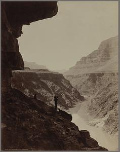
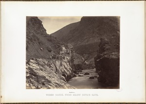
Grand Canon of the Colorado
60.
Great Bend, Missouri River, at Kansas City
61.
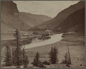
Green River Valley, looking down the river.
62.
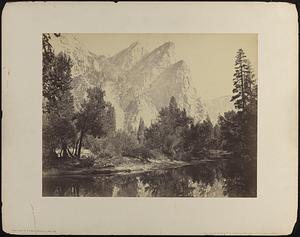
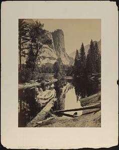
Half Dome from Yosemite Valley
63.
Mirror view of El Capitan, Yosemite
64.
Mirror view of North Dome, Yosemite
65.
Mormon Turnpike Bridge, mouth of Weber Canon.
66.
Mt. Starr King and Glacier Point, Yosemite
67.
Nevada Fall, Yosemite
68.
North Dome, the Royal Arches, and Washington Column, Yosemite
69.
North Dome, the Royal Arches, and Washington Column, Yosemite
70.
North Dome, Yosemite
71.
Overlooking Lawerence and the Kansas River.
72.
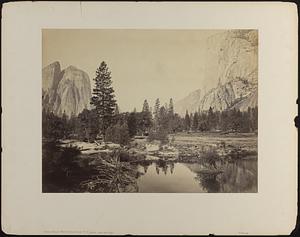
River view, Cathedral Rock, Yosemite
73.
Sentinel Rock, Yosemite
74.
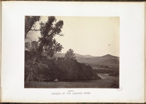
Source of the Laramie River.
75.
Tecalote Creek, New Mexico, 775 miles from Missouri River.
76.
Three Brothers
77.
Up Yosemite Valley from the foot of El Capitan
78.
Valley of the Rio Grande at Wagon Wheel Gap
79.
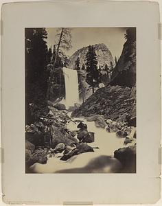
Vernal Fall, Yosemite
80.
View down Yosemite Valley from Ferry Bend
81.
View on Kaw River, in Delaware Reservation, Kansas.
82.
Washington Column, mirror view, Yosemite
83.
Weber Canon, from below Devil's Gate.
84.
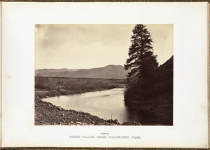
Weber Valley, from Willhelmina Pass.
85.
50' radius curve in subway near Boylston & Tremont
86.
868 B & M Railroad
87.
Accidents
88.
Aeral view of Arlington Center (from First Parish Steeple?)
89.
Aerial view of Arlington
90.
Aerial View of Arlington Center
91.
Aerial view of Arlington Center
92.
Approaches to Gatun Lock
93.
Arlington + Brattle Street Stations
94.
Arlington Avenue at Beacham Street
95.
Arlington Bridges
96.
Arlington c. 1900
97.
Art and industry, Chicago
98.
At Townshend Station B & W RR
99.
Auto in a hole
100.
Auto totaled on RR tracks
« Previous
Next »
1
2
3
4
5
…
62
63
Limit your search
Subject
Rivers
5,263
Bridges
1,070
Cities & towns
706
Boats
600
Railroad tracks
465
Trees
449
Bodies of water
344
Waterfronts
313
more
Subject
»
Place
North and Central America
4,748
United States
4,623
Massachusetts
2,951
Charles
740
Suffolk (county)
692
Essex (county)
631
Middlesex (county)
618
Boston
604
more
Place
»
Format
Photographs
4,358
Postcards/Cards
897
Prints
851
Manuscripts
55
Maps/Atlases
49
Paintings
49
Drawings/Illustrations
44
Ephemera
24
more
Format
»
Available to use
No known restrictions
3,217
Creative Commons license
1,036
Date
View distribution
Current results range from
1747
to
2016
Date range begin
Date range end
View larger »
Unknown
40
Collection
Project DOCUMERICA Photographs by Ernst Halberstadt
610
Photographs of the American West
570
Tichnor Brothers Postcard Collection
547
Stereograph Collection
413
Historical Society of Old Yarmouth Archives and Local History Collection
349
British Artists
333
Bill Lane Photograph Collection
274
Arthur Griffin Photographs
262
more
Collection
»
Institution
Boston Public Library
3,765
Historical Society of Old Yarmouth
383
Newburyport Public Library
274
Griffin Museum of Photography
262
Historical Society of Old Newbury
189
The Medford Historical Society & Museum
161
Phillips Library at the Peabody Essex Museum
149
Lawrence Public Library
87
more
Institution
»