Skip to search
Skip to main content
Digital Commonwealth
Sign Up / Log In
Search for
Search
Search
Search
Basic
Advanced
Explore
Map
Collections
Institutions
Formats
For Educators
Primary Source Sets
Lesson Plans
Using Primary Sources
Searching Digital Commonwealth
For Institutions
Join Digital Commonwealth
Conferences, Trainings, & Events
How to Contribute Collections
Digitization Services
Board & Committees
Frequently Asked Questions
About
About Digital Commonwealth
News & Announcements
Copyright & Terms of Use
Harmful Content Statement
Partners
API
Contact Us
Newton Free Library
Villages of Newton, Massachusetts: Auburndale, Chestnut Hill, Newton Lower Falls, 1900-1979
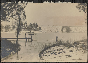
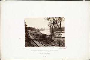
Villages of Newton, MA. Auburndale. Central St. toward Charles River, railroad tracks, Auburndale
Villages of Newton, MA. Auburndale. Central St. toward Charles River, railroad tracks, Auburndale
×
Item Information
Title:
Villages of Newton, MA. Auburndale. Central St. toward Charles River, railroad tracks, Auburndale
Date:
[ca. 1972]
Format:
Photographs
Genre:
Photographic prints
Landscape photographs
Location:
Newton Free Library
Box 1 of 4, #1-94 (shelf locator)
Collection (local):
Villages of Newton, Massachusetts: Auburndale, Chestnut Hill, Newton Lower Falls, 1900-1979
Subjects:
Rivers
Railroad tracks
Places:
Massachusetts
>
Middlesex (county)
>
Newton
>
Auburndale
Permalink:
https://ark.digitalcommonwealth.org/ark:/50959/ng451s52d
Terms of Use:
Rights status not evaluated.
Contact host institution for more information.
Notes:
Title supplied by cataloger.
Identifier:
3
Barcode:
31323016422502
show more...
View MODS XML
More Like This
Arch bridge under RR tracks in Salisbury
Banks of the Kaw, near Fort Riley, 135 miles west of Missouri River.
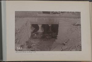
Cheesecake Brook looking North
Chester, Massachusetts
Find More Like This >>
Tools
Share
Facebook
Pinterest
X
Reddit
Tumblr
Email
Copy link
Add to Folder
Questions/Comments
Cite This Item