Search


Limit your search
- Ships2,015
- Harbors1,661
- Sailing ships1,534
- Boats1,025
- Piers & wharves932
- Naval yards & naval stations853
- Constitution (Frigate)744
- Boat & ship industry488
- North and Central America7,305
- United States6,977
- Massachusetts5,125
- Suffolk (county)2,917
- Boston2,637
- Essex (county)961
- Boston Harbor681
- Newburyport641
- Photographs8,390
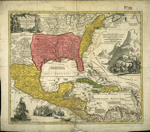
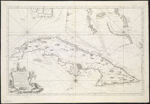
- Maps/Atlases1,365
- Postcards/Cards982
- Prints798
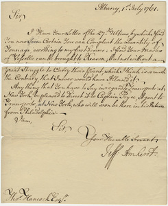
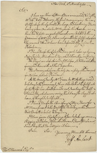
- Manuscripts237
- Letters/Correspondence218
- Ephemera154
- Documents135
- Leslie Jones Collection3,104
- Norman B. Leventhal Map Center Collection821
- Press Photography from the Brearley Collection740
- Tichnor Brothers Postcard Collection739
- Bill Lane Photograph Collection634
- Boston Pictorial Archive (Collection of Distinction)480
- Mass. Memories Road Show470
- Maritime Charts and Atlases (Collection of Distinction)399