Skip to search
Skip to main content
Skip to first result
Digital Commonwealth
Folders
Sign Up / Log In
Search for
Search
Search
Search
Basic
Advanced
Explore
Map
Collections
Institutions
Formats
For Educators
Primary Source Sets
Lesson Plans
Using Primary Sources
Searching Digital Commonwealth
For Institutions
Join Digital Commonwealth
Conferences, Trainings, & Events
How to Contribute Collections
Digitization Services
Board & Committees
Frequently Asked Questions
About
About Digital Commonwealth
News & Announcements
Copyright & Terms of Use
Harmful Content Statement
Partners
API
Contact Us
Search
« Prev.
|
1,218,801
-
1,218,900
of
1,236,493
|
Next »
Sort
by relevance
relevance
title
date (asc)
date (desc)
Number of results to display per page
100
per page
per page
10
per page
20
per page
50
per page
100
per page
View results as:
List
list view
Maps
map view
Gallery
grid view
Search Results
1218801.
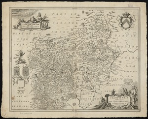
Herefordia comitatus vernacule Hereford Shire
1218802.
An epitome of Sr. William Petty's large survey of Ireland divided into its 4 provinces...
1218803.
A map of the principall part of Europe
1218804.
Surria : vernacule Surrey
1218805.
Suthsexia : vernacule Sussex
1218806.
Wigorniensis comitatus cum Warwicensi, nec non Conventriae Libertas
1218807.
Salopiensis comitatus cum Staffordiensi : Shrop Shire & Staffordshire
1218808.
Comitatus Northumbria vernacule Northumber Land
1218809.
Comitatus Nottinghamiensis : sive Nottingham Shire
1218810.
Suffolcia vernacula Suffolke
1218811.
Wiltonia sive comitatus Wiltoniensis : Anglis Wil Shire
1218812.
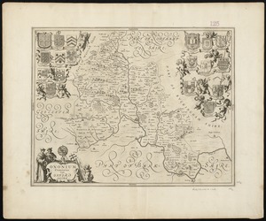
Oxonium comitatus, vulgo Oxford Shire
1218813.
Carte particuliere du havre de Boston : avec les sondes les bancs de Sable, les...
1218814.
A correct map of the coast of New England
1218815.
Map of the city of Boston and its environs
1218816.
Plan of Boston and its vicinity, showing the drainage area of Stony Brook which...
1218817.
Map of Boston and its vicinity from actual survey
1218818.
Colebrook, N.H., Coos Co., 1887
1218819.
Goffstown, N.H. 1887
1218820.
Map of Boston and its vicinity from actual survey
1218821.
Plan of Boston, with additions and corrections
1218822.
Ipswich, Mass : incorporated 1634
1218823.
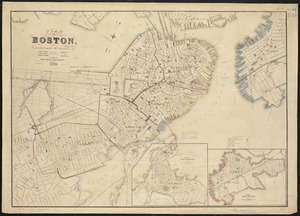
The city of Boston : 1879
1218824.
Cochituate, Mass. and North Natick, 1887
1218825.
Rochester, N.H : Gonic and East-Rochester, 1884
1218826.
Townsend Center, Mass
1218827.
Map of Boston from the latest surveys
1218828.
Harriman, Tenn : 1892
1218829.
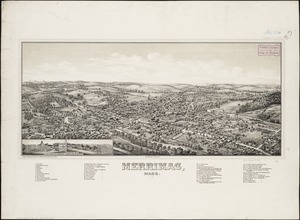
Merrimac, Mass
1218830.
Amesbury and Salisbury Mills, Mass : 1880
1218831.
Plan of Boston comprising a part of Charlestown and Cambridge
1218832.
New map of Boston, comprising the whole city, with the new boundaries of the wards
1218833.
New map of Boston, comprising the whole city, with the new boundaries of the wards
1218834.
Plan of Boston comprising a part of Charlestown and Cambridge
1218835.
New map of Boston, comprising the whole city, with the new boundaries of the wards
1218836.
New map of Boston, comprising the whole city, with the new boundaries of the wards
1218837.
Plan of Boston comprising a part of Charlestown and Cambridge
1218838.
Plan of Boston comprising a part of Charlestown and Cambridge
1218839.
Plan of the city of Boston
1218840.
Plan of Boston
1218841.
Plan of Boston
1218842.
Plan of Boston and its vicinity, showing the drainage area of Stony Brook which...
1218843.
New map of Boston, comprising the whole city, with the new boundaries of the wards
1218844.
New map of Boston, comprising the whole city, with the new boundaries of the wards
1218845.
Citizens & travelers guide map in, to and from the city of New York and adjacent places
1218846.
Plan of the city of New York : showing the made and swamp land
1218847.
At the request of the recorder Thomas Jones Esqr. chairman, & the other gentlemen of...
1218848.
Wilmington, Delaware
1218849.
Map of the city of New York and its vicinity
1218850.
Topographical map of the District of Columbia
1218851.
Map of Connecticut
1218852.
Johnson's map of New York and the adjacent cities
1218853.
Map of New York and vicinity
1218854.
[Plan of the land at Prince Street and Snowhill Street, Boston]
1218855.
Map of the rail roads of New Jersey 1887
1218856.
Map of Adams Co., Pa
1218857.
The Price & Lee Co's new map of the city of Paterson, Haledon and borough of Prospect...
1218858.
Fac simile of Holmes' map of the Province of Pennsylvania : with the names of the...
1218859.
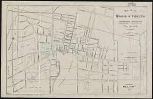
Map of the borough of Princeton, Mercer County, New Jersey
1218860.
The tourist's pocket map of Pennsylvania : exhibiting its internal improvements,...
1218861.
A new county map of the state of Pennsylvania and adjoining states : showing the route...
1218862.
Pennsylvania
1218863.
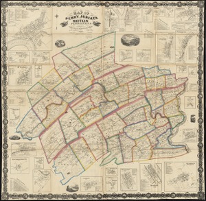
Map of the counties of Perry, Juniata and Mifflin, Pennsylvania
1218864.
Map of the city of Charleston, S.C. and vicinity : with table of reference to...
1218865.
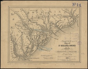
Map of St. Helena Sound, and the coast between Charleston and Savannah
1218866.
Physiographical map of North Carolina
1218867.
Map of the western parts of the colony of Virginia, as far as the Mississipi
1218868.
Map of Charleston, S.C
1218869.
Virginia
1218870.
The Rand McNally new commercial atlas map of North Carolina
1218871.
E. & G.W. Blunt's map of Charleston and vicinity
1218872.
Carolina is by vertue of a warr and under of hand and se all of the Right Honble....
1218873.
Spartanburg, South Carolina : the city of success ; city map and street directory
1218874.
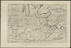
Preliminary map of south east Kentucky
1218875.
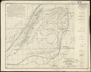
Revised map of part of the Cahaba coal fields
1218876.
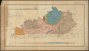
Geologic map of Kentucky : showing oil and gas pools and pipelines and the eastern and...
1218877.
Map of Arkansas : from government and other authentic sources
1218878.
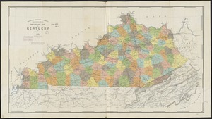
Preliminary map of Kentucky
1218879.
Preliminary map of Kentucky
1218880.
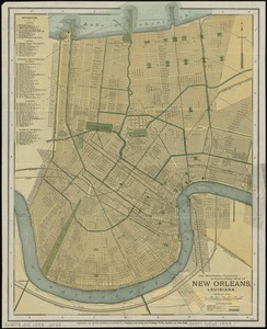
The Matthews-Northrup up-to-date map of New Orleans, Louisiana
1218881.
Colton's railroad & township map of Arkansas
1218882.
Map of Boyd, Carter and Greenup Counties
1218883.
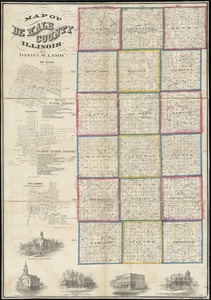
Map of De Kalb County, Illinois
1218884.
Topographic map of Lawrence County, Illinois
1218885.
Texas and Pacific Rail Way
1218886.
Texas New Yorker's railroad map of Texas : showing all completed and proposed routes,...
1218887.
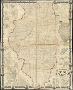
New sectional map of the state of Illinois : compiled from the United States surveys,...
1218888.
Texas New Yorker travelers' railroad map of the State of Texas
1218889.
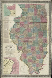
Map of the state of Illinois
1218890.
Geologic map of Illinois
1218891.
[Illinois]
1218892.
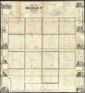
Map of Hillsdale Co., Michigan
1218893.
Portion of the copper district, Michigan, Lake Superior
1218894.
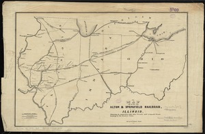
Map of the Alton & Springfield railroad, in Illinois : showing its connection with...
1218895.
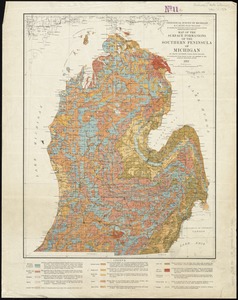
Map of the surface formations of the Southern Peninsula of Michigan
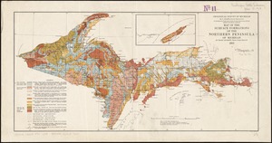
1218896.
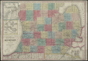
Map of the surveyed part of Michigan
1218897.
Map of the surface formations of the Northern Peninsula of Michigan
1218898.
Map of Jeffersonville enlarged
1218899.
Survey of the mouth of Trail Creek, Indiana
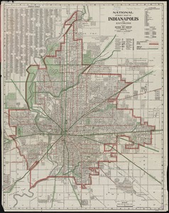
1218900.
National street map of Indianapolis and environs
« Previous
Next »
1
2
…
12,185
12,186
12,187
12,188
12,189
12,190
12,191
12,192
12,193
…
12,364
12,365
Limit your search
Subject
Houses
26,811
waterworks
19,972
Buildings
18,149
Students
15,739
Antislavery movements--United States
13,111
News
12,448
Antislavery movements--United States--History--19th century
11,293
reservoirs (water distribution structures)
11,160
more
Subject
»
Place
North and Central America
624,969
United States
620,642
Massachusetts
526,606
Suffolk (county)
215,676
Boston
210,557
Essex (county)
64,578
Middlesex (county)
54,679
Worcester (county)
51,776
more
Place
»
Format
Photographs
506,307
Manuscripts
228,395
Letters/Correspondence
185,353
Newspapers
110,045
Documents
101,422
Postcards/Cards
62,349
Film/Video
57,967
Prints
50,698
more
Format
»
Available to use
No known restrictions
266,870
Creative Commons license
161,858
Date
View distribution
Current results range from
-8000
to
2873
Date range begin
Date range end
View larger »
Unknown
79,454
Collection
W. E. B. Du Bois Papers, 1803-1999 (bulk 1877-1963)
99,739
American Archive of Public Broadcasting Collection
85,165
Newspapers from the Boston Public Library
67,760
Mark H. McCormack Papers, ca. 1920-2008 (bulk: 1957-2003)
48,824
Digitized Museum Collections
45,842
Tewksbury Almshouse Intake Records [1854-1884]
41,668
Leslie Jones Collection
37,421
Tichnor Brothers Postcard Collection
28,068
more
Collection
»
Institution
Boston Public Library
320,566
Special Collections and University Archives, University of Massachusetts Amherst Libraries
239,006
Historic New England
105,261
Northeastern University Library
68,545
Public Health Museum in Massachusetts
41,668
Massachusetts Archives
27,189
Springfield College Archives and Special Collections
22,438
Newburyport Public Library
18,961
more
Institution
»


![[Plan of the land at Prince Street and Snowhill Street, Boston]](https://bpldcassets.blob.core.windows.net/derivatives/images/commonwealth:4m90f3650/image_thumbnail_300.jpg)


![[Illinois]](https://bpldcassets.blob.core.windows.net/derivatives/images/commonwealth:4m90f716w/image_thumbnail_300.jpg)