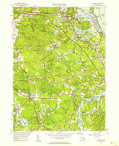
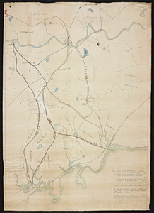
Skip to search
Skip to main content
Skip to first result
Digital Commonwealth
Folders
Sign Up / Log In
Search for
Search
Search
Search
Basic
Advanced
Explore
Map
Collections
Institutions
Formats
For Educators
Primary Source Sets
Lesson Plans
Using Primary Sources
Searching Digital Commonwealth
For Institutions
Join Digital Commonwealth
Conferences, Trainings, & Events
How to Contribute Collections
Digitization Services
Board & Committees
Frequently Asked Questions
About
About Digital Commonwealth
News & Announcements
Copyright & Terms of Use
Harmful Content Statement
Partners
API
Contact Us
Search
Search Constraints
Start Over
Save Search
Your search:
Format
Maps
✖
Remove constraint Format: Maps
Date
Unknown
✖
Remove constraint Date: Unknown
« Prev. |
1
-
100
of
289
|
Next »
Sort
by relevance
relevance
title
date (asc)
date (desc)
Number of results to display per page
100
per page
per page
10
per page
20
per page
50
per page
100
per page
View results as:
List
list view
Maps
map view
Gallery
grid view
Search Results
1.
1878 Map of Newton Center
2.
1879 Map of Halifax, Massachusetts
3.
Abbot Academy and Phillips Academy History
4.
All Shore Route
5.
America
6.
Americae Nova Tabula
7.
American Antiquarian Society Collection
8.
American Textile History Museum Image Collection
9.
Annisquam Historical Society's Collection of Historical Documents
10.
Arlington Historical Maps including Menotomy and the Old Burying Ground
11.
Arlington Historical Society Collection
12.
Arnold Arboretum Maps and Plans
13.
Art and Artifacts Collection
14.
Atlas Major
15.
Atlas of the City of New Bedford, 1911
16.
Barre Historical Society Map Collection
17.
Bay of Fundy to Cape Cod
18.
Becker collection
19.
Bedrock geologic map of Massachusetts
20.
Benjamin Smith Lyman Papers, 1831-1921 (Bulk: 1851-1915)
21.
Berkley Public Library Local History
22.
Beverly Picture Collection
23.
Bird's Eye View of Boston Harbor and South Shore to Provincetown
24.
Bird's eye view of Boston Harbor and South Shore to Provincetown showing steamboat routes
25.
Bird's Eye View of Cape Cod, Mass., and Vicinity featuring the Cape Cod Canal (2 copies)
26.
Blackstone quadrangle, Massachusetts--Rhode Island / Mapped, edited and published by...
27.
Blue Books of Newton
28.
Blue Hills quadrangle, Massachusetts [1958] / Mapped, edited, and published by the...
29.
Boston Athenaeum, Cartographic Collection
30.
Boston Black United Front
31.
Boston Harbor
32.
Boston Pictorial Archive (Collection of Distinction)
33.
Boston Redevelopment Authority Collection
34.
Boston South quadrangle, Massachusetts / Mapped, edited, and published by the...
35.
Boston with its Environs
36.
Bourne Archives Map Collection
37.
Bourne Archives Photograph Collection
38.
Brookline Photograph Collection
39.
Brookline Public Library Manuscript Collection
40.
Campus Maps from Phillips Academy Archives and Special Collections
41.
A Cape Codder's Idea of the United States of America
42.
Cape Elizabeth to Cape Cod
43.
Charles E. and M. Sybil Hartley Eshbach Papers, 1913-1990
44.
Charles River, City Hall, Community Schools, Crystal Lake, Echo Bridge, Tocci Family...
45.
Chart of Cape Cod Canal, also approaches in Buzzards Bay and Barnstable Bay
46.
Chinese Progressive Association Records
47.
Chris Bond Collection
48.
A City of Refugees, the Memories of Cambodia Collection
49.
Civil War Manuscripts (NEHGS)
50.
Civitates Orbis Terrarum
51.
Coast Guard Heritage Museum General Collection
52.
Cohasset quadrangle, Massachusetts / Mapped, edited, and published by the Geological...
53.
Colonial and Revolutionary Boston (Collection of Distinction)
54.
Commonwealth v. Sacco and Vanzetti
55.
Correspondence by Leander Gage King from Camp Hamilton, 1861 September
56.
Correspondence by Leander Gage King from Camp Hamilton, Portsmouth, Gosport Navy Yard,...
57.
David A. Hanson Collection of the History of Photomechanical Reproduction
58.
David Entin Papers, 1966-2015 (Bulk: 1966-1968)
59.
Digital Amherst Collection
60.
Digitized Museum Collections
61.
Discover Manomet Point this summer, Graphic History Association, New York, New York
62.
Early American and European Maps
63.
Edward and Orra White Hitchcock Papers
64.
Elmer C. Bartels Papers, 1961-2014
65.
Ephemera collection (EP001)
66.
Ephraim Williams Project
67.
Factory and grounds of the United Shoe Machinery Company at Beverly, Massachusetts
68.
First settlers' homesteads
69.
Folder of Arnold Arboretum maps from 1900-1936
70.
Framingham quadrangle, Massachusetts / Mapped, edited, and published by the Geological...
71.
Frank A. Waugh Papers, 1881-1993 (bulk 1905-1943)
72.
Franklin Associates
73.
French and Indian Wars Manuscripts (NEHGS)
74.
From Boston to the Arch bridge at Lowell via the Boston and Maine Railroad.
75.
General architectural and cartographic collection
76.
General architectural and cartographic collection (AR001)
77.
General Court
78.
General photographic collection (PC001)
79.
George R. Coffin Diary, 1854-1857
80.
George S. Boutwell Map Collection
81.
Gloucester Harbor, Massachusetts / from a trigonometrical survey under the direction...
82.
Gloucester Map Collection
83.
Gloucester quadrangle, Massachusetts / Mapped, edited and published by the Geological...
84.
Grade crossing at Cole's River
85.
Hampshire Council of Governments Records, 1677-1961
86.
The Harvard Forest Map Collection
87.
Harvard Forest Martha's Vineyard Collection
88.
Hatfield History Collection
89.
Highland Cemetery Collection
90.
Historic Maps
91.
Historical Records of the Town of Westborough: Administrative Documents, 1724-1929
92.
Holliston quadrangle, Massachusetts / Mapped, edited, and published by the Geological...
93.
Holmes Public Library (Halifax) and the Halifax Historical Society and Museum's Guy S....
94.
Hudson Family Papers
95.
Hull quadrangle, Massachusetts--Middlesex Co. / Mapped, edited, and published by the...
96.
Inquilinos Boricuas en Acción Records
97.
Ipswich Bay to Gloucester Harbor
98.
J. C. Phillips Nature Preserve ; Rt. 97, Beverly, Massachusetts
99.
James Walker Collection
100.
Jim Kweskin Papers, 1907-2018
« Previous
Next »
1
2
3
Limit your search
Subject
tourism
8
Boston and Maine Railroad--Maps
6
roadways
5
driving
4
Boston (Mass.)--Maps
3
Boston and Lowell Railroad Corporation--Maps
3
Cambridge (Mass.)--Maps
3
Harbors
3
more
Subject
»
Place
North and Central America
108
United States
108
Massachusetts
102
Middlesex (county)
32
Suffolk (county)
28
Boston
25
Norfolk (county)
19
Essex (county)
15
more
Place
»
Format
Any of:
Maps
✖
[remove]
Available to use
No known restrictions
4
Collection
Massachusetts Board of Railroad Commissioners
49
Gloucester Map Collection
28
Nina Heald Webber Cape Cod Canal collection (MS028)
12
Selected items from the collections of the Massachusetts Historical Society
7
Civil War Manuscripts (NEHGS)
4
Ephemera collection (EP001)
4
Beverly Picture Collection
2
William Mahoney Collection
2
more
Collection
»
Institution
State Library of Massachusetts
58
Gloucester Lyceum & Sawyer Free Library
29
Historic New England
24
University of Massachusetts Amherst Libraries Special Collections and University Archives
15
Newton Free Library
12
Boston Public Library
9
Massachusetts Historical Society
9
Lawrence Public Library
7
more
Institution
»