Skip to search
Skip to main content
Digital Commonwealth
Sign Up / Log In
Search for
Search
Search
Search
Basic
Advanced
Explore
Map
Collections
Institutions
Formats
For Educators
Primary Source Sets
Lesson Plans
Using Primary Sources
Searching Digital Commonwealth
For Institutions
Join Digital Commonwealth
Conferences, Trainings, & Events
How to Contribute Collections
Digitization Services
Board & Committees
Frequently Asked Questions
About
About Digital Commonwealth
News & Announcements
Copyright & Terms of Use
Harmful Content Statement
Partners
API
Contact Us
American Antiquarian Society
Maritime Charts and Atlases (Collection of Distinction)
/
American Antiquarian Society Collection
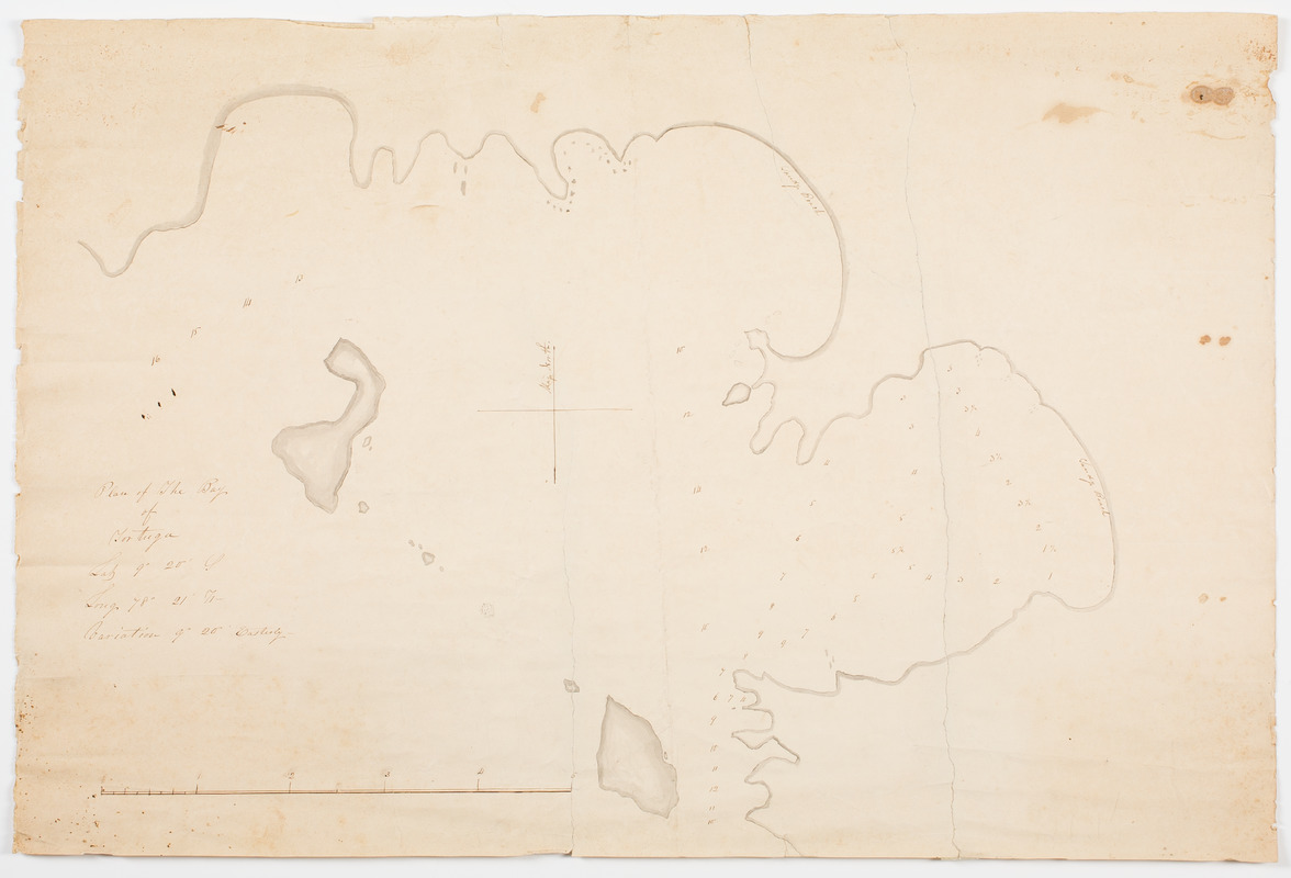
Plan of the bay of Tortuga
Plan of the bay of Tortuga
×
Item Information
Title:
Plan of the bay of Tortuga
Description:
Subject: Plan of Tortuga Bay in the West Indies.
Date:
[1800?–1830?]
Format:
Maps/Atlases
Manuscripts
Location:
American Antiquarian Society
Collection (local):
American Antiquarian Society Collection
Subjects:
West Indies--Maps
Places:
West Indies
Extent:
1 map : ink and watercolor ; 42 x 63 cm.
Permalink:
https://ark.digitalcommonwealth.org/ark:/50959/z603vh36k
Terms of Use:
Public Domain/No known restrictions on use. Contact host institution to download image.
Contact host institution for more information.
Scale:
Scale [ca. 1:36,206]
Language:
English
Referenced by:
http://catalog.mwa.org/vwebv/holdingsInfo?bibId=509964
Notes:
Depths shown by soundings.
show more...
View MODS XML
More Like This
An accurate map of the West Indies, : containing the Bahama & ...
An accurate map of the West Indies
An Accurate map of the West Indies, with the adjacent coast
An accurate map of the West Indies with the adjacent coast of America
Find More Like This >>
Tools
Share
Facebook
Pinterest
X
Reddit
Tumblr
Email
Copy link
Add to Folder
Questions/Comments
Cite This Item
IIIF Manifest