Skip to search
Skip to main content
Digital Commonwealth
Sign Up / Log In
Search for
Search
Search
Search
Basic
Advanced
Explore
Map
Collections
Institutions
Formats
For Educators
Primary Source Sets
Lesson Plans
Using Primary Sources
Searching Digital Commonwealth
For Institutions
Join Digital Commonwealth
Conferences, Trainings, & Events
How to Contribute Collections
Digitization Services
Board & Committees
Frequently Asked Questions
About
About Digital Commonwealth
News & Announcements
Copyright & Terms of Use
Harmful Content Statement
Partners
API
Contact Us
Boston Public Library
Norman B. Leventhal Map Center Collection
/
American Revolutionary War-Era Maps (Collection of Distinction)
/
Maritime Charts and Atlases (Collection of Distinction)
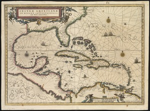
A new and improved chart of the West India or Carribbee [sic] Islands
A new and improved chart of the West India or Carribbee [sic] Islands
×
Item Information
Title:
A new and improved chart of the West India or Carribbee [sic] Islands
Creator:
Heather, William, 1764-1812
Name on Item:
drawn from the best authorities by William Heather.
Date:
1795
Format:
Maps/Atlases
Location:
Boston Public Library
Norman B. Leventhal Map Center
Collection (local):
Norman B. Leventhal Map Center Collection
Subjects:
Nautical charts--West Indies--Early works to 1800
West Indies--Maps--Early works to 1800
Places:
West Indies
Extent:
1 chart ; 78 x 62 cm.
Permalink:
https://ark.digitalcommonwealth.org/ark:/50959/kk91fq94p
Terms of Use:
No known copyright restrictions.
No known restrictions on use.
Publisher:
London : W. Heather
Scale:
Scale ca. 1:1,235,000.
Language:
English
Notes:
Depths shown by soundings.
Cataloging, conservation, and digitization made possible in part by The National Endowment for the Humanities: Exploring the human endeavor.
Identifier:
06_01_007234
Call #:
G4900 1795 .H43x
Barcode:
39999059030278
show more...
View MODS XML
More Like This
Carta esferica que comprende una parta de las Islas Antillas, las ...
Insulae Americanae in Oceano Septentrionali, cum terris adiacentibus
A new chart of the Bahama Islands and the Windward Passage
A new generall chart for the West Indies of E. Wrights projection ...
Find More Like This >>
Tools
Share
Facebook
Pinterest
X
Reddit
Tumblr
Email
Copy link
Add to Folder
Questions/Comments
Cite This Item
IIIF Manifest
Downloads
Primary (full resolution, uncompressed)
(TIF, 229 MB)
Large (full resolution)
(JPEG, 19.2 MB)
Medium
(JPEG, 192 KB)
![A new and improved chart of the West India or Carribbee [sic] Islands](https://bpldcassets.blob.core.windows.net/derivatives/images/commonwealth:kk91fq95z/image_access_800.jpg)