Skip to search
Skip to main content
Digital Commonwealth
Sign Up / Log In
Search for
Search
Search
Search
Basic
Advanced
Explore
Map
Collections
Institutions
Formats
For Educators
Primary Source Sets
Lesson Plans
Using Primary Sources
Searching Digital Commonwealth
For Institutions
Join Digital Commonwealth
Conferences, Trainings, & Events
How to Contribute Collections
Digitization Services
Board & Committees
Frequently Asked Questions
About
About Digital Commonwealth
News & Announcements
Copyright & Terms of Use
Harmful Content Statement
Partners
API
Contact Us
This site is currently undergoing maintenance and some features may be unavailable. We apologize for the inconvenience.
×
Boston Public Library
Norman B. Leventhal Map Center Collection
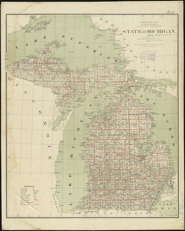
State of Michigan
State of Michigan
×
Item Information
Title:
State of Michigan
Creator:
United States. General Land Office
Name on Item:
compiled from the official records of the General Land Office and other sources by C. Roeser, Principal Draughtsman, G.L.O.
Date:
1878
Format:
Maps/Atlases
Location:
Boston Public Library
Norman B. Leventhal Map Center
Collection (local):
Norman B. Leventhal Map Center Collection
Subjects:
Public lands--Michigan--Maps
Michigan--Maps
Michigan--Surveys
Places:
Michigan
Extent:
1 map : col. ; 76 x 64 cm.
Permalink:
https://ark.digitalcommonwealth.org/ark:/50959/7h14b339g
Terms of Use:
No known copyright restrictions.
No known restrictions on use.
Publisher:
[Washington] : General Land Office
Scale:
Scale [1:1,013,760]. 16 miles to 1 in.
Language:
English
Notes:
Relief shown by hachures.
Shows drainage, county boundaries, railroads, railroad grants, Indian reservations, townships, etc.
Prime meridans: Greenwich and Washington.
"J.S. Williamson, Commissioner."
Identifier:
06_01_008826
Call #:
G4110 1878 .U55
Barcode:
39999065657742
show more...
View MODS XML
More Like This
The great north woods tourist and fishing district of Wisconsin : ...
A map of part of the N:W: Territory of the United States : ...
Map of the states of Ohio, Indiana and Illinois with the settled ...
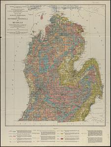
Map of the surface formations of the southern peninsula of Michigan
Find More Like This >>
Tools
Share
Facebook
Pinterest
X
Reddit
Tumblr
Email
Copy link
Add to Folder
Questions/Comments
Cite This Item
IIIF Manifest
Downloads
Primary (full resolution, uncompressed)
(TIF, 130 MB)
Large (full resolution)
(JPEG, 10.9 MB)
Medium
(JPEG, 194 KB)
GeoTIFF (georeferenced)
(TIF, 159 MB)