Skip to search
Skip to main content
Digital Commonwealth
Sign Up / Log In
Search for
Search
Search
Search
Basic
Advanced
Explore
Map
Collections
Institutions
Formats
For Educators
Primary Source Sets
Lesson Plans
Using Primary Sources
Searching Digital Commonwealth
For Institutions
Join Digital Commonwealth
Conferences, Trainings, & Events
How to Contribute Collections
Digitization Services
Board & Committees
Frequently Asked Questions
About
About Digital Commonwealth
News & Announcements
Copyright & Terms of Use
Harmful Content Statement
Partners
API
Contact Us
Boston Public Library
Norman B. Leventhal Map & Education Center Collection
/
Urban Maps (Collection of Distinction)
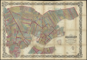
Plan of a part of New Brighton, Staten Island, showing the 500 blocks comprised in a proposed sale of lots
Plan of a part of New Brighton, Staten Island, showing the 500 blocks comprised in a proposed sale of lots
×
Item Information
Title:
Plan of a part of New Brighton, Staten Island, showing the 500 blocks comprised in a proposed sale of lots
Creator:
McKean, Henry S.
Name on Item:
enlarged from J. Lyon's plan, with additions, by Henry S. McKean, c.e.
Date:
[1841]
Format:
Maps/Atlases
Location:
Boston Public Library
Norman B. Leventhal Map & Education Center
Collection (local):
Norman B. Leventhal Map & Education Center Collection
Subjects:
Real property--New York (State)--New York--Maps
Landowners--New York (State)--New York--Maps
Staten Island (New York, N.Y.)--Maps
Places:
New York
>
New York
>
Staten Island
Extent:
1 map ; 97 x 157 cm.
Permalink:
https://ark.digitalcommonwealth.org/ark:/50959/4m90f1916
Terms of Use:
No known copyright restrictions.
No known restrictions on use.
Publisher:
S.l : s.n.
Scale:
Scale [ca. 1:1,600]
Language:
English
Notes:
Oriented with north to the lower left.
Date handwritten below title statement.
Notes (date):
This date is inferred.
Identifier:
06_01_010675
Call #:
G3804.N4:2S8G46 1841 .M34
Barcode:
39999065676734
show more...
View MODS XML
More Like This
At the request of the recorder Thomas Jones Esqr. chairman, & the ...
Map of the City of Brooklyn as consolidated by an act of the ...
The city of New York as laid out by the Commissioners with the ...
Ground plan of the markets of the City of New-York
Find More Like This >>
Tools
Share
Facebook
Pinterest
X
Reddit
Tumblr
Email
Copy link
Add to Folder
Questions/Comments
Cite This Item
IIIF Manifest
Downloads
Primary (full resolution, uncompressed)
(TIF, 518 MB)
Large (full resolution)
(JPEG, 43.5 MB)
Medium
(JPEG, 277 KB)