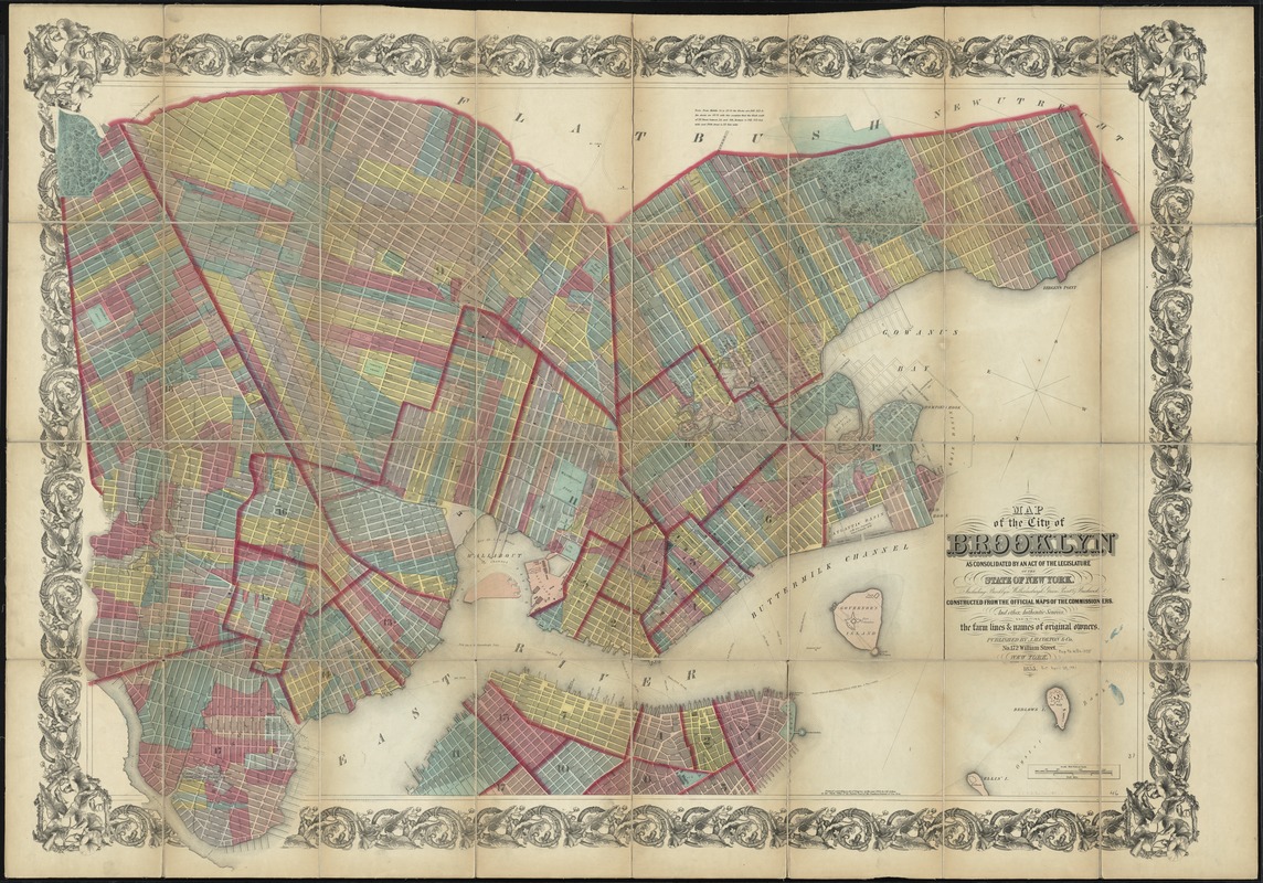
Map of the City of Brooklyn as consolidated by an act of the legislature of the State of New York : including Brooklyn, Williamsburgh, Green Point & Bushwick, constructed from the official maps of the Commissioners, and other authentic sources, exhibiting the farm lines & names of original owners
Map of the City of Brooklyn as consolidated by an act of the legislature of the State of New York
Item Information
Title:
Map of the City of Brooklyn as consolidated by an act of the legislature of the State of New York : including Brooklyn, Williamsburgh, Green Point & Bushwick, constructed from the official maps of the Commissioners, and other authentic sources, exhibiting the farm lines & names of original owners
Cadastral map. Covers Brooklyn, New York (N.Y.) south to 60th Street and east to Greenwood Cemetery and Cemetery of the Evergreens; also Manhattan, New York (N.Y.) south of 12th Street. Map shows existing and proposed streets, property lines, buildings and owners' names. Also shows streams and wetlands.
Shows depths by soundings.
Oriented with north to the bottom of sheet.