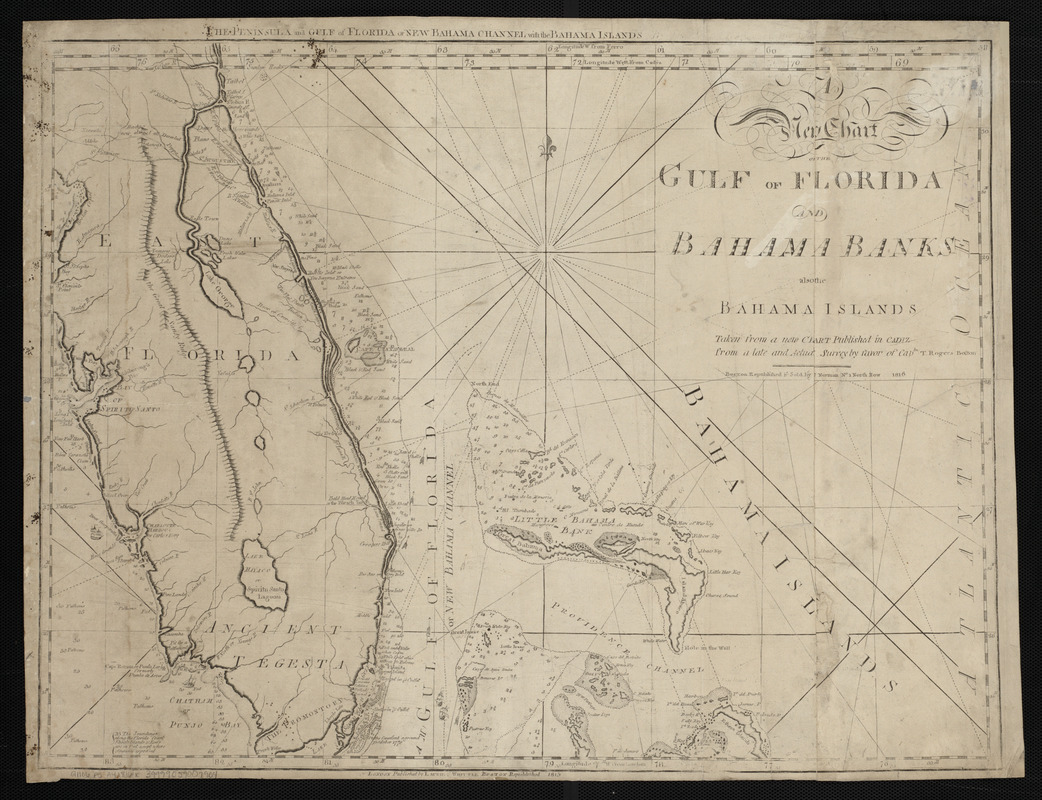
A new chart of the Gulf of Florida and Bahama Banks also the Bahama Islands taken from a new chart published in Cadiz from a late and actual survey by favor of Captn. T. Rogers
A new chart of the Gulf of Florida and Bahama Banks also the Bahama Islands taken from a new chart published in Cadiz from a late and actual survey by favor of Captn. T. Rogers
Item Information
Title:
A new chart of the Gulf of Florida and Bahama Banks also the Bahama Islands taken from a new chart published in Cadiz from a late and actual survey by favor of Captn. T. Rogers
Title (alt.):
Peninsula and Gulf of Florida or New Bahama Channel with the Bahama Islands
Relief shown pictorially. Depths shown by soundings.
Prime meridians: Ferro, Cadiz and London.
In lower margin: London published by Laurie & Whittle Boston republished 1815.
In The American pilot. Boston : Andrew J. Allen, [1816].