Skip to search
Skip to main content
Skip to first result
Digital Commonwealth
Folders
Sign Up / Log In
Search for
Search
Search
Search
Basic
Advanced
Explore
Map
Collections
Institutions
Formats
For Educators
Primary Source Sets
Lesson Plans
Using Primary Sources
Searching Digital Commonwealth
For Institutions
Join Digital Commonwealth
Conferences, Trainings, & Events
How to Contribute Collections
Digitization Services
Board & Committees
Frequently Asked Questions
About
About Digital Commonwealth
News & Announcements
Copyright & Terms of Use
Harmful Content Statement
Partners
API
Contact Us
Search
Search Constraints
Start Over
Save Search
Your search:
More Like
commonwealth:wd376524n
✖
Remove constraint More Like: commonwealth:wd376524n
« Prev.
|
301
-
400
of
10,999
|
Next »
Sort
by relevance
relevance
title
date (asc)
date (desc)
Number of results to display per page
100
per page
per page
10
per page
20
per page
50
per page
100
per page
View results as:
List
list view
Maps
map view
Gallery
grid view
Search Results
301.
Asia
302.
Asia
303.
Asia
304.
Asia : with the islands adioyning described, the atire of the people, & townes of importance, all of them newly augmented
305.
Asia
306.
Asia, according to the best authorities
307.
Asia, ca. 100 A.D.
308.
Asia Florente Persarum Imperio
309.
Asia noviter delineata
310.
Asia noviter delineata
311.
Asia recens summa cura delineata
312.
Asia under the Mongols, 1290 A.D.
313.
Asiae Minoris antiquae : tabula in usum scholarum descripta
314.
Asiae Minoris antiquae : tabula in usum scholarum descripta
315.
Asiae noua descriptio
316.
Asiae nova
317.
Asiæ quæ vulgo minor dicitur et Syriæ tabula geographica : quantum per subsidia licuit elaborata, opere, si quod aliud in...
318.
Asiatische Türkei
319.
L'Asie antérieure : d'après le texte de la Nouvelle Géographie Universelle et d'autres documents récents
320.
Asien
321.
Ask Shell!
322.
Aspect général de Paris
323.
Aspect général de Rome
324.
Assiniboia
325.
An astronomical chart or diagram, in which the structure of the solar system is exhibited at one view
326.
At the request of the recorder Thomas Jones Esqr. chairman, & the other gentlemen of the committee, I have surveyed the farm...
327.
Athens
328.
Athol, Mass : 1887
329.
Atlantic Neptune [front matter]
330.
Atlantic Neptune [front matter]
331.
Atlas of Abington and Rockland, Massachusetts : from recent and actual surveys & records
332.
Atlas of Attleboro' Town, Massachusetts
333.
Atlas of Barnstable County, Massachusetts : towns of Bourne, Mashpee, Falmouth, Sandwich, Barnstable, Yarmouth, Dennis,...
334.
Atlas of Berkshire County, Massachusetts
335.
Atlas of Bristol Co., Massachusetts : from actual surveys
336.
Atlas of Brookfield, West Brookfield and No. Brookfield towns, Massachusetts : compiled from recent and actual surveys and records
337.
Atlas of Cape Ann, Gloucester, Rockport and Manchester, Essex County, Mass. : from official plans and actual surveys
338.
Atlas of Dorchester, West Roxbury and Brighton, city of Boston : index map
339.
Atlas of Dorchester, West Roxbury and Brighton, city of Boston : plate 1
340.
Atlas of Dorchester, West Roxbury and Brighton, city of Boston : plate 2
341.
Atlas of Dorchester, West Roxbury and Brighton, city of Boston : plate 3
342.
Atlas of Dorchester, West Roxbury and Brighton, city of Boston : plate 4
343.
Atlas of Dorchester, West Roxbury and Brighton, city of Boston : plate 5
344.
Atlas of Dorchester, West Roxbury and Brighton, city of Boston : plate 6
345.
Atlas of Dorchester, West Roxbury and Brighton, city of Boston : plate 7
346.
Atlas of Dorchester, West Roxbury and Brighton, city of Boston : plate 8
347.
Atlas of Dorchester, West Roxbury and Brighton, city of Boston : plate 9
348.
Atlas of Dorchester, West Roxbury and Brighton, city of Boston : plate 10
349.
Atlas of Dorchester, West Roxbury and Brighton, city of Boston : plate 11
350.
Atlas of Dorchester, West Roxbury and Brighton, city of Boston : plate 12
351.
Atlas of Dorchester, West Roxbury and Brighton, city of Boston : plate 13
352.
Atlas of Dorchester, West Roxbury and Brighton, city of Boston : plate 14
353.
Atlas of Dorchester, West Roxbury and Brighton, city of Boston : plate 15
354.
Atlas of Dorchester, West Roxbury and Brighton, city of Boston : plate 16
355.
Atlas of Dorchester, West Roxbury and Brighton, city of Boston : plate 17
356.
Atlas of Dorchester, West Roxbury and Brighton, city of Boston : plate 18
357.
Atlas of Dorchester, West Roxbury and Brighton, city of Boston : plate 19
358.
Atlas of Dorchester, West Roxbury and Brighton, city of Boston : plate 20
359.
Atlas of Dorchester, West Roxbury and Brighton, city of Boston : plate 21
360.
Atlas of Dorchester, West Roxbury and Brighton, city of Boston : plate 22
361.
Atlas of Dorchester, West Roxbury and Brighton, city of Boston : plate 23
362.
Atlas of Dorchester, West Roxbury and Brighton, city of Boston : plate 24
363.
Atlas of Dorchester, West Roxbury and Brighton, city of Boston : plate 25
364.
Atlas of Dorchester, West Roxbury and Brighton, city of Boston : plate 26
365.
Atlas of Dorchester, West Roxbury and Brighton, city of Boston : plate 27
366.
Atlas of Dorchester, West Roxbury and Brighton, city of Boston : plate 28
367.
Atlas of Dorchester, West Roxbury and Brighton, city of Boston : plate 29
368.
Atlas of Dorchester, West Roxbury and Brighton, city of Boston : plate 30
369.
Atlas of Dorchester, West Roxbury and Brighton, city of Boston : plate 31
370.
Atlas of Dorchester, West Roxbury and Brighton, city of Boston : plate 32
371.
Atlas of Dorchester, West Roxbury and Brighton, city of Boston : plate 33
372.
Atlas of Dorchester, West Roxbury and Brighton, city of Boston : plate 34
373.
Atlas of Dorchester, West Roxbury and Brighton, city of Boston : plate 35
374.
Atlas of Dorchester, West Roxbury and Brighton, city of Boston : plate 36
375.
Atlas of Dorchester, West Roxbury and Brighton, city of Boston : plate 37
376.
Atlas of Dorchester, West Roxbury and Brighton, city of Boston : plate 38
377.
Atlas of Dorchester, West Roxbury and Brighton, city of Boston : plate 39
378.
Atlas of Dorchester, West Roxbury and Brighton, city of Boston : plate 40
379.
Atlas of Dorchester, West Roxbury and Brighton, city of Boston
380.
Atlas of Essex County, Massachusetts
381.
Atlas of Essex County, Massachusetts : from actual surveys and official records
382.
Atlas of Fall River City, Massachusetts
383.
Atlas of Franklin Co. Massachusetts : from actual surveys
384.
Atlas of Gardner town, Massachusetts
385.
Atlas of Greenfield Town, Massachusetts
386.
Atlas of Hampden Co., Massachusetts : from actual surveys
387.
Atlas of Haverhill and Bradford, Massachusetts
388.
Atlas of Holyoke City, Massachusetts
389.
Atlas of Malden City, Massachusetts
390.
Atlas of Middlesex County : volume 1, Cambridge, Somerville, Arlington, Belmont, Watertown, Everett, Malden, Medford, Newton,...
391.
Atlas of Middlesex County : volume 2, cities of Melrose & Woburn, towns of Bedford, Burlington, Concord, North Reading,...
392.
Atlas of Middlesex County, Massachusetts : compiled from recent and actual surveys and records
393.
Atlas of Middlesex County, Massachusetts, volume 3 : towns of Ashland, Framingham, Holliston, Hopkinton, Natick, Sherborn,...
394.
Atlas of New Bedford city, Massachusetts
395.
Atlas of Norfolk County Mass. : from recent and actual surveys & records
396.
Atlas of Northampton City, Massachusetts
397.
Atlas of Spencer Town, Massachusetts
398.
Atlas of Springfield City, Massachusetts
399.
Atlas of Suffolk, county, vol. 7th, late town of Brighton, now ward 19 of Boston, Massachusetts : from actual survey & official...
400.
Atlas of Suffolk, county, vol. 7th, late town of Brighton, now ward 19 of Boston, Massachusetts : from actual survey & official...
« Previous
Next »
1
2
3
4
5
6
7
8
…
109
110
Limit your search
Subject
Real property--Massachusetts--Boston--Maps
2,278
Landowners--Massachusetts--Boston--Maps
2,117
Boston (Mass.)--Maps
1,966
Roxbury (Boston, Mass.)--Maps
351
Dorchester (Boston, Mass.)--Maps
317
Cambridge (Mass.)--Maps
266
Brookline (Mass.)--Maps
236
Real property--Massachusetts--Cambridge--Maps
216
more
Subject
»
Place
North and Central America
7,814
United States
6,575
Suffolk (county)
3,337
Boston
3,197
Massachusetts
3,175
Europe
963
Middlesex (county)
617
Canada
427
more
Place
»
Format
Maps/Atlases
10,940
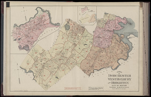
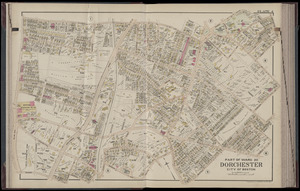
Manuscripts
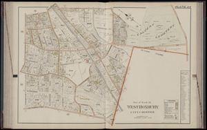
215
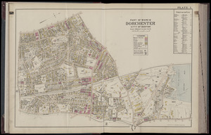
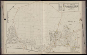
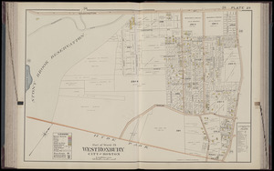
Prints
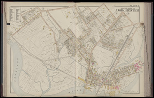
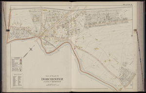
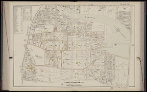
51
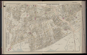
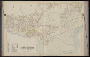
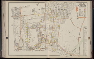
Books
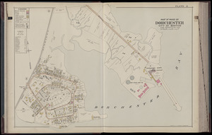
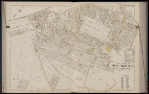
35
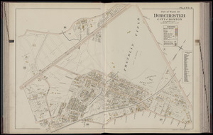
Objects/Artifacts
10
Drawings/Illustrations
8
Posters
4
Available to use
No known restrictions
10,931
Creative Commons license
46
Date
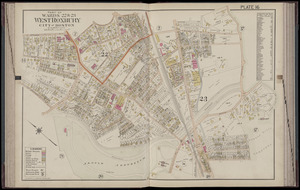
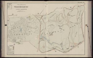
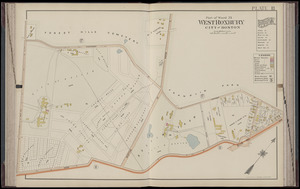
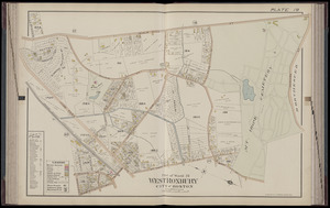
View distribution
Current results range from
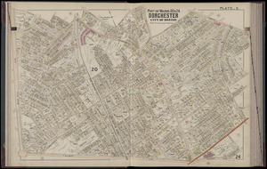
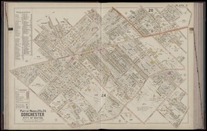
1482
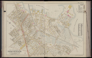
to
2023
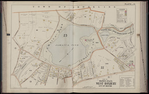
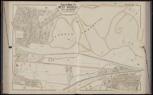
Date range begin
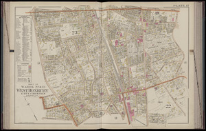
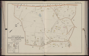
Date range end
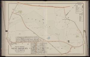
View larger »
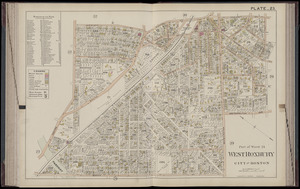
Collection
Norman B. Leventhal Map Center Collection
10,999
Boston and New England Maps (Collection of Distinction)
5,105
Urban Maps (Collection of Distinction)
4,846
Maritime Charts and Atlases (Collection of Distinction)
749
American Revolutionary War-Era Maps (Collection of Distinction)
615
Boston Redevelopment Authority Collection
86
Institution
Boston Public Library
10,999


![Atlantic Neptune [front matter]](https://bpldcassets.blob.core.windows.net/derivatives/images/commonwealth:3f462w98b/image_thumbnail_300.jpg)
![Atlantic Neptune [front matter]](https://bpldcassets.blob.core.windows.net/derivatives/images/commonwealth:3f462x58k/image_thumbnail_300.jpg)