Skip to search
Skip to main content
Skip to first result
Digital Commonwealth
Folders
Sign Up / Log In
Search for
Search
Search
Search
Basic
Advanced
Explore
Map
Collections
Institutions
Formats
For Educators
Primary Source Sets
Lesson Plans
Using Primary Sources
Searching Digital Commonwealth
For Institutions
Join Digital Commonwealth
Conferences, Trainings, & Events
How to Contribute Collections
Digitization Services
Board & Committees
Frequently Asked Questions
About
About Digital Commonwealth
News & Announcements
Copyright & Terms of Use
Harmful Content Statement
Partners
API
Contact Us
Search
Search Constraints
Start Over
Save Search
Your search:
More Like
commonwealth:vh53xt658
✖
Remove constraint More Like: commonwealth:vh53xt658
« Prev. |
1
-
20
of
817
|
Next »
Sort
by date (asc)
relevance
title
date (asc)
date (desc)
Number of results to display per page
20
per page
per page
10
per page
20
per page
50
per page
100
per page
View results as:
List
list view
Maps
map view
Gallery
grid view
Search Results
1.
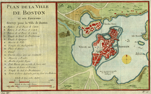
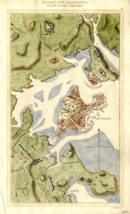
Plan De La Ville De Boston et ses environs
2.
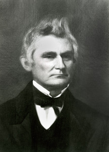
Dr. Daniel Fisher
3.
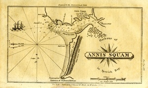
Harbour of Annis Squam in Ipswich Bay.
4.
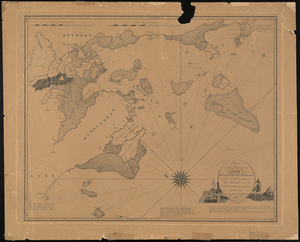
Chart of the Harbours of Salem, Marblehead, Beverly, and Manchester From a Survey Taken in the Years 1804, 5 & 6 by Nathl....
5.
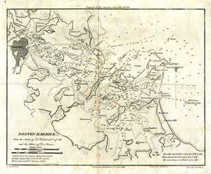
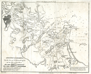
Boston Harbour: From the Survey of A.S. Wadsworth Esq., U.S.N, and the Survey of Des Barres.
6.
Boston Y Sus Aldredores - Boston Et Ses Environs
7.
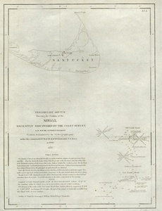
Preliminary Sketch Showing the Position of the Shoal Recently Discovered by the Coast Survey
8.
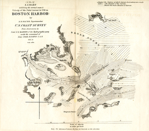
A Chart Exhibiting the Normal Course & Velocity of the Tidal Current at Ebb in Boston Harbor
9.
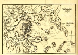
Boston With its Environs, 1775 & 1776.
10.
Boston Harbour: From the Survey of A.S. Wadsworth Esq., U.S.N, and the Survey of Des Barres.
11.
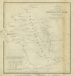
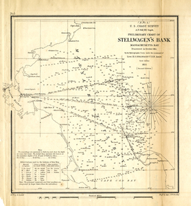
Preliminary Chart of Stellwagen's Bank, Massachusetts Bay Discovered in October, 1854, by the Hydrographic Party Under the...
12.
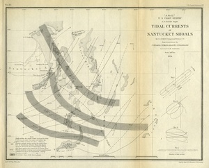
Tidal Currents of Nantucket Shoals
13.
Preliminary Chart of Stellwagen's Bank, Masachusetts Bay: Discovered in October, 1854, by the Hydrographic Party Under the...
14.
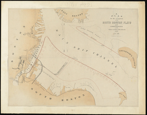
Plan For the Occupation of the South Boston Flats by the Commissioners on the Harbors and Flats of Massachusetts
15.
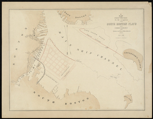
Plan of the First Section for the Occupation of the South Boston Flats by the Commissioners on the Harbors and Flats of...
16.
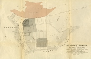
Plan for the Occupation of Flats Owned by the Commonwealth in Boston Harbor
17.
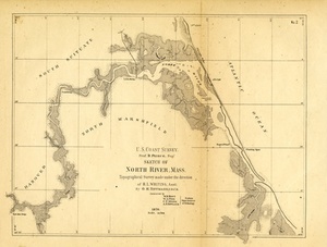
Sketch of North River, Mass.
18.
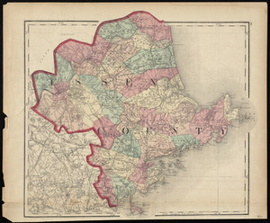
Essex County
19.
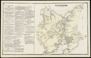
Gloucester
20.
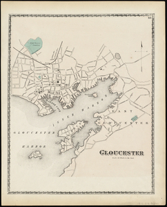
Gloucester
« Previous
Next »
1
2
3
4
5
…
40
41
Limit your search
Subject
Coastal
812
Regional Studies
738
Agriculture
71
Massachusetts
70
Hurricanes
27
Conservation and Management
23
Historic and Retrospective Studies
21
Birds
20
more
Subject
»
Place
North and Central America
807
United States
807
Dukes (county)
698
Martha's Vineyard
604
Massachusetts
548
Chilmark
161
West Tisbury
123
Chappaquiddick Island
90
more
Place
»
Format
Photographs
621
Maps/Atlases
139
Objects/Artifacts
121
Postcards/Cards
1
Drawings/Illustrations
1
Available to use
Creative Commons license
743
Date
View distribution
Current results range from
1764
to
2016
Date range begin
Date range end
View larger »
Unknown
1
Collection
Harvard Forest Martha's Vineyard Collection
744
Historic Maps
73
Institution
Harvard University
738
Salem State University Archives and Special Collections
73
Martha's Vineyard Museum
4
The Vineyard Gazette
2