Skip to search
Skip to main content
Skip to first result
Digital Commonwealth
Folders
Sign Up / Log In
Search for
Search
Search
Search
Basic
Advanced
Explore
Map
Collections
Institutions
Formats
For Educators
Primary Source Sets
Lesson Plans
Using Primary Sources
Searching Digital Commonwealth
For Institutions
Join Digital Commonwealth
Conferences, Trainings, & Events
How to Contribute Collections
Digitization Services
Board & Committees
Frequently Asked Questions
About
About Digital Commonwealth
News & Announcements
Copyright & Terms of Use
Harmful Content Statement
Partners
API
Contact Us
Search
Search Constraints
Start Over
Save Search
Your search:
More Like
commonwealth:tt44pw01j
✖
Remove constraint More Like: commonwealth:tt44pw01j
« Prev.
|
11,161
-
11,180
of
11,273
|
Next »
Sort
by date (asc)
relevance
title
date (asc)
date (desc)
Number of results to display per page
20
per page
per page
10
per page
20
per page
50
per page
100
per page
View results as:
List
list view
Maps
map view
Gallery
grid view
Search Results
11161.
Washington Street boulevard study : generalized land use - proposed
11162.
Washington Street boulevard study : proposed fabric
11163.
Washington Street boulevard study : corridor wide urban design strategy
11164.
Planting beds on Dartmouth Street and Boylston Street in Copley Square
11165.
Flirtation walk schematic planting plan Charlestown Navy Yard
11166.
Waterfront skyline
11167.
Berkeley Street community garden
11168.
Asia
11169.
Infrastructure around Tobin Bridge/US route 1 in Charlestown
11170.
Circulation plan of parking lot at the corner of VFW Parkway and Spring Street, West Roxbury
11171.
East Asia
11172.
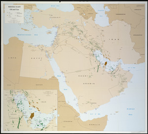
Middle East, oil and gas : Middle East
11173.
North Atlantic Ocean, West Indies
11174.
Haiti
11175.
Major thoroughfare system, city of Boston, July, 1994
11176.
North Atlantic Ocean, southeast coast of North America, including the Bahamas and Greater Antilles
11177.
Mediterranean Sea, plans on the coasts of Italy and Sicilia
11178.
Tactical pilotage chart, TPC
11179.
Boston shoreline 1630
11180.
Boston shoreline 1795
« Previous
Next »
1
2
…
555
556
557
558
559
560
561
562
563
564
Limit your search
Subject
Real property--Massachusetts--Boston--Maps
2,355
Boston (Mass.)--Maps
2,181
Landowners--Massachusetts--Boston--Maps
2,153
Roxbury (Boston, Mass.)--Maps
363
Dorchester (Boston, Mass.)--Maps
325
Cambridge (Mass.)--Maps
268
Brookline (Mass.)--Maps
237
Real property--Massachusetts--Cambridge--Maps
216
more
Subject
»
Place
North and Central America
8,087
United States
6,846
Suffolk (county)
3,606
Boston
3,466
Massachusetts
3,261
Europe
963
Middlesex (county)
619
Canada
427
more
Place
»
Format
Maps/Atlases
11,214
Manuscripts
215
Prints
51
Books
35
Objects/Artifacts
10
Drawings/Illustrations
8
Posters
4
Available to use
No known restrictions
11,075
Creative Commons license
67
Date
View distribution
Current results range from
1482
to
2023
Date range begin
Date range end
View larger »
Unknown
3
Collection
Norman B. Leventhal Map Center Collection
11,028
Boston and New England Maps (Collection of Distinction)
5,260
Urban Maps (Collection of Distinction)
4,996
Maritime Charts and Atlases (Collection of Distinction)
750
American Revolutionary War-Era Maps (Collection of Distinction)
625
Boston Redevelopment Authority Collection
222
Historic Maps
49
Massachusetts Real Estate Atlases
38
more
Collection
»
Institution
Boston Public Library
11,143
State Library of Massachusetts
51
Salem State University Archives and Special Collections
49
Private Collection
20
American Antiquarian Society
9
Boston Athenaeum
1