Search
Search Results
- Creator:
- Webb, Benjamin, active 1760-1784; Ptolemy, active 2nd century
- Format:
- Maps/Atlases
- Collection:
- Norman B. Leventhal Map Center Collection
- Date:
- [ca. 1763]
- Institution:
- Boston Public Library
- Creator:
- Blaeu, Joan, 1596-1673
- Format:
- Maps/Atlases
- Collection:
- Norman B. Leventhal Map Center Collection
- Date:
- [ca. 1670]
- Institution:
- Boston Public Library
- Creator:
- L'Isle, Guillaume de, 1675-1726
- Format:
- Maps/Atlases
- Collection:
- Norman B. Leventhal Map Center Collection
- Date:
- [1730–1742]
- Institution:
- Boston Public Library
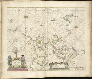
- Creator:
- Goos, Pieter, ca. 1616-1675
- Format:
- Maps/Atlases
- Collection:
- Norman B. Leventhal Map Center Collection
- Date:
- 1672
- Institution:
- Boston Public Library
- Creator:
- Ptolemy, 2nd cent
- Format:
- Maps/Atlases
- Collection:
- Norman B. Leventhal Map Center Collection
- Date:
- 1511
- Institution:
- Boston Public Library
- Creator:
- Ptolemy, 2nd cent
- Format:
- Maps/Atlases
- Collection:
- Norman B. Leventhal Map Center Collection
- Date:
- 1511
- Institution:
- Boston Public Library
- Creator:
- Moll, Herman, d. 1732
- Format:
- Maps/Atlases
- Collection:
- Norman B. Leventhal Map Center Collection
- Date:
- [1736]
- Institution:
- Boston Public Library
- Creator:
- Lufkin, Richard F. (Richard Friend)
- Format:
- Maps/Atlases
- Collection:
- Norman B. Leventhal Map Center Collection
- Date:
- 1948
- Institution:
- Boston Public Library
- Creator:
- Metropolitan Planning Organization (Mass.). Central Transportation Planning Staff
- Format:
- Maps/Atlases
- Collection:
- Norman B. Leventhal Map Center Collection
- Date:
- 2011
- Institution:
- Boston Public Library
- Creator:
- Geographical Surveys West of the 100th Meridian (U.S.)
- Format:
- Maps/Atlases
- Collection:
- Norman B. Leventhal Map Center Collection
- Date:
- [1879?]
- Institution:
- Boston Public Library