Skip to search
Skip to main content
Skip to first result
Digital Commonwealth
Folders
Sign Up / Log In
Search for
Search
Search
Search
Basic
Advanced
Explore
Map
Collections
Institutions
Formats
For Educators
Primary Source Sets
Lesson Plans
Using Primary Sources
Searching Digital Commonwealth
For Institutions
Join Digital Commonwealth
Conferences, Trainings, & Events
How to Contribute Collections
Digitization Services
Board & Committees
Frequently Asked Questions
About
About Digital Commonwealth
News & Announcements
Copyright & Terms of Use
Harmful Content Statement
Partners
API
Contact Us
Search
Search Constraints
Start Over
Save Search
Your search:
More Like
commonwealth:rr173g339
✖
Remove constraint More Like: commonwealth:rr173g339
« Prev.
|
201
-
220
of
11,498
|
Next »
Sort
by relevance
relevance
title
date (asc)
date (desc)
Number of results to display per page
20
per page
per page
10
per page
20
per page
50
per page
100
per page
View results as:
List
list view
Maps
map view
Gallery
grid view
Search Results
201.
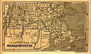
[Map of the towns of Western Massachusetts]
202.
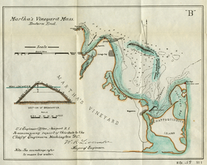
Martha's Vineyard Mass. Eastern End
203.
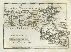
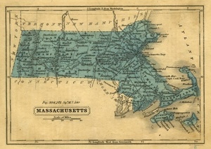
Massachusetts
204.
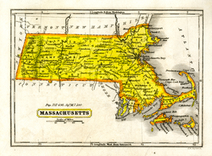
Massachusetts
205.
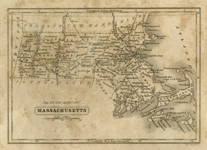
Massachusetts
206.
Massachusetts
207.
Massachusetts
208.
Massachusetts.
209.
Massachusetts
210.
Massachusetts
211.
Massachusetts
212.
Massachusetts and Rhode Island
213.
Massachusetts and Rhode Island
214.
Massachusetts areas of critical environmental concern
215.
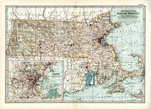
Massachusetts. Atlas Plate no. 1
216.
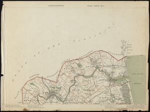
Massachusetts coastal towns
217.
Massachusetts coastal zone management program : volume 1, summary map
218.
Massachusetts CZM shoreline change analysis project
219.
Massachusetts drainage basins
220.
Massachusetts, Eastern Part.
« Previous
Next »
1
2
…
7
8
9
10
11
12
13
14
15
…
574
575
Limit your search
Subject
Real property--Massachusetts--Boston--Maps
2,278
Landowners--Massachusetts--Boston--Maps
2,117
Boston (Mass.)--Maps
1,977
Roxbury (Boston, Mass.)--Maps
351
Dorchester (Boston, Mass.)--Maps
317
Massachusetts--Maps
271
Cambridge (Mass.)--Maps
266
Brookline (Mass.)--Maps
236
more
Subject
»
Place
North and Central America
8,787
United States
7,697
Massachusetts
5,063
Suffolk (county)
3,355
Boston
3,215
Europe
1,359
Middlesex (county)
618
Canada
449
more
Place
»
Format
Maps/Atlases
11,438
Manuscripts
217
Prints
56
Books
36
Objects/Artifacts
10
Drawings/Illustrations
8
Posters
4
Available to use
No known restrictions
11,348
Creative Commons license
49
Date
View distribution
Current results range from
1482
to
2023
Date range begin
Date range end
View larger »
Unknown
2
Collection
Norman B. Leventhal Map & Education Center Collection
11,415
Boston and New England Maps (Collection of Distinction)
5,157
Urban Maps (Collection of Distinction)
4,858
Maritime Charts and Atlases (Collection of Distinction)
1,081
American Revolutionary War-Era Maps (Collection of Distinction)
622
Boston Redevelopment Authority Collection
90
Historic Maps
33
David Judkins Weaver Papers
17
more
Collection
»
Institution
Boston Public Library
11,415
Salem State University Archives and Special Collections
33
State Library of Massachusetts
33
Phillips Academy
8
American Antiquarian Society
4
Private Collection
3
Massachusetts Historical Society
1
Melrose Public Library
1
![[Map of the towns of Western Massachusetts]](https://bpldcassets.blob.core.windows.net/derivatives/images/commonwealth:6108vv02d/image_thumbnail_300.jpg)