Skip to search
Skip to main content
Digital Commonwealth
Sign Up / Log In
Search for
Search
Search
Search
Basic
Advanced
Explore
Map
Collections
Institutions
Formats
For Educators
Primary Source Sets
Lesson Plans
Using Primary Sources
Searching Digital Commonwealth
For Institutions
Join Digital Commonwealth
Conferences, Trainings, & Events
How to Contribute Collections
Digitization Services
Board & Committees
Frequently Asked Questions
About
About Digital Commonwealth
News & Announcements
Copyright & Terms of Use
Harmful Content Statement
Partners
API
Contact Us
Salem State University Archives and Special Collections
Historic Maps
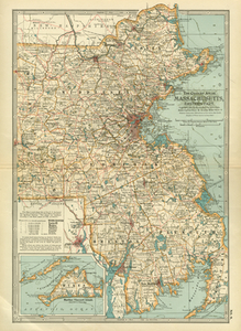
Massachusetts, Eastern Part.
View this item online at Salem State University Archives and Special Collections
Item Information
Title:
Massachusetts, Eastern Part.
Description:
"This map is made from that of the U.S. Geological Survey and contains all Towns, Post Offices, and important Railroad Stations." Relief shown by hachures. Inset map: Martha's Vineyard island.
Creator:
The Century Co
Date:
1897
Format:
Maps/Atlases
Location:
Salem State University Archives and Special Collections
Collection (local):
Historic Maps
Series:
Massachusetts
Subjects:
Massachusetts--Maps
Martha's Vineyard (Mass.)--Maps
Massachusetts
Dukes
New Enlgand
Places:
Massachusetts
Link to Item:
http://digitalcommons.salemstate.edu/maps_massachusetts/6
Terms of Use:
Rights status not evaluated.
Contact host institution for more information.
Identifier:
G 3760 1897 .C45
show more...
View MODS XML
More Like This
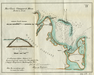
Martha's Vineyard Mass. Eastern End
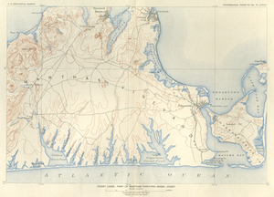
Coast Lines: Part of Martha's Vineyard (Mass.) Sheet
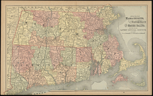
Atlas Maps of Massachusetts, Connecticut and Rhode Island, from ...
Progress Map for 1893: Canapitsit Channel, Mass. From 1. July 1892 ...
Find More Like This >>
Tools
Share
Facebook
Pinterest
X
Reddit
Tumblr
Email
Copy link
Add to Folder
Questions/Comments
Cite This Item