Skip to search
Skip to main content
Digital Commonwealth
Sign Up / Log In
Search for
Search
Search
Search
Basic
Advanced
Explore
Map
Collections
Institutions
Formats
For Educators
Primary Source Sets
Lesson Plans
Using Primary Sources
Searching Digital Commonwealth
For Institutions
Join Digital Commonwealth
Conferences, Trainings, & Events
How to Contribute Collections
Digitization Services
Board & Committees
Frequently Asked Questions
About
About Digital Commonwealth
News & Announcements
Copyright & Terms of Use
Harmful Content Statement
Partners
API
Contact Us
Salem State University Archives and Special Collections
Historic Maps
Massachusetts
View this item online at Salem State University Archives and Special Collections
Item Information
Title:
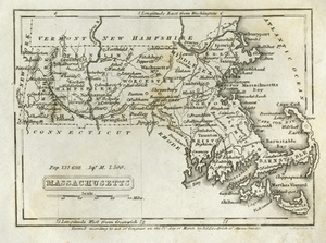
Massachusetts
Description:
"Pop. 737, 698. Sqr. M. 7,500." Townships and major rivers delineated. Taken from First Book of History for Children and Youth, rev. ed. Boston: Charles J. Hendee and Jenks and Palmer, 1844.
Creator:
Boynton, George W.
Date:
1844
Format:
Maps/Atlases
Location:
Salem State University Archives and Special Collections
Collection (local):
Historic Maps
Series:
Massachusetts
Subjects:
Massachusetts--Maps
Massachusetts
New england
Places:
Massachusetts
Link to Item:
http://digitalcommons.salemstate.edu/maps_massachusetts/1
Terms of Use:
Rights status not evaluated.
Contact host institution for more information.
Identifier:
G 3760 1844 .B68 1844
show more...
View MODS XML
More Like This
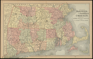
Atlas Maps of Massachusetts, Connecticut and Rhode Island, from ...
County Map of the States of New York, New Hampshire, Vermont, ...
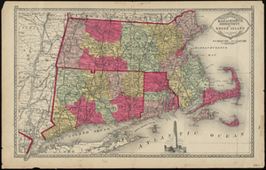
Tunison's Massachusetts, Connecticut and Rhode Island
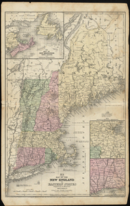
Map of the New England or Eastern States: Engraved to Illustrate ...
Find More Like This >>
Tools
Share
Facebook
Pinterest
X
Reddit
Tumblr
Email
Copy link
Add to Folder
Questions/Comments
Cite This Item