Skip to search
Skip to main content
Skip to first result
Digital Commonwealth
Folders
Sign Up / Log In
Search for
Search
Search
Search
Basic
Advanced
Explore
Map
Collections
Institutions
Formats
For Educators
Primary Source Sets
Lesson Plans
Using Primary Sources
Searching Digital Commonwealth
For Institutions
Join Digital Commonwealth
Conferences, Trainings, & Events
How to Contribute Collections
Digitization Services
Board & Committees
Frequently Asked Questions
About
About Digital Commonwealth
News & Announcements
Copyright & Terms of Use
Harmful Content Statement
Partners
API
Contact Us
Search
Search Constraints
Start Over
Save Search
Your search:
More Like
commonwealth:mk61wx07j
✖
Remove constraint More Like: commonwealth:mk61wx07j
« Prev. |
1
-
20
of
118
|
Next »
Sort
by relevance
relevance
title
date (asc)
date (desc)
Number of results to display per page
20
per page
per page
10
per page
20
per page
50
per page
100
per page
View results as:
List
list view
Maps
map view
Gallery
grid view
Search Results
1.
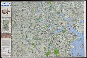
Boston bikemap : toward intelligent commuting
2.
Free 1978 Boston bikemap : featuring an illustrated guide to commuting & recreation
3.
The 1976 proposed regional open space plan
4.
Major transportation system : Boston region MAPC area
5.
The regional open space system : [Boston, Massachusetts metropolitan area]
6.
Bay State Street Ry. Co's lines and connections
7.
Boston I
8.
Boston personal income ; Boston personal income [and] residential population density
9.
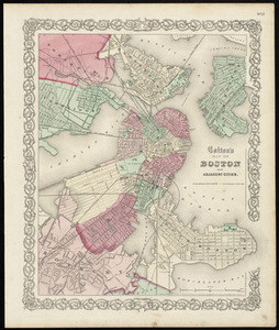
Colton's Map of Boston and Adjacent Cities.
10.
How we get around today
11.
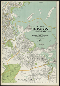
Map of Boston and Suburbs
12.
Map of Commonwealth Avenue Street Railway Company, and connecting lines : showing route to Norumbega Park
13.
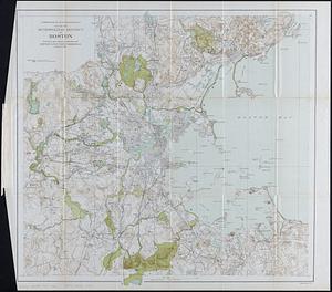
Map of the Boston Metropolitan District showing park reservations and holdings of the Metropolitan District Commission and...
14.
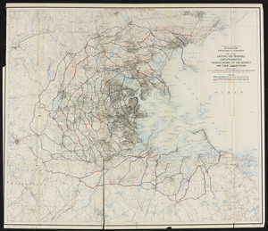
Map of the existing and proposed circumferential thoroughfares of the district and their connections
15.
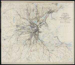
Map of the existing and proposed radial thoroughfares of the district and their connections
16.
Map of the metropolitan district of Boston : showing local public reservations, and holdings of the Metropolitan Park...
17.
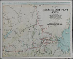
Map of the suburban street railway systems : including Newton Street Railway, Lexington and Boston, Newton and Boston, Natick...
18.
Map showing horse rail roads and the surface steam roads with 104 stations in and around Boston : including 91 surface steam...
19.
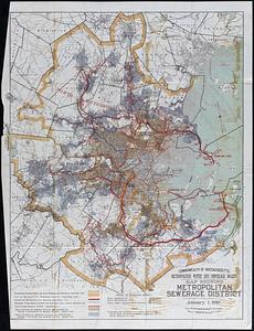
Map showing metropolitan sewerage district : January 1, 1910
20.
Master highway plan metropolitan Boston showing the Massachusetts turnpike, route 128 (circumferential highway), Boston central...
« Previous
Next »
1
2
3
4
5
6
Limit your search
Subject
Boston Metropolitan Area (Mass.)--Maps
25
Massachusetts--Maps
17
Boston (Mass.)--Maps
10
United States--History--Civil War, 1861-1865--Maps
10
Land use--Massachusetts--Maps
7
Virginia--History--Civil War, 1861-1865--Maps
7
Connecticut--Maps
5
Watersheds--Massachusetts--Maps
5
more
Subject
»
Place
North and Central America
103
United States
102
Massachusetts
57
Boston
29
Suffolk (county)
29
Virginia
13
Connecticut
5
Essex (county)
5
more
Place
»
Format
Maps/Atlases
115
Ephemera
2
Documents
1
Posters
1
Available to use
No known restrictions
110
Creative Commons license
2
Date
View distribution
Current results range from
1855
to
2023
Date range begin
Date range end
View larger »
Collection
Norman B. Leventhal Map Center Collection
113
David Judkins Weaver Papers
96
Boston and New England Maps (Collection of Distinction)
76
Urban Maps (Collection of Distinction)
13
Historic Maps
3
Massachusetts Department of Transportation
2
Boston Redevelopment Authority Collection
1
Mapping Boston Collection
1
Institution
Boston Public Library
112
Salem State University Archives and Special Collections
3
State Library of Massachusetts
2
Private Collection
1


![Boston personal income ; Boston personal income [and] residential population density](https://bpldcassets.blob.core.windows.net/derivatives/images/commonwealth:fn107c409/image_thumbnail_300.jpg)