2241. A rough and inaccurate sketch of the streets of Boston as they are supposed to have been first laid out & the owners of the soil, from 1630 to 1650 or thereabouts Creator: Appleton, William. Format: Maps/Atlases; Manuscripts Collection: Boston and New England Maps (Collection of Distinction) / Norman B. Leventhal Map & Education Center Collection / Urban Maps (Collection of Distinction) Date: [1866] Institution: Boston Public Library
2242. Boston with Charlestown and Roxbury Creator: Davies, Benjamin Rees; Society for the Diffusion of Useful Knowledge (Great Britain) Format: Maps/Atlases Collection: Boston and New England Maps (Collection of Distinction) / Mapping Boston Collection / Norman B. Leventhal Map & Education Center Collection / Urban Maps (Collection of Distinction) Date: 1853 Institution: Boston Public Library
2243. Charlestown urban renewal area r-55 : property map and perimeter boundaries Creator: Boston Redevelopment Authority Format: Maps/Atlases Collection: Boston Redevelopment Authority Collection / Boston and New England Maps (Collection of Distinction) / Urban Maps (Collection of Distinction) Date: January 29, 1964 Institution: Boston Public Library
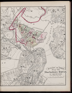
2244. Atlas of the county of Suffolk, Massachusetts : vol. 6th including the late city of Charlestown, now wards 20,21 and 22, city of Boston : from actual survey & official... Creator: Hopkins, Griffith Morgan, Jr., Busch, Edward (Engraver), and G.M. Hopkins & Co. Format: Maps/Atlases Collection: Boston and New England Maps (Collection of Distinction) / Norman B. Leventhal Map & Education Center Collection / Urban Maps (Collection of Distinction) Date: 1875 Institution: Boston Public Library
2245. Charlestown Navy Yard area Creator: Boston Redevelopment Authority Format: Maps/Atlases Collection: Boston Redevelopment Authority Collection / Boston and New England Maps (Collection of Distinction) / Norman B. Leventhal Map & Education Center Collection / Urban Maps (Collection of Distinction) Date: [1988] Institution: Boston Public Library
2246. Charlestown Navy Yard master plan Creator: Boston Redevelopment Authority Format: Maps/Atlases Collection: Boston Redevelopment Authority Collection / Boston and New England Maps (Collection of Distinction) / Norman B. Leventhal Map & Education Center Collection / Urban Maps (Collection of Distinction) Date: [ca. 1990] Institution: Boston Public Library
2247. Charlestown urban renewal project Boston (Suffolk County) Massachusetts Mass. R-55 : topographic map Creator: Yunits Engineering Company; Boston Redevelopment Authority Format: Maps/Atlases Collection: Boston and New England Maps (Collection of Distinction) / Norman B. Leventhal Map & Education Center Collection / Urban Maps (Collection of Distinction) Date: 1968 Institution: Boston Public Library
2248. Charlestown Veterans Memorial, Charlestown, Massachusetts Creator: Rojas Vogt Associates Format: Maps/Atlases Collection: Boston Redevelopment Authority Collection / Boston and New England Maps (Collection of Distinction) / Norman B. Leventhal Map & Education Center Collection / Urban Maps (Collection of Distinction) Date: [1988] Institution: Boston Public Library
2249. Flirtation walk existing conditions plan Charlestown Navy Yard Creator: Boston Redevelopment Authority Format: Maps/Atlases Collection: Boston Redevelopment Authority Collection / Boston and New England Maps (Collection of Distinction) / Norman B. Leventhal Map & Education Center Collection / Urban Maps (Collection of Distinction) Date: 1990 Institution: Boston Public Library
2250. Flirtation walk schematic planting plan Charlestown Navy Yard Creator: Boston Redevelopment Authority Format: Maps/Atlases Collection: Boston Redevelopment Authority Collection / Boston and New England Maps (Collection of Distinction) / Norman B. Leventhal Map & Education Center Collection / Urban Maps (Collection of Distinction) Date: July 30, 1990 Institution: Boston Public Library
2251. Gate 5 - Chelsea Street modified landscape scheme, Charlestown, MA Creator: Boston Redevelopment Authority Format: Maps/Atlases Collection: Boston Redevelopment Authority Collection / Boston and New England Maps (Collection of Distinction) / Norman B. Leventhal Map & Education Center Collection / Urban Maps (Collection of Distinction) Date: 1990 Institution: Boston Public Library
2252. Infrastructure around Tobin Bridge/US route 1 in Charlestown Creator: Boston Redevelopment Authority Format: Maps/Atlases Collection: Boston Redevelopment Authority Collection / Boston and New England Maps (Collection of Distinction) / Norman B. Leventhal Map & Education Center Collection / Urban Maps (Collection of Distinction) Date: [1992] Institution: Boston Public Library
2253. Insurance maps of Boston volume 4 : comprising portions of Charlestown, East Cambridge, Cambridge Port, Old Cambridge & Somerville Creator: Sanborn Map & Publishing Co. Format: Maps/Atlases Collection: Boston and New England Maps (Collection of Distinction) / Norman B. Leventhal Map & Education Center Collection / Urban Maps (Collection of Distinction) Date: 1885 Institution: Boston Public Library
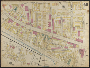
2254. Insurance maps of Boston volume 4 : comprising portions of Charlestown, East Cambridge, Cambridge Port, Old Cambridge & Somerville : plate 85 Creator: Sanborn Map & Publishing Co. Format: Maps/Atlases Collection: Boston and New England Maps (Collection of Distinction) / Norman B. Leventhal Map & Education Center Collection / Urban Maps (Collection of Distinction) Date: 1885 Institution: Boston Public Library
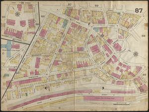
2255. Insurance maps of Boston volume 4 : comprising portions of Charlestown, East Cambridge, Cambridge Port, Old Cambridge & Somerville : plate 87 Creator: Sanborn Map & Publishing Co. Format: Maps/Atlases Collection: Boston and New England Maps (Collection of Distinction) / Norman B. Leventhal Map & Education Center Collection / Urban Maps (Collection of Distinction) Date: 1885 Institution: Boston Public Library
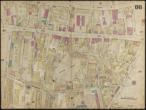
2256. Insurance maps of Boston volume 4 : comprising portions of Charlestown, East Cambridge, Cambridge Port, Old Cambridge & Somerville : plate 86 Creator: Sanborn Map & Publishing Co. Format: Maps/Atlases Collection: Boston and New England Maps (Collection of Distinction) / Norman B. Leventhal Map & Education Center Collection / Urban Maps (Collection of Distinction) Date: 1885 Institution: Boston Public Library
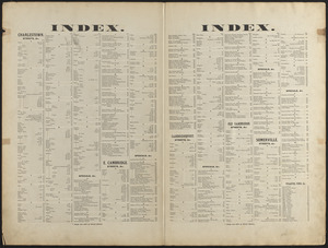
2257. Insurance maps of Boston volume 4 : comprising portions of Charlestown, East Cambridge, Cambridge Port, Old Cambridge & Somerville : street index Creator: Sanborn Map & Publishing Co. Format: Maps/Atlases Collection: Boston and New England Maps (Collection of Distinction) / Norman B. Leventhal Map & Education Center Collection / Urban Maps (Collection of Distinction) Date: 1885 Institution: Boston Public Library
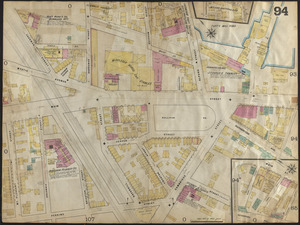
2258. Insurance maps of Boston volume 4 : comprising portions of Charlestown, East Cambridge, Cambridge Port, Old Cambridge & Somerville : plate 94 Creator: Sanborn Map & Publishing Co. Format: Maps/Atlases Collection: Boston and New England Maps (Collection of Distinction) / Norman B. Leventhal Map & Education Center Collection / Urban Maps (Collection of Distinction) Date: 1885 Institution: Boston Public Library
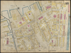
2259. Insurance maps of Boston volume 4 : comprising portions of Charlestown, East Cambridge, Cambridge Port, Old Cambridge & Somerville : plate 90 Creator: Sanborn Map & Publishing Co. Format: Maps/Atlases Collection: Boston and New England Maps (Collection of Distinction) / Norman B. Leventhal Map & Education Center Collection / Urban Maps (Collection of Distinction) Date: 1885 Institution: Boston Public Library
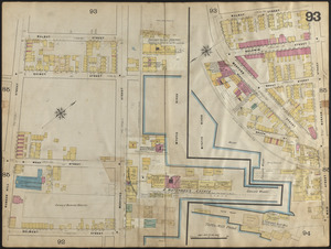
2260. Insurance maps of Boston volume 4 : comprising portions of Charlestown, East Cambridge, Cambridge Port, Old Cambridge & Somerville : plate 93 Creator: Sanborn Map & Publishing Co. Format: Maps/Atlases Collection: Boston and New England Maps (Collection of Distinction) / Norman B. Leventhal Map & Education Center Collection / Urban Maps (Collection of Distinction) Date: 1885 Institution: Boston Public Library