Skip to search
Skip to main content
Skip to first result
Digital Commonwealth
Folders
Sign Up / Log In
Search for
Search
Search
Search
Basic
Advanced
Explore
Map
Collections
Institutions
Formats
For Educators
Primary Source Sets
Lesson Plans
Using Primary Sources
Searching Digital Commonwealth
For Institutions
Join Digital Commonwealth
Conferences, Trainings, & Events
How to Contribute Collections
Digitization Services
Board & Committees
Frequently Asked Questions
About
About Digital Commonwealth
News & Announcements
Copyright & Terms of Use
Harmful Content Statement
Partners
API
Contact Us
Search
Search Constraints
Start Over
Save Search
Your search:
More Like
commonwealth:j3862r034
✖
Remove constraint More Like: commonwealth:j3862r034
« Prev.
|
81
-
100
of
63,487
|
Next »
Sort
by date (desc)
relevance
title
date (asc)
date (desc)
Number of results to display per page
20
per page
per page
10
per page
20
per page
50
per page
100
per page
View results as:
List
list view
Maps
map view
Gallery
grid view
Search Results
81.
Parcel D-10
82.
Aerial photo of Charlestown, Massachusetts
83.
Allston-Brighton open space plan site inventory
84.
Appleton St. Woonerf
85.
Columbia Point development study
86.
A land ownership map for the Longwood Medical Area as of January 1980
87.
Metropolitan District Commission combined sewer overflow project Dorchester Bay area
88.
Parcel 22
89.
Topographic map of Boston, Mass.
90.
Waterfront project, Pierhead Line, Boston, Mass.
91.
Boston Harbor : challenges and opportunities for the 1980's
92.
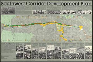
Southwest corridor development plan
93.
South End urban renewal area project Mass. r-56 : site preparation contract no. 16 street lighting and drainage
94.
Park Plaza urban renewal area : map no. 6 land disposal map
95.
Boylston Street : Fenway to Massachusetts Avenue
96.
Park Plaza traffic improvements & grade level controls
97.
Roxbury
98.
Park Plaza urban renewal area : map no. 3 land acquisition map
99.
Adams Nervine Asylum
100.
Park Plaza : illustrative site plan
« Previous
Next »
1
2
3
4
5
6
7
8
9
…
3,174
3,175
Limit your search
Subject
City planning--Massachusetts--Boston--Maps
417
Urban renewal--Massachusetts--Boston--Maps
253
Boston (Mass.)--Maps
137
Land use--Massachusetts--Boston--Maps
100
Buildings--Massachusetts--Boston--Maps
80
Real property--Massachusetts--Boston--Maps
68
Italian Americans
56
Italians
56
more
Subject
»
Place
North and Central America
62,008
United States
62,002
Massachusetts
61,408
Suffolk (county)
44,096
Boston
44,095
Worcester (county)
12,913
Worcester
12,825
Dorchester
6,454
more
Place
»
Format
Newspapers
62,777
Maps/Atlases
495
Books
111
Objects/Artifacts
86
Paintings
17
Drawings/Illustrations
3
Manuscripts
2
Prints
1
Available to use
No known restrictions
63,482
Date
View distribution
Current results range from
1770
to
2017
Date range begin
Date range end
View larger »
Unknown
9
Collection
Newspapers from the Boston Public Library
62,777
Boston Evening Transcript
11,563
Worcester Daily Spy
7,740
Daily Evening Transcript
7,037
Springfield Weekly Republican
4,712
Roxbury Gazette and South End Advertiser
3,447
South Boston Gazette
2,944
The Dorchester Beacon
2,865
more
Collection
»
Institution
Boston Public Library
63,486
Salem State University Archives and Special Collections
1