Skip to search
Skip to main content
Digital Commonwealth
Sign Up / Log In
Search for
Search
Search
Search
Basic
Advanced
Explore
Map
Collections
Institutions
Formats
For Educators
Primary Source Sets
Lesson Plans
Using Primary Sources
Searching Digital Commonwealth
For Institutions
Join Digital Commonwealth
Conferences, Trainings, & Events
How to Contribute Collections
Digitization Services
Board & Committees
Frequently Asked Questions
About
About Digital Commonwealth
News & Announcements
Copyright & Terms of Use
Harmful Content Statement
Partners
API
Contact Us
Boston Public Library
Boston Redevelopment Authority Collection
/
Urban Maps (Collection of Distinction)
/
Boston and New England Maps (Collection of Distinction)
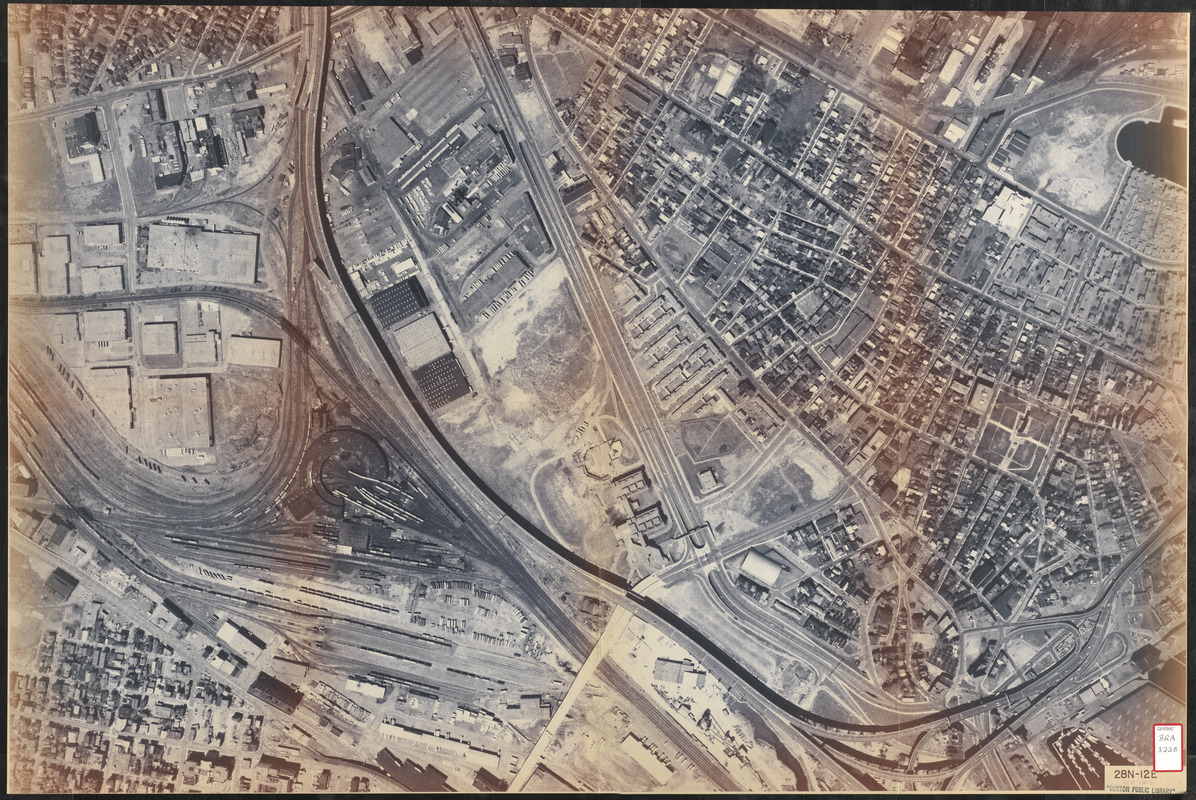
Aerial photo of Charlestown, Massachusetts
Aerial photo of Charlestown, Massachusetts
×
Item Information
Title:
Aerial photo of Charlestown, Massachusetts
Title (alt.):
28N-12E
Description:
Aerial view of Boston's Charlestown neighborhood and a portion of Cambridge, MA.
Date:
[ca. 1980]
Format:
Maps/Atlases
Prints
Location:
Boston Public Library
Central Library in Copley Square
Collection (local):
Boston Public Library Collection
Subjects:
Cambridge (Mass.)--Aerial views
Charlestown (Boston, Mass.)--Aerial views
Places:
Suffolk (county)
>
Boston
>
Charlestown
Middlesex (county)
>
Cambridge
Extent:
1 aerial image ; 61 x 92 cm
Permalink:
https://ark.digitalcommonwealth.org/ark:/50959/7h14cx31d
Terms of Use:
No known copyright restrictions.
No known restrictions on use.
Scale:
Scale not given
Language:
English
Referenced by:
http://bpl.bibliocommons.com/item/show/1034635075
Identifier:
06_01_017249
Call #:
BRA/3228
Barcode:
39999065833996
show more...
View MODS XML
More Like This
City of Cambridge, Mass : 1877
1975 general land use plan
Adams Nervine Asylum
Address delivered at Bowdoin College upon the opening of the ...
Find More Like This >>
Tools
Share
Facebook
Pinterest
X
Reddit
Tumblr
Email
Copy link
Add to Folder
Questions/Comments
Cite This Item
IIIF Manifest
Downloads
Primary (full resolution, uncompressed)
(TIF, 176 MB)
Large (full resolution)
(JPEG, 14.8 MB)
Medium
(JPEG, 530 KB)
GeoTIFF (georeferenced)
(TIF, 222 MB)


![Address delivered at Bowdoin College upon the opening of the Walker art school [Front cover]](https://bpldcassets.blob.core.windows.net/derivatives/images/commonwealth:r207tz586/image_thumbnail_300.jpg)