Search


Limit your search
- North and Central America66,516
- United States66,507
- Massachusetts65,384
- Suffolk (county)48,056
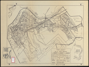
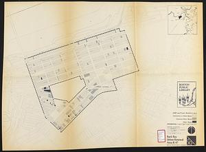
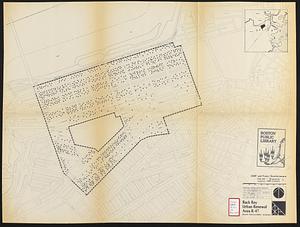
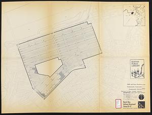
- Boston48,055
- Worcester (county)12,915
- Worcester12,827
- Dorchester6,570
- Newspapers64,713
- Maps/Atlases2,528
- Photographs490
- Books112
- Objects/Artifacts86
- Prints39
- Paintings17
- Manuscripts10