Skip to search
Skip to main content
Digital Commonwealth
Sign Up / Log In
Search for
Search
Search
Search
Basic
Advanced
Explore
Map
Collections
Institutions
Formats
For Educators
Primary Source Sets
Lesson Plans
Using Primary Sources
Searching Digital Commonwealth
For Institutions
Join Digital Commonwealth
Conferences, Trainings, & Events
How to Contribute Collections
Digitization Services
Board & Committees
Frequently Asked Questions
About
About Digital Commonwealth
News & Announcements
Copyright & Terms of Use
Harmful Content Statement
Partners
API
Contact Us
Boston Public Library
Boston Redevelopment Authority Collection
/
Urban Maps (Collection of Distinction)
/
Boston and New England Maps (Collection of Distinction)
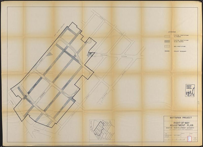
Mattapan project : right-of-way adjustment plan
Mattapan project
×
Item Information
Title:
Mattapan project : right-of-way adjustment plan
Description:
Part of a grant application submitted to the US Urban Renewal Administration seeking funds to execute an urban renewal project in Boston's Mattapan neighborhood.
Cartographer:
Boston Redevelopment Authority
Date:
September 10, 1962
Format:
Maps/Atlases
Location:
Boston Public Library
Central Library in Copley Square
Collection (local):
Boston Public Library Collection
Subjects:
Mattapan (Mass.)--Maps
City planning--Massachusetts--Boston--Maps
Urban renewal--Massachusetts--Boston--Maps
Roads--Right of way--Massachusetts--Boston--Maps
Places:
Suffolk (county)
>
Boston
>
Mattapan
Extent:
1 map ; 86 x 132 cm
Permalink:
https://ark.digitalcommonwealth.org/ark:/50959/3n206f77z
Terms of Use:
No known copyright restrictions.
No known restrictions on use.
Publisher:
Boston : Boston Redevelopment Authority
Scale:
Scale approximately 1:1,120
Language:
English
Referenced by:
Accompanying text
Notes:
Shows existing right-of-way to remain, existing right-of-way to be vacated, and new right-of-way.
Inset: [Location map].
Identifier:
06_01_017737
Call #:
BRA/FOLIO/96 map 4
Barcode:
mq6311181
show more...
View MODS XML
More Like This
Mattapan project : building deficiencies
Mattapan project : property map
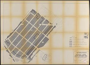
Mattapan project : proposed zoning under proposed code
Mattapan project : land use and disposition plan
Find More Like This >>
Tools
Share
Facebook
Pinterest
X
Reddit
Tumblr
Email
Copy link
Add to Folder
Questions/Comments
Cite This Item
IIIF Manifest
Downloads
Primary (full resolution, uncompressed)
(TIF, 297 MB)
Large (full resolution)
(JPEG, 24.9 MB)
Medium
(JPEG, 70.4 KB)