Suggestion for the improvement of Muddy River and for completing a continuous promenade from the Common to Jamaica Pond
Suggestion for the improvement of Muddy River and for completing a continuous promenade from the Common to Jamaica Pond
Item Information
Title:
Suggestion for the improvement of Muddy River and for completing a continuous promenade from the Common to Jamaica Pond
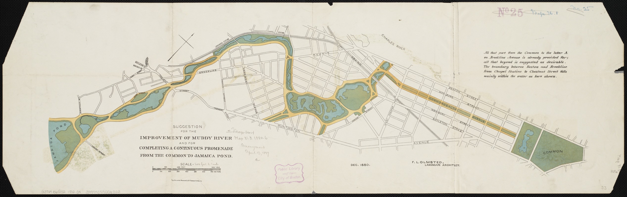
Description:
Originally part of the Back Bay salt marsh, the narrow, tidal Muddy River formed the boundary between Boston and Brookline. By 1880, urban growth had taken its toll, and the once-flowing tributary was notoriously polluted and prone to flooding. The simple schematic plan shown here was Olmsted’s preliminary design for improving the waterway. In it, he sculpted the erratic river into a gently meandering stream, and transformed the swamp south of Tremont Street into a large pond. Olmsted would later alter this plan, going so far as to reroute the river and shift the Boston-Brookline border; this change was legally adopted in 1890.