Skip to search
Skip to main content
Skip to first result
Digital Commonwealth
Folders
Sign Up / Log In
Search for
Search
Search
Search
Basic
Advanced
Explore
Map
Collections
Institutions
Formats
For Educators
Primary Source Sets
Lesson Plans
Using Primary Sources
Searching Digital Commonwealth
For Institutions
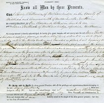
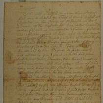
Join Digital Commonwealth
Conferences, Trainings, & Events
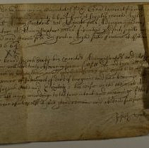
How to Contribute Collections
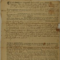
Digitization Services
Board & Committees
Frequently Asked Questions
About
About Digital Commonwealth
News & Announcements
Copyright & Terms of Use
Harmful Content Statement
Partners
API
Contact Us
Search
Search Constraints
Start Over
Save Search
Your search:
More Like
commonwealth:66830k13f
✖
Remove constraint More Like: commonwealth:66830k13f
« Prev. |
1
-
100
of
137
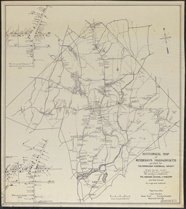
|
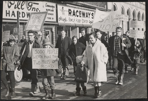
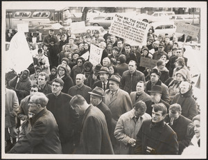
Next »
Sort
by relevance
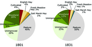
relevance
title
date (asc)
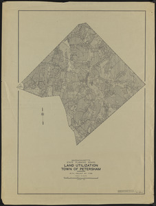
date (desc)
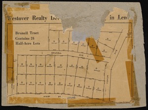
Number of results to display per page
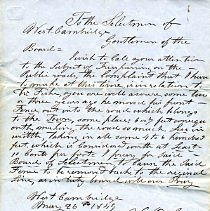
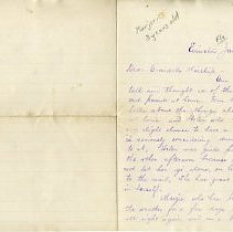
100
per page
per page
10
per page
20
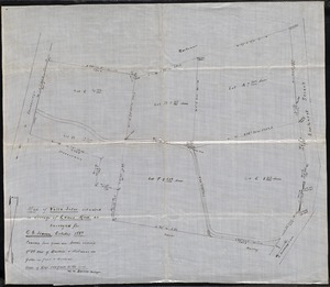
per page
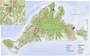
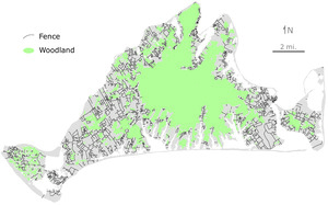
50
per page
100
per page
View results as:
List
list view
Maps
map view
Gallery
grid view
Search Results
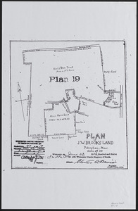
1.
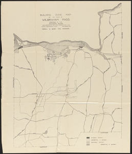
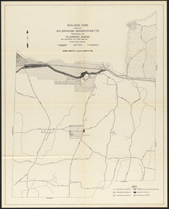
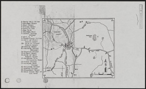
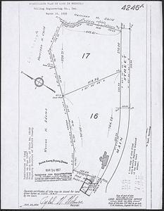
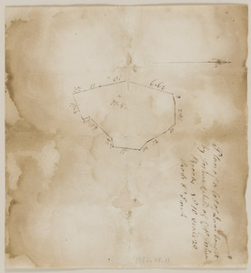
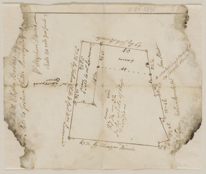
Building zone map of the town of Wilbraham, Mass.
2.
Building zone map of the town of Wilbraham, Massachusetts
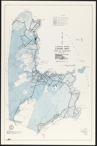
3.
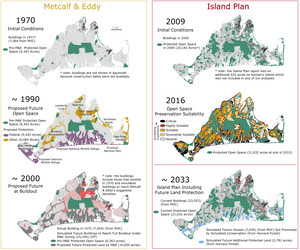
Building zone map of Wilbraham, Mass.
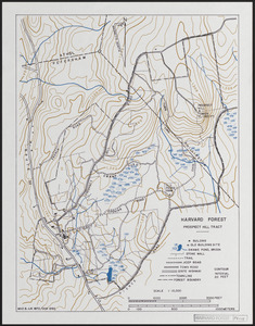
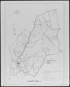
4.
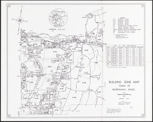
Building zone map of Wilbraham, Massachusetts
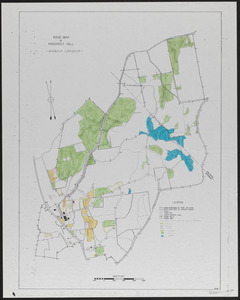
5.
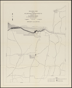
Building zone map of Wilbraham, Massachusetts
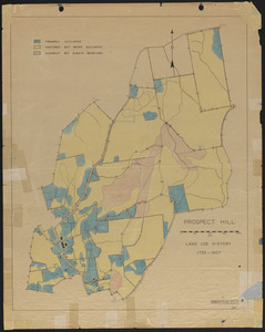
6.
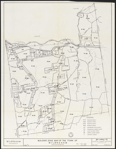
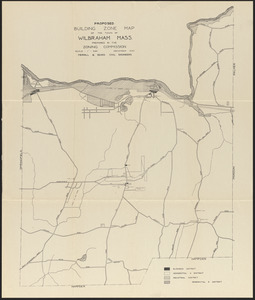
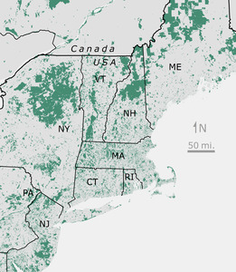
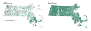
Proposed building zone map of the town of Wilbraham, Mass.
7.
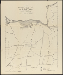
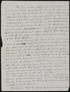
Proposed building zone map of the town of Wilbraham, Mass.
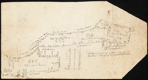
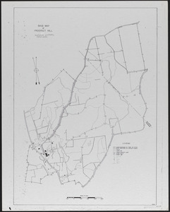
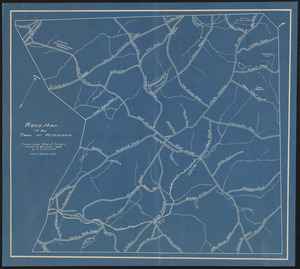
8.
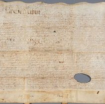
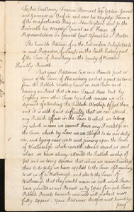
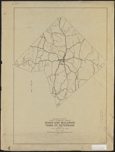
13th of March 1664 Deed between Joseph Cook of Stanianary?, Co. Essex, England to John Adams of Camb 13a meadow to upland in...
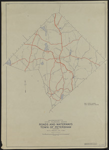
9.
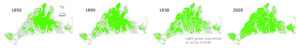
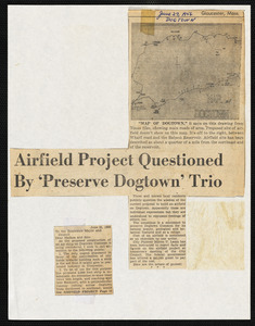
1850 Landscape
10.
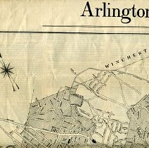
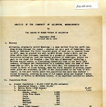
Arlington, The Story of a Social Studies Unit for Grade 4
11.
Arlmont Golf Course
12.
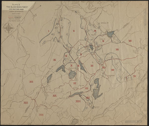
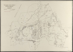
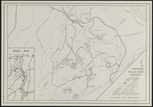
The Black Rock Forest
13.
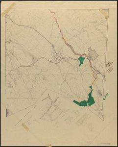
Black Rock Forest Map of Inoperable Land, Wetlands and Protection Forests
14.
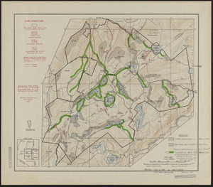
The Black Rock Forest Research Plots and Activities
15.
Block busting 9/13/71
16.
Blockbusting
17.
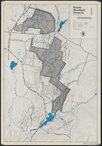
Brooks Woodland Preserve
18.
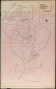
Brooks Woodland Preserve
19.
Cellar Holes of Pirate Valley, Sherman Hill, Swift River, Harvard Forest and Vicinity
20.
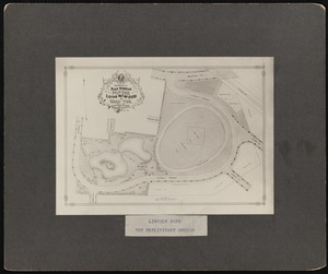
City of Somerville plan showing proposed laying out of park in Ward Two. Dec. 31, 1897. Ernest W. Bailey, City Engineer
21.
Conservation Easements in the Town of Petersham
22.
Conserved Land of New England
23.
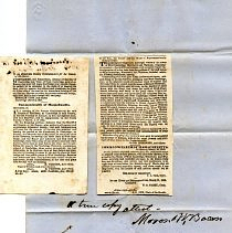
Deed
24.
Deed
25.
Deed between Joseph Cook and John Addams, 1664.
26.
Deed from Henry and Martha Dunster to Jason Russell, 1744.
27.
Deed from Mary Russell to Jason Russell and Jason Dunster, 1737.
28.
Document
29.
Documents
30.
Documents
31.
Documents, Governing
32.
Dogtown Foundation
33.
Fire Ponds of Petersham
34.
Focus 580; Coal and Energy Policy in Illinois
35.
Focus 580; Forest Primeval: The Natural history of an Ancient Forest
36.
Focus 580; Habitat for Humanity International and in Champaign County
37.
Focus 580; Invasive Species: Impacts of Biological Invasions
38.
Focus 580; Low Level Nuclear Waste Issues
39.
Focus 580; New Urbanism
40.
Focus 580; Public Participation in Architecture
41.
Focus 580; Tending Fire: Coping With Americas Wildland Fires
42.
Focus 580; The Edges of the Field: Lessons on the Obligation of Ownership
43.
Focus 580; The Land We Share: Private Property and the Common Good
44.
Focus 580; The Making of Environmental Law
45.
Focus 580; The University of Illinois Land Use Evolution and Impact Assessment Model
46.
Focus 580; Water And Its Publics: Social Action Across Spaces And Scales
47.
Focus 580; Water Resources in Illinois
48.
Focus 580; Whats a Landscape For? Smart Growth and Livability in the 21st Century
49.
Harvard Black Rock Forest - Trail Map
50.
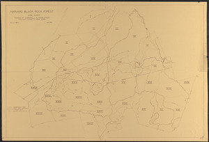
Harvard Black Rock Forest 1951
51.
Historic Land use
52.
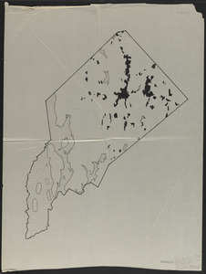
Historical Map of Petersham, MA
53.
Inner belt protest march in Cambridge
54.
Inner belt protest march in Cambridge
55.
Land Petitions, Plot Plans, and Land Leases, 1762-1874
56.
Land Use Maps of Petersham, Showing Wooded and Open Areas - 1830
57.
Land Use Maps of Petersham, Showing Wooded and Open Areas 1938
58.
Land Use Maps of Petersham, Showing Wooded and Open Areas 1965
59.
Land Utilization Town of Petersham
60.
Lenox: map of lots on Brunell Avenue, West Street, and Yokun Avenue
61.
Letter
62.
Letter
63.
Making of the Modern Forest Cover
64.
Map
65.
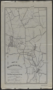
Map of Petersham, Mass.
66.
Map of the North Part of Petersham with Part of Poquage
67.
Map of Villa Sites situated in village of Lenox, Mass. as surveyed for G.G. Haven
68.
Martha's Vineyard 1850 Active Farmed Areas and Woodlots
69.
Mayor White
70.
Notes on Peak House - by various individuals
71.
Notice
72.
Open Fields, Pastures, Abandoned Fields, and House Influence Zones in Petersham
73.
Open Lands in Petersham, 1974
74.
Operation Stop/Southwest Corridor (I-95) : (1/2 folders)
75.
Operation Stop/Southwest Corridor (I-95) : (2/2 folders)
76.
Ownership of Peak House (plots, valuation, zoning)
77.
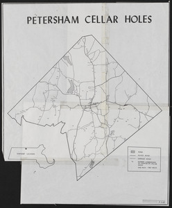
Petersham Cellar Holes
78.
Petition
79.
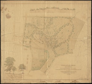
Phillips Academy, Andover, Mass. : plan for development of lands lying between Bartlett, Morton and Highland Sts.
80.
Plan of J. W. Brooks Land
81.
Plan of land conveyed by Capt. Joshua Brooks to Joshua Child
82.
Plan of land in Lincoln conveyed from Brooks to Child, April 25, 1768
83.
Plan of part of a farm lying in Brookline belonging to B. White and W. White
84.
Planning board zoning map, Town of Rockport
85.
Planning The Island Comparison of Metcalf Reports
86.
Prospect Hill 1992 Base Map with Trails, roads, stonewalls, cellar holes, buildings
87.
Prospect Hill Cultural Features
88.
Prospect Hill Land Use
89.
Prospect Hill Land Use
90.
Prospect Hill Land Use History - 1733-1907
91.
Regreening of Massachusetts
92.
Report
93.
Report of committee appointed to purchase land for town use
94.
Road map of the town of Petersham
95.
Roads and Buildings Town of Petersham
96.
Roads and Waterways Town of Petersham
97.
Saving Dogtown, 1950s-1970s
98.
Scrapbook
99.
Scrapbook #2 George Harris, selectman
100.
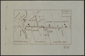
Sewall farm history, genealogy, map
« Previous
Next »
1
2
Limit your search
Subject
Land use
113
Boundaries
12
COVID-19 Pandemic, 2020-
11
Community
10
Environment
9
Cities & towns
7
Coastal
7
Regional Studies
7
more
Subject
»
Place
North and Central America
98
United States
98
Massachusetts
90
Worcester (county)
33
Petersham
32
Hampden (county)
30
Wilbraham
29
Prospect Hill
7
more
Place
»
Format
Maps/Atlases
84
Objects/Artifacts
15
Audio recordings (nonmusical)
15
Documents
11
Letters/Correspondence
7
Manuscripts
6
Photographs
5
Ephemera
4
more
Format
»
Available to use
Creative Commons license
85
No known restrictions
8
Date
View distribution
Current results range from
1664
to
2016
Date range begin
Date range end
View larger »
Collection
The Harvard Forest Map Collection
37
Wilbraham Library Maps Collection
31
Arlington Historical Society Collection
22
American Archive of Public Broadcasting Collection
15
Harvard Forest Martha's Vineyard Collection
7
Brookline Public Library Manuscript Collection
3
Peak House Institutional Records Collection
3
Rockport Town Clerk, Street, Roads and Maps
3
more
Collection
»
Institution
Harvard University
44
Wilbraham Public Library
31
Arlington Historical Society
22
Illinois Public Media (WILL)
15
Boston Public Library
3
Peak House Heritage Center
3
Public Library of Brookline
3
Town of Rockport
3
more
Institution
»