Skip to search
Skip to main content
Skip to first result
Digital Commonwealth
Folders
Sign Up / Log In
Search for
Search
Search
Search
Basic
Advanced
Explore
Map
Collections
Institutions
Formats
For Educators
Primary Source Sets
Lesson Plans
Using Primary Sources
Searching Digital Commonwealth
For Institutions
Join Digital Commonwealth
Conferences, Trainings, & Events
How to Contribute Collections
Digitization Services
Board & Committees
Frequently Asked Questions
About
About Digital Commonwealth
News & Announcements
Copyright & Terms of Use
Harmful Content Statement
Partners
API
Contact Us
Search
Search Constraints
Start Over
Save Search
Your search:
More Like
commonwealth:3n206t74d
✖
Remove constraint More Like: commonwealth:3n206t74d
« Prev.
|
11,001
-
11,050
of
11,066
|
Next »
Sort
by date (asc)
relevance
title
date (asc)
date (desc)
Number of results to display per page
50
per page
per page
10
per page
20
per page
50
per page
100
per page
View results as:
List
list view
Maps
map view
Gallery
grid view
Search Results
11001.
The world turned upside down
11002.
Peters World map
11003.
Boston Over Time : filling in the land 1630 - present
11004.
The people's republic of Cambridge
11005.
State of Louisiana, highlighting low-lying areas derived from USGS digital elevation data
11006.
Nantucket
11007.
1630 shoreline
11008.
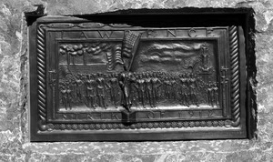
Lawrence strike of 1912
11009.
Massachusetts official transportation map
11010.
Neighborhoods of Boston
11011.
Boston's diversity index, 2010 : measures of diversity : age
11012.
Boston's diversity index, 2010 : measures of diversity : region of birth
11013.
Boston's diversity index, 2010 : measures of diversity : education
11014.
Boston's diversity index, 2010 : measures of diversity : language other than English spoken at home
11015.
Boston's diversity index, 2010 : measures of diversity : household income
11016.
Boston's diversity index, 2010 : measures of diversity : race
11017.
Boston's top 6 foreign languages spoken at home, 2010
11018.
Boston's top foreign-born populations : Cape Verdeans
11019.
Boston's top foreign-born populations : Haitians
11020.
Boston's top foreign-born populations : Dominicans
11021.
Boston's top foreign-born populations : Salvadorans
11022.
Boston's top foreign-born populations : Chinese
11023.
Boston's top foreign-born populations : Vietnamese
11024.
Map of the countries near to the land of Oz
11025.
A South Ender's view of the world
11026.
Boston over Time
11027.
Boston distance to the nearest supermarket
11028.
Boston open space and supermarkets
11029.
View of SoWa food trucks
11030.
Back Bay view of the world
11031.
Open space 2017
11032.
Boston Public Library
11033.
Boston's neighborhoods by percentage of foreign-born (by census tract)
11034.
Boston kids count
11035.
Change in median housing value, 2010 to 2018
11036.
Change in white population (non-Hispanic), 2010 to 2018
11037.
Disconnected : Boston's free wi-fi leaves many in the dark
11038.
The great transit desert
11039.
Health crisis : Massachusetts' low income families more likely to live near hazardous sites
11040.
Health success : Massachusetts well-prepared to deal with health issues from hazardous sites
11041.
A hexagonal chart of yearly snowfall in New England up through and including November 1, 2020
11042.
Hotbeds of contamination : the toxicity of our cities
11043.
Jamaica Plain view of the world
11044.
Map of public transportation routes in Greater Boston served by the Massachusetts Bay Transportation Authority comprising 64...
11045.
Mean travel time to work
11046.
Most popular mode of commuting : 2014-2018 American Community Survey
11047.
Percent foreign-born
11048.
Plenty of free wi-fi is keeping Boston connected!
11049.
Proportion of units where rent costs over 30% of resident's income
11050.
Rethinking hazardous beliefs : challenging perceptions of the "dirty city"
« Previous
Next »
1
2
…
217
218
219
220
221
222
Limit your search
Subject
Real property--Massachusetts--Boston--Maps
2,278
Landowners--Massachusetts--Boston--Maps
2,117
Boston (Mass.)--Maps
1,967
Roxbury (Boston, Mass.)--Maps
351
Dorchester (Boston, Mass.)--Maps
317
Cambridge (Mass.)--Maps
266
Brookline (Mass.)--Maps
236
Real property--Massachusetts--Cambridge--Maps
216
more
Subject
»
Place
North and Central America
7,880
United States
6,640
Suffolk (county)
3,337
Massachusetts
3,238
Boston
3,197
Europe
963
Middlesex (county)
618
Canada
427
more
Place
»
Format
Maps/Atlases
10,949
Manuscripts
215
Prints
62
Books
35
Photographs
32
Ephemera
10
Objects/Artifacts
10
Drawings/Illustrations
8
more
Format
»
Available to use
No known restrictions
10,954
Creative Commons license
45
Date
View distribution
Current results range from
1482
to
2023
Date range begin
Date range end
View larger »
Collection
Norman B. Leventhal Map Center Collection
10,999
Boston and New England Maps (Collection of Distinction)
5,104
Urban Maps (Collection of Distinction)
4,846
Maritime Charts and Atlases (Collection of Distinction)
750
American Revolutionary War-Era Maps (Collection of Distinction)
615
Boston Redevelopment Authority Collection
86
Lawrence History Center Photograph Collection
34
Lawrence, Mass. Textile Strike of 1912
13
more
Collection
»
Institution
Boston Public Library
11,008
Lawrence History Center
34
Lawrence Public Library
13
State Library of Massachusetts
6
Salem State University Archives and Special Collections
3
Special Collections and University Archives, University of Massachusetts Amherst Libraries
2