Skip to search
Skip to main content
Skip to first result
Digital Commonwealth
Folders
Sign Up / Log In
Search for
Search
Search
Search
Basic
Advanced
Explore
Map
Collections
Institutions
Formats
For Educators
Primary Source Sets
Lesson Plans
Using Primary Sources
Searching Digital Commonwealth
For Institutions
Join Digital Commonwealth
Conferences, Trainings, & Events
How to Contribute Collections
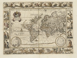
Digitization Services
Board & Committees
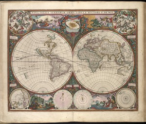
Frequently Asked Questions
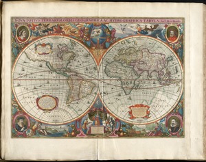
About
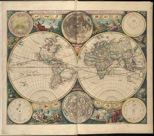
About Digital Commonwealth
News & Announcements
Copyright & Terms of Use
Harmful Content Statement
Partners
API
Contact Us
Search
Search Constraints
Start Over
Save Search
Your search:
More Like
commonwealth:2514p062h
✖
Remove constraint More Like: commonwealth:2514p062h
« Prev. |
1
-
100
of
11,032
|
Next »
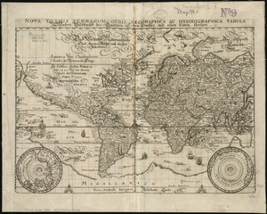
Sort
by relevance
relevance
title
date (asc)
date (desc)
Number of results to display per page
100
per page
per page
10
per page
20
per page
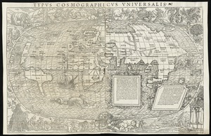
50
per page
100
per page
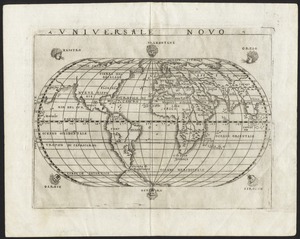
View results as:
List
list view
Maps
map view
Gallery
grid view
Search Results
1.
Carta universal en que se contiene todo lo que del mundo se ha descubierto fasta agora
2.
Chart of the track of the Dolphin, Tamar, Swallow & Endeavour through the South Seas ; & of the track of M. Bougainville round...
3.
Chart of the world according to Mercators projection, shewing the tracks & discoveries of Captn. Cook
4.
A chart of the world upon Mercator's projection : describing the tracks of Capt. Cook in the year 1768, 69, 70, 71, and in...
5.
Diversi globi terr-aquei statione variante et visu intercedente, per coluros tropicorum, per ambos polos et particul : sphaerae...
6.
[Hamadaradz Asharhatsuyts] = [Extensive world map]
7.
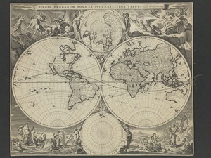
A map of the world : corrected from the observations communicated to the Royal Societys of London and Paris
8.
A map of the world from the best authorities
9.
A map of the world on a globular projection : exhibiting particularly the nautical researches of Captain James Cook, F.R.S. :...
10.
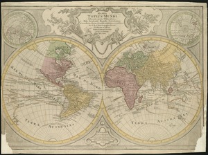
Mappa totius mundi : adornata juxta observationes dnn. academiae regalis scientiarum et nonnullorum aliorum secundum...
11.
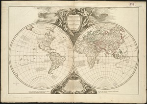
Mappe Monde ou carte générale du globe terrestre dessinée suivant les regles de la projection des cartes réduites
12.
Mappe-monde
13.
Mappemonde ou Description du globe terrestre
14.
Mappmonde ou description generale du globe terrestre
15.
A Mercators chart
16.
A new & correct map of the whole world : shewing ye situation of its principal parts. viz. the oceans, kingdoms, rivers, capes,...
17.
A new and accurat map of the world : drawne according to ye truest descriptions latest discoveries & best observations yt have...
18.
A new and accurat map of the world drawne according to ye truest descriptions latest discoveries & best observations yt have...
19.
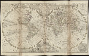
A new and correct map of the world, laid down according to the newest discoveries, and from the most exact observations
20.
A new map of the terraqueous globe according to the ancient discoveries and most general divisions of it into continents and...
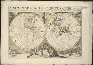
21.
A new map of the terraqueous globe according to the latest discoveries and most general divisions of it into continents and oceans
22.
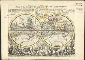
A new map of the whole world with the trade winds according to ye latest and most exact observations
23.
A new map of the world from the latest observations
24.
A new mapp of the world
25.
Nouus planiglobii terrestris per utrumque polum conspectus
26.
Nova totius terrarum orbis geographica ac hydrographica tabula
27.
Nova totius terrarum orbis geographica ac hydrographica tabula = Wahre Biltnüss des Gantzen Erden Kraÿses mit allen seinen...
28.
Nova totius terrarum orbis tabula
29.
Nova totivs terrarvm orbis geographica ac hydrographica tabvla
30.
Novissima totius terrarum orbis tabula
31.
Orbis terrarum nova et accuratissima tabula
32.
Orbis terrarum nova et accuratissima tabula
33.
Orbis vetus in utrâque continente juxtà mentem Sansonianam distinctus, nec non observationibus astronomicis
34.
Planiglobii terrestris mappa universalis utrumq hemisphærium orient. et occidentale repræsentans ex IV mappis generalibus =...
35.
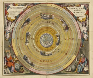
Planisphaerium Ptolemaicum siue machina orbium mundi ex hypothesi Ptolemaica in plano disposita
36.
Systema ideale quo exprimitur, aquarum per canales hydragogos subterraneos ex mari et in montium hydrophylacia protrusio,...
37.
[The World]
38.
[The World]
39.
Typus orbis terrarum
40.
A variation chart
41.
[World map]
42.
[World map]
43.
The world with all modern discoveries
44.
Carta marina nova tabula
45.
Circular world map
46.
Die gantze Welt in ein Kleberblat, welches in der Stadt Hannover, meines lieben Vaterlandes Wapen
47.
Generale Ptholemei
48.
Geographica restituta per globi trientes
49.
Hemispheriu[m] ab aequinoctiali linea, ad circulu[m] Poli Arctici : Hemispheriu[m] ab aequinoctiali linea, ad circulu[m] Poli...
50.
La heroike enterprinse faict par le Signeur Draeck d'avoir cirquit toute la terre
51.
A new and accurat map of the world
52.
Noua, et integra vniuersi orbis descriptio
53.
Noua orbis terrarum delineatio singulari ratione accommodata meridiano tabb. Rudolphi astronomicarum
54.
Noua totius terrarum orbis geographica ac hydrographica tabula
55.
Noua totius terrarum orbis geographica ac hydrographica tabula
56.
Nova, et integra universi orbis descriptio
57.
Orbis terrae compendiosa descriptio : quam ex magna universali Gerardi Mercatoris Domino Richardo Gartho, geographie ac...
58.
Orbis terrarum typus de integro multis in locis emendatus
59.
Orbis typus uniuersalis iuxta hydrographorum traditionem
60.
Orbis typus uniuersalis iuxta hydrographorum traditionem
61.
Oval map of the world
62.
A plat of all the world : projected according to the truest rules being far more exact than either the plain-card or the maps...
63.
Quam hic vides orbis imagine[m] lector ca[n]dide ea[m] ut posteriore[m] ita & eme[n]datiorem ijs que hactenus...
64.
Secunda etas mundi = Secunda etas mũdi
65.
Secunda etas mundi = Secunda etas mũdi
66.
Tipus orbis uniuersalis iuxta Ptolomei cosmographi traditionem et Americi Vespucii alior[um]que
67.
Tipus orbis uniuersalis iuxta Ptolomei cosmographi traditionem et Americi Vespucii alior[um]que
68.
Typus cosmographicus uniuersalis
69.
Typus cosmographicus uniuersalis
70.
Uniuersalior cogniti orbis tabula ex recentibus confecta obseruationibus
71.
Uniuersi orbis seu terreni globi in plano effigies
72.
Universale novo
73.
Universalis de terrao orarium ex vera recen [...] traditione
74.
World map
75.
World map
76.
World map
77.
The 100th anniversary map of Abraham Lincoln's visit to Massachusetts, September 11-23, 1848
78.
1630 shoreline
79.
1879. Progress map of the U.S. Geographical Surveys west of the 100th Meridian : prepared under the direction of 1st Lieut....
80.
1903 Map of Salem and surrounding places
81.
19th annual convention of the National Association of Real Estate Boards : at Tulsa, June 7 to June 11 in 1926
82.
2005 significant U.S. hurricane strikes
83.
227 Harzgerode
84.
305 Glatz
85.
38,000,000 escaped -- 10,000,000 died
86.
4 Kinten
87.
660 Wakulah St., Roxbury
88.
[A chart of Boston Bay and vicinity]
89.
[A chart of New York Island & North River : East River, passage through Hell Gate, Flushing Bay, Hampstead Bay, Oyster,...
90.
The A.A.A. key road map of continental Europe
91.
Aaron Bohrod's America, its history
92.
ABC pathfinder railway guide map : eastern division
93.
Aboriginal map of North America, denoting the boundaries and the locations of various Indian tribes
94.
Acapulco, México
95.
Accurata delineatio Castrorum Suecicorum, ut et Haffniae, Regni Daniae Metropolis
96.
Accurata delineatio oppugnatae a faederatis, Caesareis, Polonicis, Danicis, et Brandeburgicis copijs sub-ductu Seren: Electoris...
97.
Accurata delineatio regionis circa Nieburgum Fioniæ cum prælio ibi commisso inter Danorum et fæderatorum exercitum ab una et...
98.
Accurata Scaniae, Blekingiae et Hallandiae descriptio
99.
An accurate map of Cuba, and the adjacent islands
100.
An accurate map of Dorset Shire divided into hundreds
« Previous
Next »
1
2
3
4
5
…
110
111
Limit your search
Subject
Real property--Massachusetts--Boston--Maps
2,278
Landowners--Massachusetts--Boston--Maps
2,117
Boston (Mass.)--Maps
1,966
Roxbury (Boston, Mass.)--Maps
351
Dorchester (Boston, Mass.)--Maps
317
Cambridge (Mass.)--Maps
266
Brookline (Mass.)--Maps
236
Real property--Massachusetts--Cambridge--Maps
216
more
Subject
»
Place
North and Central America
7,814
United States
6,575
Suffolk (county)
3,337
Boston
3,197
Massachusetts
3,174
Europe
964
Middlesex (county)
617
Canada
427
more
Place
»
Format
Maps/Atlases
10,973
Manuscripts
215
Prints
51
Books
35
Objects/Artifacts
10
Drawings/Illustrations
8
Posters
4
Available to use
No known restrictions
10,932
Creative Commons license
65
Date
View distribution
Current results range from
1482
to
2023
Date range begin
Date range end
View larger »
Collection
Norman B. Leventhal Map Center Collection
11,019
Boston and New England Maps (Collection of Distinction)
5,105
Urban Maps (Collection of Distinction)
4,846
Maritime Charts and Atlases (Collection of Distinction)
750
American Revolutionary War-Era Maps (Collection of Distinction)
615
Boston Redevelopment Authority Collection
86
Mapping Boston Collection
19
Sidney R. Knafel Map Collection at Phillips Academy
13
Institution
Boston Public Library
11,000
Private Collection
19
Phillips Academy
13


![[Hamadaradz Asharhatsuyts]](https://bpldcassets.blob.core.windows.net/derivatives/images/commonwealth:x633f982n/image_thumbnail_300.jpg)


![Systema ideale quo exprimitur, aquarum per canales hydragogos subterraneos ex mari et in montium hydrophylacia protrusio, aquarumq[ue] subterrestrium per pyragogos canales concoctus](https://bpldcassets.blob.core.windows.net/derivatives/images/commonwealth:n8710p89m/image_thumbnail_300.jpg)
![[The World]](https://bpldcassets.blob.core.windows.net/derivatives/images/commonwealth:9g54xj67p/image_thumbnail_300.jpg)
![[The World]](https://bpldcassets.blob.core.windows.net/derivatives/images/commonwealth:st74cx537/image_thumbnail_300.jpg)


![[World map]](https://bpldcassets.blob.core.windows.net/derivatives/images/commonwealth:st74cz00d/image_thumbnail_300.jpg)
![[World map]](https://bpldcassets.blob.core.windows.net/derivatives/images/commonwealth:wd3762879/image_thumbnail_300.jpg)


![Hemispheriu[m] ab aequinoctiali linea, ad circulu[m] Poli Arctici](https://bpldcassets.blob.core.windows.net/derivatives/images/commonwealth:3f462s45p/image_thumbnail_300.jpg)


![Quam hic vides orbis imagine[m] lector ca[n]dide ea[m] ut posteriore[m] ita & eme[n]datiorem ijs que hactenus circu[m]ferebantur esse America sarmatiaq[ue] ac India testantur ... lemei expectato vale](https://bpldcassets.blob.core.windows.net/derivatives/images/commonwealth:3f463b69r/image_thumbnail_300.jpg)


![Tipus orbis uniuersalis iuxta Ptolomei cosmographi traditionem et Americi Vespucii alior[um]que](https://bpldcassets.blob.core.windows.net/derivatives/images/commonwealth:j3860806q/image_thumbnail_300.jpg)
![Tipus orbis uniuersalis iuxta Ptolomei cosmographi traditionem et Americi Vespucii alior[um]que](https://bpldcassets.blob.core.windows.net/derivatives/images/commonwealth:3f463b65n/image_thumbnail_300.jpg)


![Universalis de terrao orarium ex vera recen [...] traditione](https://bpldcassets.blob.core.windows.net/derivatives/images/commonwealth:hq37vv39x/image_thumbnail_300.jpg)


![[A chart of Boston Bay and vicinity]](https://bpldcassets.blob.core.windows.net/derivatives/images/commonwealth:cj82m2976/image_thumbnail_300.jpg)


