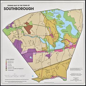
20381. Zoning map of the town of Southborough Creator: Massachusetts. Metropolitan Area Planning Council; Southborough (Mass. : Town). Planning Board Format: Maps/Atlases Collection: Boston and New England Maps (Collection of Distinction) / David Judkins Weaver Papers / Norman B. Leventhal Map & Education Center Collection / Urban Maps (Collection of Distinction) Date: 1984 Institution: Boston Public Library
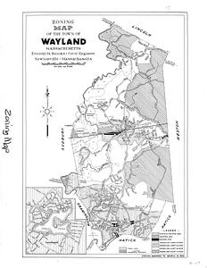
20382. Zoning map of the town of Wayland Massachusetts, 1954 Creator: Brooks, Everett M. Format: Maps/Atlases Collection: Wayland Historical Maps and Plans Date: 1954 Institution: Wayland Free Public Library
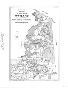
20383. Zoning map of the town of Wayland Massachusetts amended to August 11, 1958 Creator: Brooks, Everett M. Format: Maps/Atlases Collection: Wayland Historical Maps and Plans Date: January 1, 1959 Institution: Wayland Free Public Library
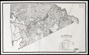
20384. Zoning map of Town of Wellesley, Mass. Creator: Wellesley Planning Board Format: Maps/Atlases Collection: Wellesley Free Library Local Historical Maps Date: January 1, 1980 Institution: Wellesley Free Library
20385. Zoning map of town-planning area of Tokyo - 1925 Format: Maps/Atlases Collection: Norman B. Leventhal Map & Education Center Collection Date: [1928] Institution: Boston Public Library
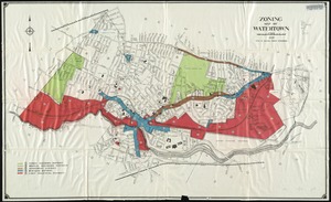
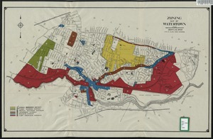
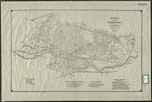
20386. Zoning map of Watertown Creator: Allen, Otis D. Format: Maps/Atlases Collection: Watertown Maps Date: 1935 Institution: Watertown Free Public Library
20387. Zoning map of Watertown Creator: Allen, Otis D. Format: Maps/Atlases Collection: Watertown Maps Date: 1948 Institution: Watertown Free Public Library
20388. Zoning map of Watertown, compiled from former surveys Creator: Allen, Otis D.; Johnson, Eric L. Format: Maps/Atlases Collection: Watertown Maps Date: 1931 Institution: Watertown Free Public Library
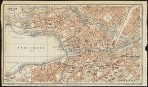
20389. Zürich Creator: Wagner & Debes Format: Maps/Atlases Collection: Norman B. Leventhal Map & Education Center Collection Date: [1913] Institution: Boston Public Library