Skip to search
Skip to main content
Skip to first result
Digital Commonwealth
Folders
Sign Up / Log In
Search for
Search
Search
Search
Basic
Advanced
Explore
Map
Collections
Institutions
Formats
For Educators
Primary Source Sets
Lesson Plans
Using Primary Sources
Searching Digital Commonwealth
For Institutions
Join Digital Commonwealth
Conferences, Trainings, & Events
How to Contribute Collections
Digitization Services
Board & Committees
Frequently Asked Questions
About
About Digital Commonwealth
News & Announcements
Copyright & Terms of Use
Harmful Content Statement
Partners
API
Contact Us
Search
Search Constraints
Start Over
Save Search
Your search:
Format
Maps
✖
Remove constraint Format: Maps
« Prev.
|
20,301
-
20,320
of
20,389
|
Next »
Sort
by relevance
relevance
title
date (asc)
date (desc)
Number of results to display per page
20
per page
per page
10
per page
20
per page
50
per page
100
per page
View results as:
List
list view
Maps
map view
Gallery
grid view
Search Results
20301.
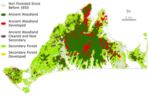
Woodland History in the Modern Landscape
20302.
Woods Hole, Mass.
20303.
Woods Hole Quadrangle, Massachusetts
20304.
Woods Hole Quadrangle Massachusetts
20305.
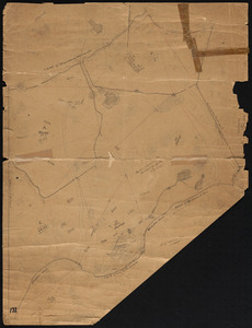
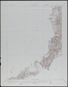
Wood's Holl [sic], Falmouth, Mass
20306.
Woodstock, New Brunswick : 1889
20307.
Worcester & Frost Land, South End
20308.
Worcester, Barre and Cheshire R.R. route to Winchendon, Massachusetts / M. Conant, engr.
20309.
Worcester County : Essex County
20310.
Worcester, May 28, 1795. : The above plan was surveyed between the months of October, 1794 and the month of April, 1795
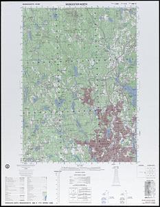
20311.
Worcester North, Massachusetts
20312.
Worcester North Massachusetts, Worcester Co.
20313.
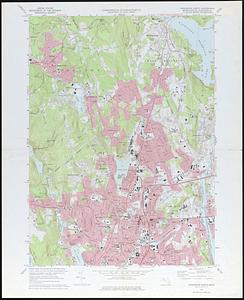
Worcester south Quadrangle Massachusetts, Worcester Co.
20314.
Worcester station
20315.
Worcestershire
20316.
Worcestershire and Gloucestershire
20317.
The world
20318.
The world
20319.
The world
20320.
The World
« Previous
Next »
1
2
…
1,012
1,013
1,014
1,015
1,016
1,017
1,018
1,019
1,020
Limit your search
Subject
Real property--Massachusetts--Boston--Maps
2,356
Boston (Mass.)--Maps
2,182
Landowners--Massachusetts--Boston--Maps
2,154
Roads
1,692
Cities and towns
1,681
Land use mapping
1,679
Soil mapping
1,679
United States. Work Projects Administration
1,679
more
Subject
»
Place
North and Central America
16,996
United States
15,792
Massachusetts
11,534
Suffolk (county)
4,209
Boston
4,056
Essex (county)
2,374
Lawrence
1,525
Middlesex (county)
1,476
more
Place
»
Format
Any of:
Maps
✖
[remove]
Available to use
No known restrictions
16,354
Creative Commons license
1,777
Date
View distribution
Current results range from
1482
to
2023
Date range begin
Date range end
View larger »
Unknown
289
Collection
Norman B. Leventhal Map & Education Center Collection
11,626
Boston and New England Maps (Collection of Distinction)
5,672
Urban Maps (Collection of Distinction)
5,268
Land study maps, 1936-1937
1,679
Maritime Charts and Atlases (Collection of Distinction)
1,110
American Revolutionary War-Era Maps (Collection of Distinction)
848
Lawrence, Mass. Engineering Department. City Sewers
717
Lawrence, Mass. Engineering Department. City Streets
667
more
Collection
»
Institution
Boston Public Library
11,891
Massachusetts Archives
2,453
Lawrence Public Library
1,490
Harvard University
714
State Library of Massachusetts
632
New Bedford Free Public Library
480
Salem State University Archives and Special Collections
280
Phillips Academy
249
more
Institution
»
![Wood's Holl [sic], Falmouth, Mass](https://bpldcassets.blob.core.windows.net/derivatives/images/commonwealth:qb98n7935/image_thumbnail_300.jpg)