Skip to search
Skip to main content
Skip to first result
Digital Commonwealth
Folders
Sign Up / Log In
Search for
Search
Search
Search
Basic
Advanced
Explore
Map
Collections
Institutions
Formats
For Educators
Primary Source Sets
Lesson Plans
Using Primary Sources
Searching Digital Commonwealth
For Institutions
Join Digital Commonwealth
Conferences, Trainings, & Events
How to Contribute Collections
Digitization Services
Board & Committees
Frequently Asked Questions
About
About Digital Commonwealth
News & Announcements
Copyright & Terms of Use
Harmful Content Statement
Partners
API
Contact Us
Search
« Prev.
|
1,223,601
-
1,223,700
of
1,236,461
|
Next »
Sort
by relevance
relevance
title
date (asc)
date (desc)
Number of results to display per page
100
per page
per page
10
per page
20
per page
50
per page
100
per page
View results as:
List
list view
Maps
map view
Gallery
grid view
Search Results
1223601.
Atlas of the city of Boston : East Boston, Mass. : plate 32
1223602.
Atlas of the city of Boston, Boston proper and Roxbury : plate 19
1223603.
Atlas of the city of Boston, Boston proper and Roxbury : plate 4
1223604.
Atlas of the city of Boston : Dorchester, Mass. : plate 32
1223605.
Atlas of the city of Boston, Boston proper and Roxbury : plate 17
1223606.
Atlas of the city of Boston, Boston proper and Roxbury : plate 18
1223607.
Atlas of the city of Boston, Boston proper and Roxbury : plate 5
1223608.
Atlas of the city of Boston : Dorchester, Mass. : plate 13
1223609.
Atlas of the city of Boston : Charlestown : plate 2
1223610.
Atlas of the city of Boston, Boston proper and Roxbury : plate 30
1223611.
Mount Hope Bridge, Bristol, Rhode Island
1223612.
Italy
1223613.
A pictorial map of the British Isles
1223614.
Italy with Vatican City
1223615.
France
1223616.
Plan de Paris
1223617.
The picture map of France
1223618.
The map of pioneer Hartford : founded 1636, incorporated 1784, showing early landmarks and the locations of historical events
1223619.
Pratts high test map of the Great North Road
1223620.
The British Commonwealth of Nations
1223621.
A map of North America, denoting the boundaries of the yearly meetings of Friends and the locations of the various Indian tribes
1223622.
Plan of Nashua River from Lancaster Mills to S. Harris
1223623.
Plan of Clinton Company's property, "Sawyer's Mills" Boylston, Mass.
1223624.
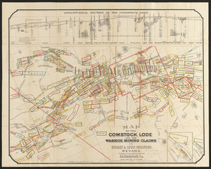
Map of the Comstock Lode and the Washoe mining claims in Storey & Lyon counties, Nevada
1223625.
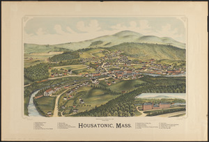
Housatonic, Mass.
1223626.
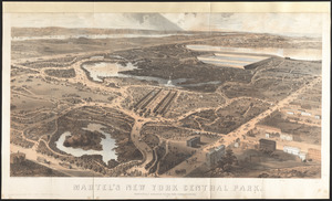
Martel's New York Central Park : respectfully dedicated to the park commissioners
1223627.
Morrisville, Bucks County, Pennsylvania, 1893
1223628.
East view of the village of North Bridgewater, Mass, 1844 : from a lithograph in possession of Mr R.C. Kimball
1223629.
Plan of Gregory Farm in Weston
1223630.
Road map of the Boston district showing the metropolitan park system.
1223631.
Preliminary study of a plan for a Pleasure Bay between Dorchester Point and Castle Island
1223632.
The West Indies exhibiting the English, French, Spanish, Dutch & Danish settlements
1223633.
A map of the most inhabited part of Virginia containing the whole province of Maryland with part of Pensilvania, New Jersey and...
1223634.
Open space 2017
1223635.
A map of South Carolina and a part of Georgia : containing the whole sea-coast; all the islands, inlets, rivers, creeks,...
1223636.
Course of cholera in Boston in 1849
1223637.
Localities of one thousand cases of intestinal diseases (diarrhoea, cholera-infantum & dysentery) in children, for the months...
1223638.
Rhein Panorama von Cöln nach Düsseldorf und Mainz
1223639.
Atlas of the city of Boston : Dorchester : volume three : from actual surveys and official records : index map
1223640.
Atlas of Suffolk, county, vol. 7th, late town of Brighton, now ward 19 of Boston, Massachusetts : from actual survey & official...
1223641.
Atlas of Suffolk, county, vol. 7th, late town of Brighton, now ward 19 of Boston, Massachusetts : from actual survey & official...
1223642.
Atlas of Suffolk, county, vol. 7th, late town of Brighton, now ward 19 of Boston, Massachusetts : from actual survey & official...
1223643.
Atlas of the city of Boston : Dorchester : volume three : from actual surveys and official records : plate C
1223644.
Atlas of the city of Boston : Dorchester : volume three : from actual surveys and official records : plate A
1223645.
Atlas of the city of Boston : Dorchester : volume three : from actual surveys and official records : plate E
1223646.
Atlas of the city of Boston : Dorchester : volume three : from actual surveys and official records : plate D
1223647.
Atlas of the city of Boston : Dorchester : volume three : from actual surveys and official records : plate B
1223648.
Atlas of the city of Boston : Roxbury, Mass. : volume three : from actual surveys and official records : plate 30
1223649.
Atlas of the city of Boston : Roxbury, Mass. : volume three : from actual surveys and official records : plate 27
1223650.
Atlas of the city of Boston : Roxbury, Mass. : volume three : from actual surveys and official records : plate 26
1223651.
Atlas of the city of Boston : Roxbury, Mass. : volume three : from actual surveys and official records : plate 32
1223652.
Atlas of the city of Boston : Roxbury, Mass. : volume three : from actual surveys and official records : plate 33
1223653.
Atlas of the city of Boston : Roxbury, Mass. : volume three : from actual surveys and official records : plate 24
1223654.
Atlas of the city of Boston : Roxbury, Mass. : volume three : from actual surveys and official records : plate 31
1223655.
Atlas of the city of Boston : Roxbury, Mass. : volume three : from actual surveys and official records : plate 28
1223656.
Atlas of the city of Boston : Roxbury, Mass. : volume three : from actual surveys and official records : plate 29
1223657.
City atlas of Boston, Massachusetts : complete in one volume : from official records, private plans and actual surveys : plate 30
1223658.
Plan of the city of Boston : plate 9
1223659.
Plan of the city of Boston : plate 4
1223660.
Plan of the city of Boston : plate 6
1223661.
Plan of the city of Boston : plate 8
1223662.
Plan of the city of Boston : plate 7
1223663.
Plan of the city of Boston : plate 10
1223664.
Plan of the city of Boston : plate 5
1223665.
Plan of the city of Boston : plate 3
1223666.
Insurance map of Charlestown : portions of Roxbury (now annexed to Boston) and Cambridge : plate 20
1223667.
Insurance map of Charlestown : portions of Roxbury (now annexed to Boston) and Cambridge : plate 18
1223668.
Insurance map of Charlestown : portions of Roxbury (now annexed to Boston) and Cambridge : plate 21
1223669.
Insurance map of Charlestown : portions of Roxbury (now annexed to Boston) and Cambridge : plate 16
1223670.
Insurance map of Charlestown : portions of Roxbury (now annexed to Boston) and Cambridge : plate 15
1223671.
Insurance map of Charlestown : portions of Roxbury (now annexed to Boston) and Cambridge : plate 11
1223672.
Insurance map of Charlestown : portions of Roxbury (now annexed to Boston) and Cambridge : plate 14
1223673.
Insurance map of Charlestown : portions of Roxbury (now annexed to Boston) and Cambridge : plate 17
1223674.
Insurance map of Charlestown : portions of Roxbury (now annexed to Boston) and Cambridge : plate 13
1223675.
Insurance map of Charlestown : portions of Roxbury (now annexed to Boston) and Cambridge : plate 19
1223676.
Insurance map of Charlestown : portions of Roxbury (now annexed to Boston) and Cambridge : plate 29
1223677.
Insurance map of Charlestown : portions of Roxbury (now annexed to Boston) and Cambridge : plate 25
1223678.
Insurance map of Charlestown : portions of Roxbury (now annexed to Boston) and Cambridge : plate 28
1223679.
Insurance map of Charlestown : portions of Roxbury (now annexed to Boston) and Cambridge : plate 22
1223680.
Insurance map of Charlestown : portions of Roxbury (now annexed to Boston) and Cambridge : plate 23
1223681.
Insurance map of Charlestown : portions of Roxbury (now annexed to Boston) and Cambridge : plate 27
1223682.
Insurance map of Charlestown : portions of Roxbury (now annexed to Boston) and Cambridge : plate 24
1223683.
Insurance map of Charlestown : portions of Roxbury (now annexed to Boston) and Cambridge : plate 26
1223684.
Insurance map of Charlestown : portions of Roxbury (now annexed to Boston) and Cambridge : plate 30
1223685.
The victory war map
1223686.
A map of Portsmouth, N.H. : an old town by the sea
1223687.
Plan of the Kenberma Park Estates : Nantasket Beach, Hull, Mass.
1223688.
Plan of ancient Rome
1223689.
Plan of Boston in 1630 and 1900
1223690.
Japan, the target : a pictorial Jap-map
1223691.
The Wonderground map of London town
1223692.
Historic Massachusetts : a travel map to help you feel at home in the Bay State
1223693.
Plan of Shakspeare's birth-place
1223694.
Plan of corner of Centry & Beacon St's -- 1741
1223695.
Athens
1223696.
Civil War centennial
1223697.
Map no. I
1223698.
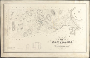
Map of the town of Brookline, Mass. : made by order of the town authorities from actual survey
1223699.
Broadway of America an all year ... all weather comfortable route from coast to coast
1223700.
Maine Central Railroad : through the White Mountains
« Previous
Next »
1
2
…
12,233
12,234
12,235
12,236
12,237
12,238
12,239
12,240
12,241
…
12,364
12,365
Limit your search
Subject
Houses
26,811
waterworks
19,972
Buildings
18,149
Students
15,739
Antislavery movements--United States
13,111
News
12,448
Antislavery movements--United States--History--19th century
11,293
reservoirs (water distribution structures)
11,160
more
Subject
»
Place
North and Central America
624,937
United States
620,610
Massachusetts
526,574
Suffolk (county)
215,643
Boston
210,524
Essex (county)
64,578
Middlesex (county)
54,680
Worcester (county)
51,776
more
Place
»
Format
Photographs
506,308
Manuscripts
228,395
Letters/Correspondence
185,353
Newspapers
110,012
Documents
101,422
Postcards/Cards
62,349
Film/Video
57,967
Prints
50,698
more
Format
»
Available to use
No known restrictions
266,837
Creative Commons license
161,858
Date
View distribution
Current results range from
-8000
to
2873
Date range begin
Date range end
View larger »
Unknown
79,454
Collection
W. E. B. Du Bois Papers, 1803-1999 (bulk 1877-1963)
99,739
American Archive of Public Broadcasting Collection
85,165
Newspapers from the Boston Public Library
67,727
Mark H. McCormack Papers, ca. 1920-2008 (bulk: 1957-2003)
48,824
Digitized Museum Collections
45,842
Tewksbury Almshouse Intake Records [1854-1884]
41,668
Leslie Jones Collection
37,421
Tichnor Brothers Postcard Collection
28,068
more
Collection
»
Institution
Boston Public Library
320,533
Special Collections and University Archives, University of Massachusetts Amherst Libraries
239,006
Historic New England
105,261
Northeastern University Library
68,545
Public Health Museum in Massachusetts
41,668
Massachusetts Archives
27,189
Springfield College Archives and Special Collections
22,438
Newburyport Public Library
18,961
more
Institution
»