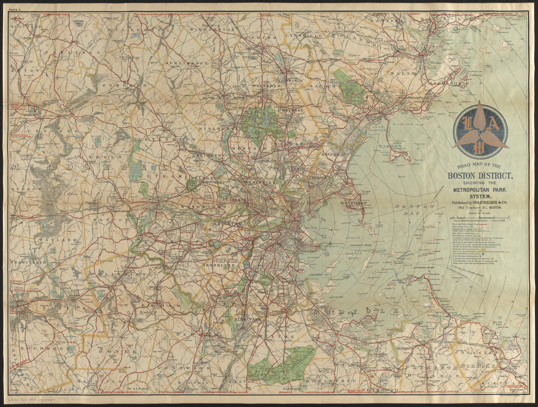
Road map of the Boston district showing the metropolitan park system.
Road map of the Boston district showing the metropolitan park system.
Item Information
Title:
Road map of the Boston district showing the metropolitan park system.
Title (alt.):
Bicycle map of Massachusetts
Description:
By the late 19th century, the advent of the "safety" bicycle-so named because its two equally sized wheels, chain driver, and gears rendered it exponentially safer than the high-wheeled penny-farthing—ushered in a period of bicycle fever. One vocal bike fanatic was Sylvester Baxter, the Metropolitan Park Commission’s secretary, who advocated bicycling much as he did the use of parks; both promoted the physical, intellectual, social, and moral health of city-dwelling men and women. This map shows Boston and its Metropolitan Park System, with red-lined bicycle routes offering a means of exploring the nation’s first regional park system.
Conservation of this piece was funded by Thomas L. Clemence in loving memory of Beverly E. Clemence.
Relief shown by contours and spot heights. Depths shown by isolines.
Also shows bicycling routes, street railways, Post Office sites, and radial distances from Boston State House.
Differs from other 1898 ed. in that it has insignia "L.A.W." [League of American Wheelmen] above the title.
In upper left margin: Plate Y.
Notes (exhibitions):
Exhibited: "Breathing Room: Mapping Boston's Green Spaces" organized by the Norman B. Leventhal Map Center at the Boston Public Library, 2018.


![Boston personal income ; Boston personal income [and] residential population density](https://bpldcassets.blob.core.windows.net/derivatives/images/commonwealth:fn107c409/image_thumbnail_300.jpg)