Skip to search
Skip to main content
Digital Commonwealth
Sign Up / Log In
Search for
Search
Search
Search
Basic
Advanced
Explore
Map
Collections
Institutions
Formats
For Educators
Primary Source Sets
Lesson Plans
Using Primary Sources
Searching Digital Commonwealth
For Institutions
Join Digital Commonwealth
Conferences, Trainings, & Events
How to Contribute Collections
Digitization Services
Board & Committees
Frequently Asked Questions
About
About Digital Commonwealth
News & Announcements
Copyright & Terms of Use
Harmful Content Statement
Partners
API
Contact Us
Boston Public Library
Norman B. Leventhal Map Center Collection
/
Urban Maps (Collection of Distinction)
/
Boston and New England Maps (Collection of Distinction)
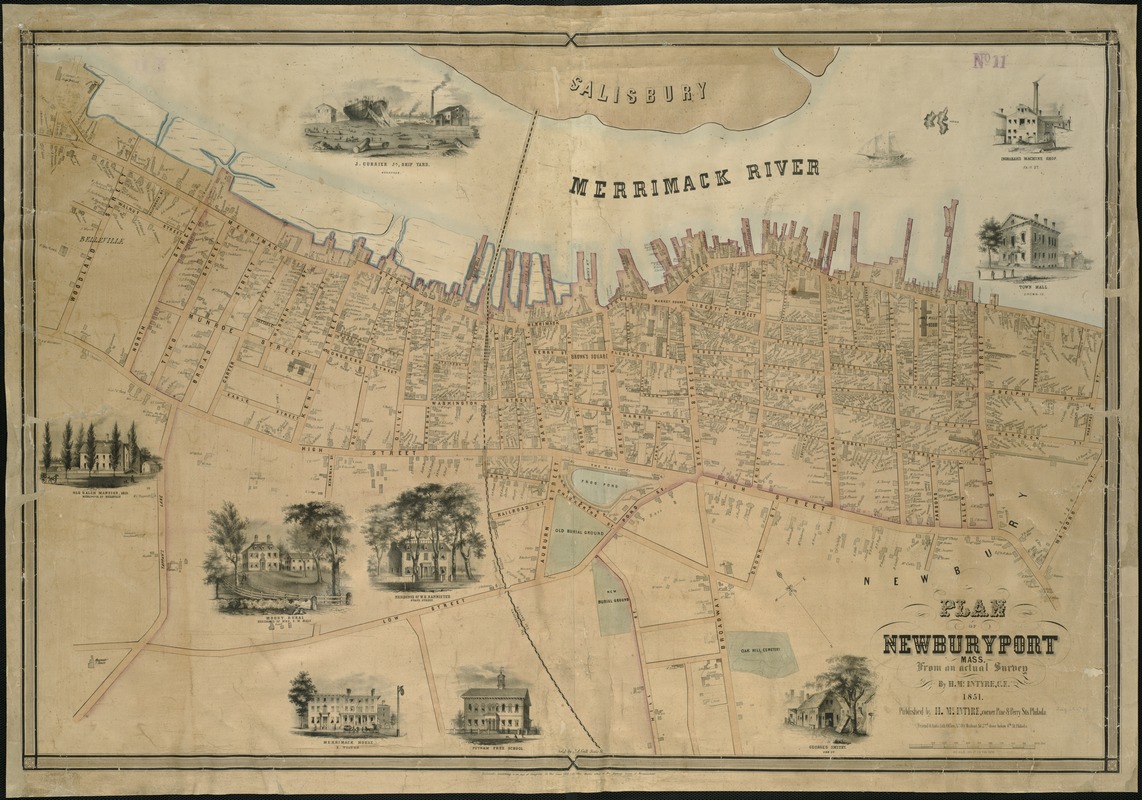
Plan of Newburyport Mass. from an actual survey
Plan of Newburyport Mass. from an actual survey
×
Item Information
Title:
Plan of Newburyport Mass. from an actual survey
Creator:
McIntyre, H. (Henry)
Name on Item:
H. McIntyre.
Date:
1851
Format:
Maps/Atlases
Location:
Boston Public Library
Norman B. Leventhal Map Center
Collection (local):
Norman B. Leventhal Map Center Collection
Subjects:
Landowners--Massachusetts--Newburyport--Maps
Real property--Massachusetts--Newburyport--Maps
Newburyport (Mass.)--Maps
Places:
Essex (county)
>
Newburyport
Extent:
1 map : col. ; 63 x 94 cm.
Permalink:
https://ark.digitalcommonwealth.org/ark:/50959/x059c9462
Terms of Use:
No known copyright restrictions.
No known restrictions on use.
Publisher:
Philadelphia : H. McIntyre
Scale:
Scale 1:3,000.
Language:
English
Notes:
Oriented with north toward the upper left.
Identifier:
06_01_005389
Call #:
G3764.N48G46 1851 .M3x
Barcode:
39999059013662
show more...
View MODS XML
More Like This
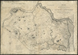
Map of the original town of Newbury, now divided into Newbury, ...
Atlas of Essex County, Massachusetts
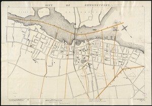
City of Newburyport
Atlas of Massachusetts
Find More Like This >>
Tools
Share
Facebook
Pinterest
X
Reddit
Tumblr
Email
Copy link
Add to Folder
Questions/Comments
Cite This Item
IIIF Manifest
Downloads
Primary (full resolution, uncompressed)
(TIF, 210 MB)
Large (full resolution)
(JPEG, 17.7 MB)
Medium
(JPEG, 320 KB)
GeoTIFF (georeferenced)
(TIF, 300 MB)