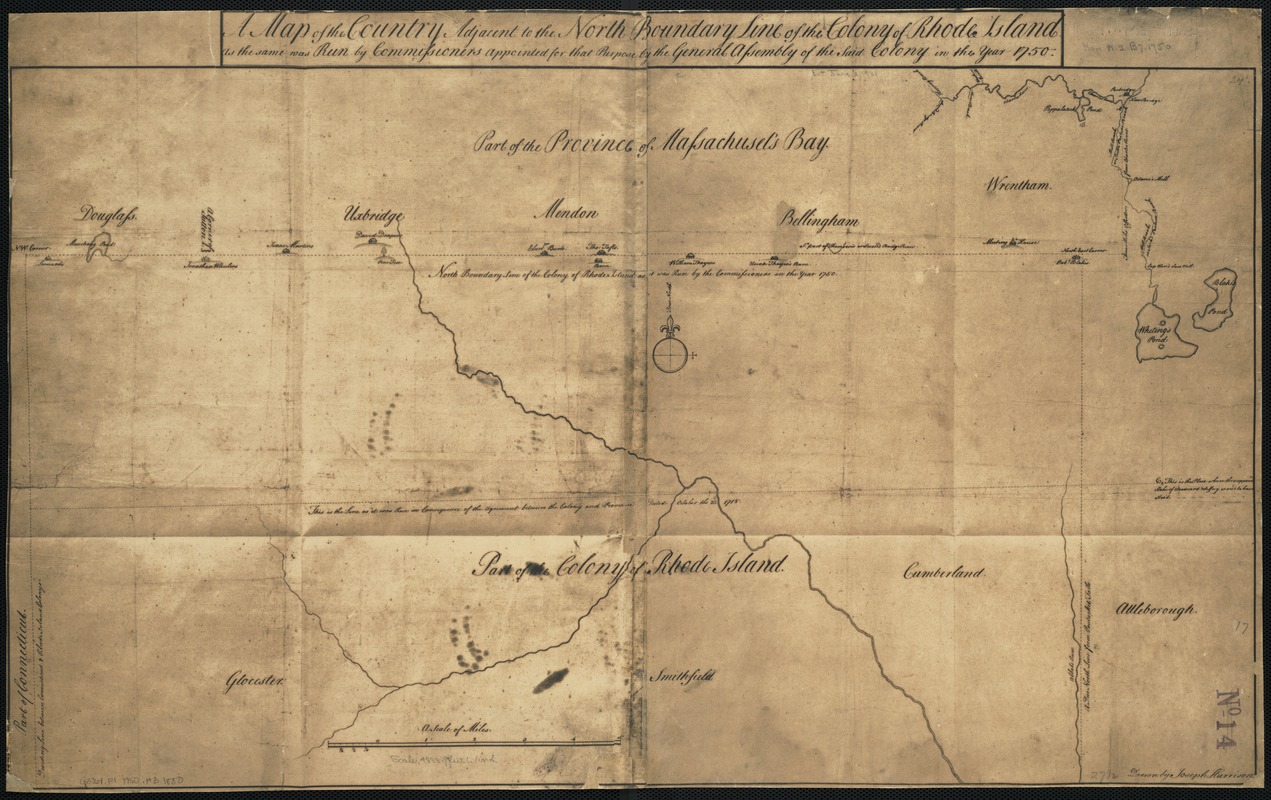
A map of the country adjacent to the north boundary line of the colony of Rhode Island as the same was run by commissioners appointed for that purpose by the general assembly of the said colony in the year 1750
A map of the country adjacent to the north boundary line of the colony of Rhode Island as the same was run by commissioners appointed for that purpose by the general assembly of the said colony in the year 1750
Item Information
Title:
A map of the country adjacent to the north boundary line of the colony of Rhode Island as the same was run by commissioners appointed for that purpose by the general assembly of the said colony in the year 1750
Facsimile of manuscript map.
The original is in the office of the Secretary of State of Rhode Island.
Depicts the towns of Douglass [sic], Uxbridge, Mendon, Bellingham, Wrentham and Attleborough [sic] in part of the Province of Massachusets [sic] Bay.
Original version: 1750.

![[Coast of New England from Chatham Harbor to Naragansett Bay]](https://bpldcassets.blob.core.windows.net/derivatives/images/commonwealth:7h149x27g/image_thumbnail_300.jpg)
![[Coast of New England from Chatham Harbor to Naragansett Bay]](https://bpldcassets.blob.core.windows.net/derivatives/images/commonwealth:7h149z37x/image_thumbnail_300.jpg)
