Skip to search
Skip to main content
Digital Commonwealth
Sign Up / Log In
Search for
Search
Search
Search
Basic
Advanced
Explore
Map
Collections
Institutions
Formats
For Educators
Primary Source Sets
Lesson Plans
Using Primary Sources
Searching Digital Commonwealth
For Institutions
Join Digital Commonwealth
Conferences, Trainings, & Events
How to Contribute Collections
Digitization Services
Board & Committees
Frequently Asked Questions
About
About Digital Commonwealth
News & Announcements
Copyright & Terms of Use
Harmful Content Statement
Partners
API
Contact Us
Boston Public Library
Norman B. Leventhal Map & Education Center Collection
/
Maritime Charts and Atlases (Collection of Distinction)
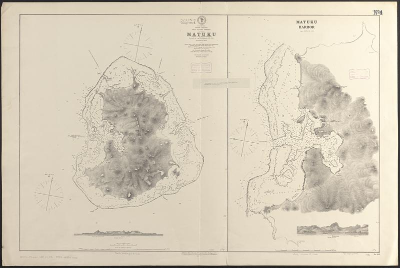
South Pacific, Fiji or Viti Group, Matuku ; Matuku Harbor
South Pacific, Fiji or Viti Group, Matuku ; Matuku Harbor
×
Item Information
Title:
South Pacific, Fiji or Viti Group, Matuku ; Matuku Harbor
Issuing body:
United States. Hydrographic Office
Surveyor:
Denham, Henry Mangles, Sir, 1800-1887
Name on Item:
surveyed, by Captn. H.M. Denham, R.N., 1855 ; corrected to 1872
Date:
1873
Format:
Maps/Atlases
Genre:
Nautical charts
Location:
Boston Public Library
Norman B. Leventhal Map & Education Center
Collection (local):
Norman B. Leventhal Map & Education Center Collection
Subjects:
Matuku Island (Fiji)--Maps
Matuku Harbour (Fiji)--Maps
Nautical charts--Fiji--Matuku Island
Nautical charts--Fiji--Matuku Harbour
Places:
Fiji
>
Cakaudrove
(province)
>
Matuku Island
(island)
Matuku Harbour
Extent:
2 maps on 1 sheet ; 64 x 97 cm
Permalink:
https://ark.digitalcommonwealth.org/ark:/50959/qv33x772h
Terms of Use:
No known copyright restrictions.
No known restrictions on use.
Publisher:
Washington, D.C. : Hydrographic Office
Scale:
Scale approximately 1:12,500
Scale approximately 1:25,000
Language:
English
Table of Contents:
Matuku
Matuku Harbor
Notes:
Relief shown by hachures and spot heights. Depths shown by soundings and pictorially.
Includes 2 coastal views.
Note referencing hydrographic notice 32, IV, 80 tipped on in center of map.
Identifier:
06_01_017514
Call #:
G9096.P5 svar .U55 no. 413
Barcode:
39999085960266
show more...
View MODS XML
More Like This
The 100th anniversary map of Abraham Lincoln's visit to ...
1630 shoreline
1879. Progress map of the U.S. Geographical Surveys west of the ...
1903 Map of Salem and surrounding places
Find More Like This >>
Tools
Share
Facebook
Pinterest
X
Reddit
Tumblr
Email
Copy link
Add to Folder
Questions/Comments
Cite This Item
IIIF Manifest
Downloads
Primary (full resolution, uncompressed)
(TIF, 129 MB)
Large (full resolution)
(JPEG, 10.8 MB)
Medium
(JPEG, 70.4 KB)