Skip to search
Skip to main content
Digital Commonwealth
Sign Up / Log In
Search for
Search
Search
Search
Basic
Advanced
Explore
Map
Collections
Institutions
Formats
For Educators
Primary Source Sets
Lesson Plans
Using Primary Sources
Searching Digital Commonwealth
For Institutions
Join Digital Commonwealth
Conferences, Trainings, & Events
How to Contribute Collections
Digitization Services
Board & Committees
Frequently Asked Questions
About
About Digital Commonwealth
News & Announcements
Copyright & Terms of Use
Harmful Content Statement
Partners
API
Contact Us
Boston Public Library
Boston Redevelopment Authority Collection
/
Urban Maps (Collection of Distinction)
/
Boston and New England Maps (Collection of Distinction)
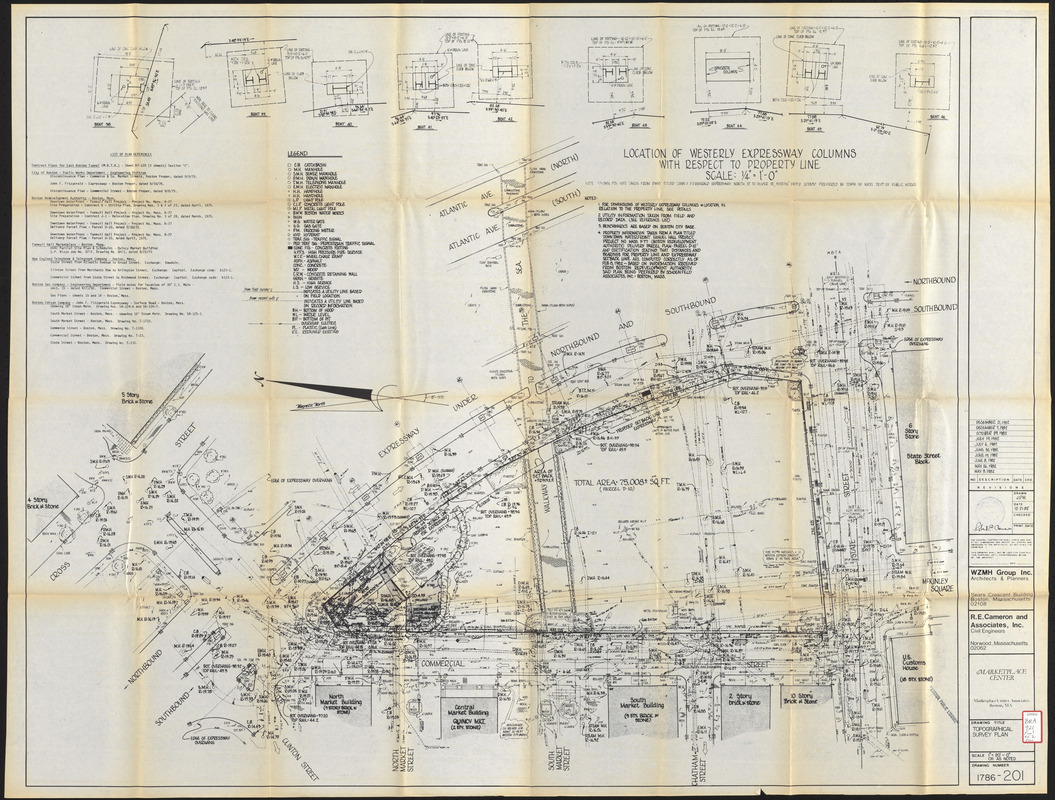
Marketplace Center : topographical survey plan
Marketplace Center
×
Item Information
Title:
Marketplace Center : topographical survey plan
Description:
Part of an environmental impact statement for a proposed mixed-use (commercial and cultural) building and improved pedestrian access ways on urban renewal parcel D-10 located just east of Faneuil Hall and adjacent to the central artery.
Cartographer:
Webb, Zerafa, Menkès, Housden (Firm)
Cartographer:
R.E. Cameron and Associates
Contributor:
Sasaki Associates
Contributor:
Marketplace Center Associates
Name on Item:
WZMH Group Inc. ; R.E. Cameron and Associates, Inc.
Date:
December 21, 1982
Format:
Maps/Atlases
Location:
Boston Public Library
Central Library in Copley Square
Collection (local):
Boston Public Library Collection
Subjects:
City planning--Massachusetts--Boston--Maps
Central business districts--Massachusetts--Boston--Maps
Boston (Mass.)--Maps
Faneuil Hall (Boston, Mass.)
Places:
Massachusetts
>
Suffolk (county)
>
Boston
Extent:
1 map ; 90 x 109 cm
Permalink:
https://ark.digitalcommonwealth.org/ark:/50959/7h14cw83z
Terms of Use:
No known copyright restrictions.
No known restrictions on use.
Publisher:
Boston : Marketplace Center Associates
Scale:
Scale 1:240
Language:
English
Referenced by:
http://bpl.bibliocommons.com/item/show/1020157075
Notes:
Oriented with north to the left.
Includes list of references and 9 diagrams of location of westerly expressway columns with respect to property line.
Identifier:
06_01_017231
Call #:
BRA/921 Final vol. 2 plan
Barcode:
39999063149379
show more...
View MODS XML
More Like This
Parcel D-10
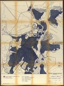
Central business district project no Mass r- : existing land use
Central business district project no Mass r- : existing building ...
Central business district project no Mass r- : locality map 2
Find More Like This >>
Tools
Share
Facebook
Pinterest
X
Reddit
Tumblr
Email
Copy link
Add to Folder
Questions/Comments
Cite This Item
IIIF Manifest
Downloads
Primary (full resolution, uncompressed)
(TIF, 464 MB)
Large (full resolution)
(JPEG, 39 MB)
Medium
(JPEG, 361 KB)