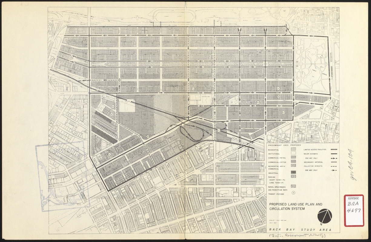
Map of Back Bay showing the footprints of existing buildings and the following: proposed uses (residential, institutional, commercial - retail, commercial - office, residential and/or commercial, industrial, parking - short term and long term, parks, open space, pedestrian ways, and transit stations. Traffic circulation information shows limited access facilities, major highways, secondary arterials, collection streets, and direction of one-way streets.