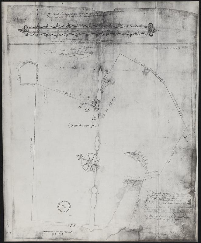
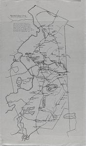
Photostat of a draft map of Marlborough, Massachusetts. The map shows the bounds of the planation with reference to the Court. "It contents is 29,419 acres." It shows 8 houses, 3 buildings, the Indian planting field, with a partical stone wall. "Elizabeth River" [known today as the Assabet River], "Seader Swamp" and the Sudbury River. The cartographer was "Samuell Andrews". The original is housed at Massachusetts State Archives (#71, vol.1 p.63)
Title from item or accompanying material.
"The scale contains six miles or 1,920 rods - the greatest division contains 160 rods the smaller division contains 16 rods."