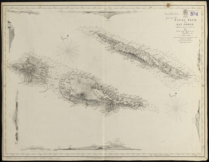
Relief shown by hachures and spot heights. Depths shown by soundings and isolines.
Includes 8 coastal views of the islands from different directions.
"Published according to Act of Parliament at the Hydrographic Office of the Admiralty, July 25th, 1849."
"[Chart] 1855."--Lower right corner.