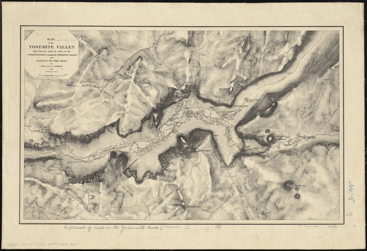
Map of the Yosemite Valley : from surveys made by order of the Commissioners to manage the Yosemite Valley and Mariposa Big Tree Grove
Map of the Yosemite Valley
Item Information
Title:
Map of the Yosemite Valley : from surveys made by order of the Commissioners to manage the Yosemite Valley and Mariposa Big Tree Grove
Description:
America Transformed: In 1890, California's Yosemite Valley became the second national park, although it had already been set aside as a state preserve in 1864, following the violent expulsion of the Ahwahnechee people. Both Yellowstone and Yosemite were mapped as part of four Great Western Surveys that preceded the establishment of the U.S. Geological Survey in 1879. Clarence King, who headed the Geological Exploration of the Fortieth Parallel, mapped Yosemite in 1870, while F. V. Hayden, who led the Geological and Geographical Survey of the Territories, mapped Yellowstone in 1871. Both used the traditional method of hachuring—drawing ink strokes along sloped land—to depict the rugged terrain of these unusual landscapes.
Ladders moved from preceding Bridge to above Vernal Falls; erasure is visible. Other place names added or removed.
Relief shown by hachures.
Notes (date):
This date is inferred.
Notes (exhibitions):
Exhibited: "America Transformed. Part 2: Homesteads to Modern Cities," organized by the Norman B. Leventhal Map & Education Center at the Boston Public Library, 2019-2020.