Skip to search
Skip to main content
Digital Commonwealth
Sign Up / Log In
Search for
Search
Search
Search
Basic
Advanced
Explore
Map
Collections
Institutions
Formats
For Educators
Primary Source Sets
Lesson Plans
Using Primary Sources
Searching Digital Commonwealth
For Institutions
Join Digital Commonwealth
Conferences, Trainings, & Events
How to Contribute Collections
Digitization Services
Board & Committees
Frequently Asked Questions
About
About Digital Commonwealth
News & Announcements
Copyright & Terms of Use
Harmful Content Statement
Partners
API
Contact Us
Boston Public Library
Norman B. Leventhal Map & Education Center Collection
/
Boston and New England Maps (Collection of Distinction)
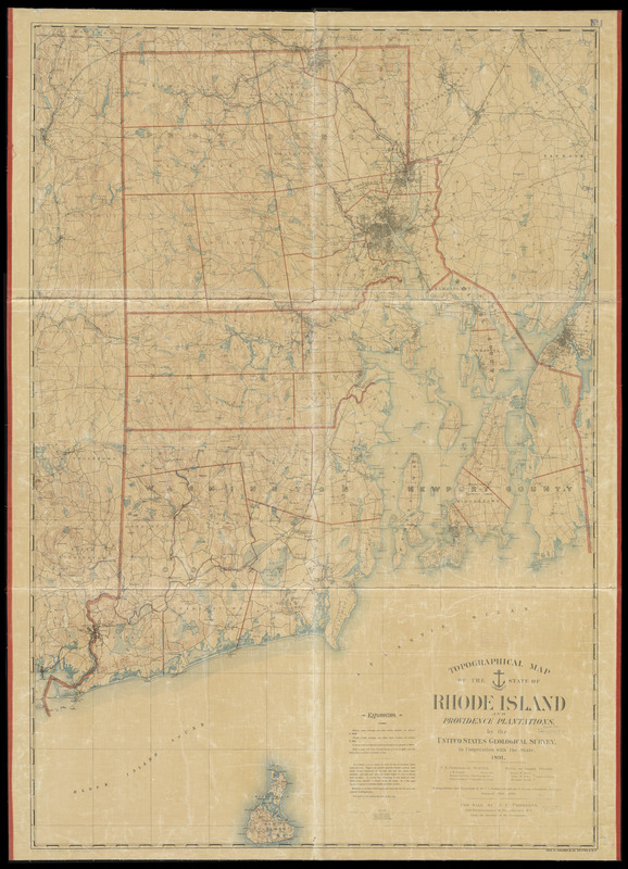
Topographical map of the state of Rhode Island and Providence plantations
Topographical map of the state of Rhode Island and Providence plantations
×
Item Information
Title:
Topographical map of the state of Rhode Island and Providence plantations
Creator:
Geological Survey (U.S.)
Contributor:
U.S. Coast and Geodetic Survey
Contributor:
Rhode Island
Name on Item:
by the United States Geological Survey in cooperation with the state
Date:
1891
Format:
Maps/Atlases
Location:
Boston Public Library
Norman B. Leventhal Map & Education Center
Collection (local):
Norman B. Leventhal Map & Education Center Collection
Subjects:
Rhode Island--Maps
Places:
Rhode Island
Extent:
1 map : color ; 157 x 108 cm.
Permalink:
https://ark.digitalcommonwealth.org/ark:/50959/3f463569q
Terms of Use:
No known copyright restrictions.
No known restrictions on use.
Publisher:
Providence, R.I ; Boston : For sale by J.C. Thompson under the direction of the Commission ; Geo. H. Walker & Co.
Scale:
Scale 1:62.500
Language:
English
Notes:
Relief shown by contours.
"Triangulation and topography by the U.S. Geological and the U.S. Coast & Geodetic Surveys. Surveyed 1885-1888."
"Contour interval, 20 feet. Datum, mean sea level. Water contour, 20 feet depth."
Identifier:
06_01_010540
Call #:
G3770 1891 .G46
Barcode:
39999065674143
show more...
View MODS XML
More Like This
74 miles on the ocean scenic highway U.S. 1
The city of New York as laid out by the Commissioners with the ...
Coast of the United States, from New York to Cape Ann : drawn from ...
Colton's Massachusetts and Rhode Island
Find More Like This >>
Tools
Share
Facebook
Pinterest
X
Reddit
Tumblr
Email
Copy link
Add to Folder
Questions/Comments
Cite This Item
IIIF Manifest
Downloads
Primary (full resolution, uncompressed)
(TIF, 382 MB)
Large (full resolution)
(JPEG, 32.1 MB)
Medium
(JPEG, 219 KB)