Skip to search
Skip to main content
Digital Commonwealth
Sign Up / Log In
Search for
Search
Search
Search
Basic
Advanced
Explore
Map
Collections
Institutions
Formats
For Educators
Primary Source Sets
Lesson Plans
Using Primary Sources
Searching Digital Commonwealth
For Institutions
Join Digital Commonwealth
Conferences, Trainings, & Events
How to Contribute Collections
Digitization Services
Board & Committees
Frequently Asked Questions
About
About Digital Commonwealth
News & Announcements
Copyright & Terms of Use
Harmful Content Statement
Partners
API
Contact Us
Boston Public Library
Norman B. Leventhal Map & Education Center Collection
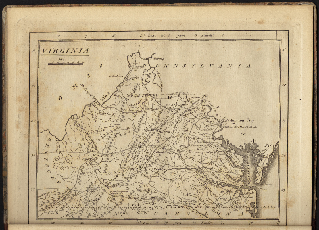
Virginia
Virginia
×
Item Information
Title:
Virginia
Engraver:
Barker, W. (William), active 1795-1803
Creator:
Carey, Mathew, 1760-1839
Publisher:
Carey, Mathew, 1760-1839
Name on Item:
W. Barker sculp.
Date:
1806
Format:
Maps/Atlases
Location:
Boston Public Library
Norman B. Leventhal Map & Education Center
Collection (local):
Norman B. Leventhal Map & Education Center Collection
Subjects:
Virginia--Maps
West Virginia--Maps
Places:
West Virginia
Virginia
Extent:
1 map ; 14 x 18 cm
Permalink:
https://ark.digitalcommonwealth.org/ark:/50959/3f463107w
Terms of Use:
No known copyright restrictions.
No known restrictions on use.
Publisher:
Philadelphia : Mathew Carey
Scale:
Scale approximately 1:4,400,000
Language:
English
Notes:
Relief shown pictorially.
Prime meridians: London and Philadelphia.
In his Carey's American minor atlas. Philadelphia : Mathew Carey, 1806.
Identifier:
06_01_004681
Call #:
G1200 .C37 1806
Barcode:
30000005066379
show more...
View MODS XML
More Like This
Colton's new topographical map of the states of Virginia, Maryland ...
Colton's new topographical map of the states of Virginia, West ...
Johnson's Virginia, Delaware, Maryland & West Virginia
Map of the State of Virginia
Find More Like This >>
Tools
Share
Facebook
Pinterest
X
Reddit
Tumblr
Email
Copy link
Add to Folder
Questions/Comments
Cite This Item
IIIF Manifest
Downloads
Primary (full resolution, uncompressed)
(TIF, 29.2 MB)
Large (full resolution)
(JPEG, 2.45 MB)
Medium
(JPEG, 400 KB)
GeoTIFF (georeferenced)
(TIF, 30.2 MB)