A new chart of America with the harbors of New York, Boston, &c
Item Information
- Title:
- A new chart of America with the harbors of New York, Boston, &c
- Description:
-
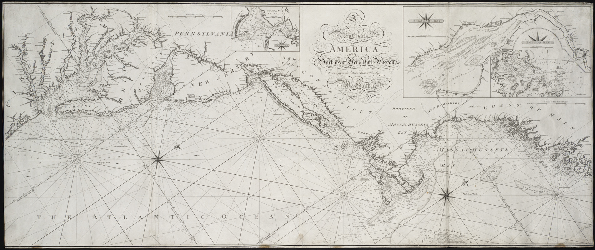
Heather, a London engraver and chart maker, published this two-sheet chart of the American coast, along with his Pilot for the Atlantic Ocean, at the end of the 18th century. The chart displays detailed coastal topography, depth soundings, and tidal and current information from Virginia to Maine. Its most attractive features are the elaborate calligraphy displayed in the title and the fine series of insets depicting New York Harbor, the Delaware River and Bay, and Boston Bay.
- Creator:
- Heather, William, 1764-1812
- Engraver:
- Stephenson, J.
- Contributor:
- Norie, J. W. (John William), 1772-1843
- Contributor:
- Heather and Williams
- Name on Item:
-
drawn from the latest authorities by W. Heather, 1799 ; Stephenson sculp. ; drawn by J. Norie
- Date:
-
1799
- Format:
-
Maps/Atlases
- Location:
- Private Collection
- Collection (local):
-
Mapping Boston Collection
- Subjects:
-
Nautical charts--Atlantic Coast (U.S.)--Early works to 1800
Atlantic Coast (U.S.)--Maps--Early works to 1800
- Places:
-
Northeastern United States (area)
Middle Atlantic (area)
- Extent:
- 1 map ; 62 x 154 cm.
- Permalink:
- https://ark.digitalcommonwealth.org/ark:/50959/3f462z592
- Terms of Use:
-
No known copyright restrictions.
This work is licensed for use under a Creative Commons Attribution Non-Commercial Share Alike License (CC BY-NC-SA).


