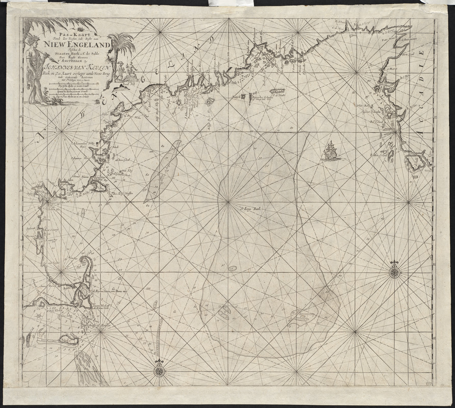
Pas-kaart vande zee kusten inde boght van Niew Engeland : tusschen de staaten Hoek en C. de Sable
Item Information
- Title:
- Pas-kaart vande zee kusten inde boght van Niew Engeland : tusschen de staaten Hoek en C. de Sable
- Description:
-
Published by the leading Dutch producer of navigational aids, this chart of New England is unlike any other of the region. It was the only Dutch chart of the colony published in the 17th century. Near the end of the 17th century, the Dutch family of van Keulen became involved in ship building, instrument making, and maritime publishing. The successes of the Dutch overseas trade generated quantities of fine manuscript charts of most parts of the world. The van Keulens had these manuscripts engraved in the best Dutch style, and published them in sumptuous atlases that were made to order, often for wealthy merchants.
- Creator:
- Keulen, Johannes van, 1654-1715
- Name on Item:
-
door vooght geometra t'Amsterdam by Johannes van Keulen
- Date:
-
1683
- Format:
-
Maps/Atlases
- Location:
- Private Collection
- Collection (local):
-
Mapping Boston Collection
- Subjects:
-
Nautical charts--New England--Early works to 1800
New England--Maps--Early works to 1800
Atlantic Coast (U.S.)--Maps--Early works to 1800
- Places:
-
New England (area)
- Extent:
- 1 map ; 56 x 59 cm.
- Permalink:
- https://ark.digitalcommonwealth.org/ark:/50959/3f462s990
- Terms of Use:
-
No known copyright restrictions.
This work is licensed for use under a Creative Commons Attribution Non-Commercial Share Alike License (CC BY-NC-SA).


