Search
Search Results
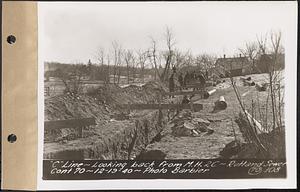
- Creator:
- Massachusetts. Metropolitan District Water Supply Commission; Barbier, Ernest E., 1912-2007
- Format:
- Photographs
- Collection:
- Massachusetts Metropolitan District Water Supply Commission, Quabbin Reservoir, Photographs of Contract Construction (selections from), 1928-1947
- Date:
- December 19, 1940
- Institution:
- Massachusetts Archives
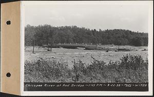
- Creator:
- Massachusetts. Metropolitan District Water Supply Commission; Pike, Stuart D., 1910-1978
- Format:
- Photographs
- Collection:
- Massachusetts Metropolitan District Water Supply Commission, Quabbin Reservoir, Photographs of Real Estate, Sanitary Conditions, and Flooding in the Ware River Watershed, and of General Engineering, 1928-1948
- Date:
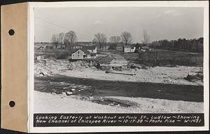
- September 22, 1938
- Institution:
- Massachusetts Archives
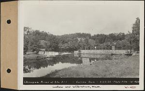
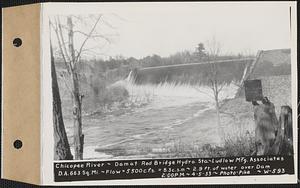
- Creator:
- Massachusetts. Metropolitan District Water Supply Commission; Pike, Stuart D., 1910-1978
- Format:
- Photographs
- Collection:
- Massachusetts Metropolitan District Water Supply Commission, Quabbin Reservoir, Photographs of Real Estate, Sanitary Conditions, and Flooding in the Ware River Watershed, and of General Engineering, 1928-1948
- Date:
- September 23, 1932
- Institution:
- Massachusetts Archives
- Creator:
- Massachusetts. Metropolitan District Water Supply Commission; Pike, Stuart D., 1910-1978
- Format:
- Photographs
- Collection:
- Massachusetts Metropolitan District Water Supply Commission, Quabbin Reservoir, Photographs of Real Estate, Sanitary Conditions, and Flooding in the Ware River Watershed, and of General Engineering, 1928-1948
- Date:
- October 1, 1938
- Institution:
- Massachusetts Archives
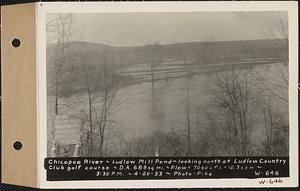
- Creator:
- Massachusetts. Metropolitan District Water Supply Commission; Pike, Stuart D., 1910-1978
- Format:
- Photographs
- Collection:
- Massachusetts Metropolitan District Water Supply Commission, Quabbin Reservoir, Photographs of Real Estate, Sanitary Conditions, and Flooding in the Ware River Watershed, and of General Engineering, 1928-1948
- Date:
- April 20, 1933
- Institution:
- Massachusetts Archives
- Creator:
- Massachusetts. Metropolitan District Water Supply Commission; Pike, Stuart D., 1910-1978
- Format:
- Photographs
- Collection:
- Massachusetts Metropolitan District Water Supply Commission, Quabbin Reservoir, Photographs of Real Estate, Sanitary Conditions, and Flooding in the Ware River Watershed, and of General Engineering, 1928-1948
- Date:
- March 13, 1936
- Institution:
- Massachusetts Archives
- Creator:
- Massachusetts. Metropolitan District Water Supply Commission; Pike, Stuart D., 1910-1978
- Format:
- Photographs
- Collection:
- Massachusetts Metropolitan District Water Supply Commission, Quabbin Reservoir, Photographs of Real Estate, Sanitary Conditions, and Flooding in the Ware River Watershed, and of General Engineering, 1928-1948
- Date:
- October 1, 1938
- Institution:
- Massachusetts Archives
- Creator:
- Massachusetts. Metropolitan District Water Supply Commission; Pike, Stuart D., 1910-1978
- Format:
- Photographs
- Collection:
- Massachusetts Metropolitan District Water Supply Commission, Quabbin Reservoir, Photographs of Real Estate, Sanitary Conditions, and Flooding in the Ware River Watershed, and of General Engineering, 1928-1948
- Date:
- October 17, 1938
- Institution:
- Massachusetts Archives
- Creator:
- Massachusetts. Metropolitan District Water Supply Commission; Pike, Stuart D., 1910-1978
- Format:
- Photographs
- Collection:
- Massachusetts Metropolitan District Water Supply Commission, Quabbin Reservoir, Photographs of Real Estate, Sanitary Conditions, and Flooding in the Ware River Watershed, and of General Engineering, 1928-1948
- Date:
- October 1, 1938
- Institution:
- Massachusetts Archives
- Creator:
- Massachusetts. Metropolitan District Water Supply Commission; Pike, Stuart D., 1910-1978
- Format:
- Photographs
- Collection:
- Massachusetts Metropolitan District Water Supply Commission, Quabbin Reservoir, Photographs of Real Estate, Sanitary Conditions, and Flooding in the Ware River Watershed, and of General Engineering, 1928-1948
- Date:
- October 17, 1938
- Institution:
- Massachusetts Archives
- Creator:
- Massachusetts. Metropolitan District Water Supply Commission; Barbier, Ernest E., 1912-2007
- Format:
- Photographs
- Collection:
- Massachusetts Metropolitan District Water Supply Commission, Quabbin Reservoir, Photographs of Contract Construction (selections from), 1928-1947
- Date:
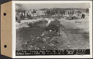
- January 9, 1941
- Institution:
- Massachusetts Archives
- Creator:
- Massachusetts. Metropolitan District Commission. Water Division; Snow, Russell, 1902-1969
- Format:
- Photographs
- Collection:
- Massachusetts Metropolitan District Water Supply Commission, Quabbin Reservoir, Photographs of Real Estate in the Swift River Valley, and of General Engineering of Quabbin Reservoir, 1927-1950
- Date:
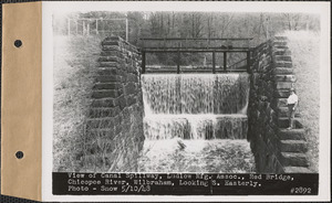
- May 10, 1948
- Institution:
- Massachusetts Archives
- Creator:
- Massachusetts. Metropolitan District Water Supply Commission; Pike, Stuart D., 1910-1978
- Format:
- Photographs
- Collection:
- Massachusetts Metropolitan District Water Supply Commission, Quabbin Reservoir, Photographs of Real Estate, Sanitary Conditions, and Flooding in the Ware River Watershed, and of General Engineering, 1928-1948
- Date:
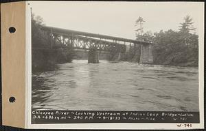
- September 18, 1933
- Institution:
- Massachusetts Archives
- Creator:
- Massachusetts. Metropolitan District Water Supply Commission; Pike, Stuart D., 1910-1978
- Format:
- Photographs
- Collection:
- Massachusetts Metropolitan District Water Supply Commission, Quabbin Reservoir, Photographs of Real Estate, Sanitary Conditions, and Flooding in the Ware River Watershed, and of General Engineering, 1928-1948
- Date:
- April 5, 1933
- Institution:
- Massachusetts Archives
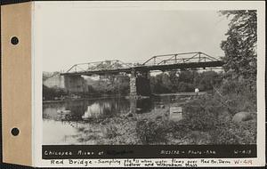
- Creator:
- Massachusetts. Metropolitan District Water Supply Commission; Pike, Stuart D., 1910-1978
- Format:
- Photographs
- Collection:
- Massachusetts Metropolitan District Water Supply Commission, Quabbin Reservoir, Photographs of Real Estate, Sanitary Conditions, and Flooding in the Ware River Watershed, and of General Engineering, 1928-1948
- Date:
- September 23, 1932
- Institution:
- Massachusetts Archives
- Format:
- Postcards/Cards; Ephemera
- Collection:
- Ephemera collection (EP001)
- Date:
- 1887
- Institution:
- Historic New England
- Format:
- Postcards/Cards; Ephemera
- Collection:
- Ephemera collection (EP001)
- Date:
- 1887
- Institution:
- Historic New England
- Creator:
- Massachusetts. Metropolitan District Water Supply Commission; Pike, Stuart D., 1910-1978
- Format:
- Photographs
- Collection:
- Massachusetts Metropolitan District Water Supply Commission, Quabbin Reservoir, Photographs of Real Estate, Sanitary Conditions, and Flooding in the Ware River Watershed, and of General Engineering, 1928-1948
- Date:
- April 18, 1933
- Institution:
- Massachusetts Archives
- Creator:
- Massachusetts. Metropolitan District Water Supply Commission; Pike, Stuart D., 1910-1978
- Format:
- Photographs
- Collection:
- Massachusetts Metropolitan District Water Supply Commission, Quabbin Reservoir, Photographs of Real Estate, Sanitary Conditions, and Flooding in the Ware River Watershed, and of General Engineering, 1928-1948
- Date:
- April 5, 1933
- Institution:
- Massachusetts Archives