Search
Limit your search
- Harvard Forest Martha's Vineyard Collection740
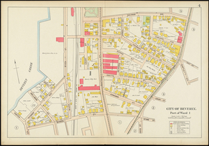
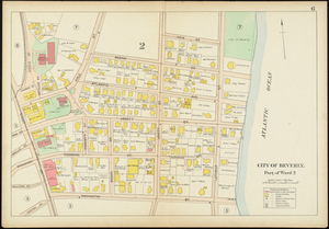
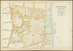
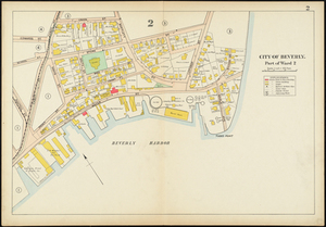
- Historic Maps278
- Norman B. Leventhal Map Center Collection4
- Boston and New England Maps (Collection of Distinction)3
- Urban Maps (Collection of Distinction)3
- Mass. Memories Road Show2
- Massachusetts Board of Harbor and Land Commissioners2
- Massachusetts Real Estate Atlases1